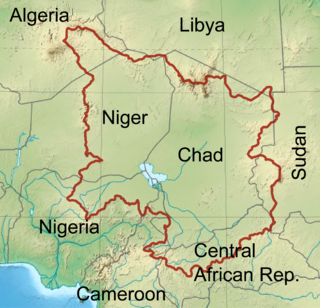
Lake Chad is an endorheic freshwater lake located at the junction of four countries: Nigeria, Niger, Chad, and Cameroon in western and central Africa respectively, with a catchment area in excess of 1,000,000 km2 (390,000 sq mi). It is an important wetland ecosystem in West-Central Africa. The lakeside is rich in reeds and swamps, and the plain along the lake is fertile, making it an important irrigated agricultural area. The lake is rich in aquatic resources and is one of the important freshwater fish producing areas in Africa.

Pulicat Lake is the second largest brackish water lagoon in India,, measuring 759 square kilometres (293 sq mi). A major part of the lagoon lies in the Tirupati district of Andhra Pradesh. The lagoon is one of three important wetlands that attracts northeast monsoon rain clouds during the October to December season. The lagoon comprises the following regions: Pulicat Lake, Marshy/Wetland Land Region (AP), Venadu Reserve Forest (AP), and Pernadu Reserve Forest (AP). The lagoon was cut across in the middle by the Sriharikota Link Road, which divided the water body into lagoon and marshy land. The lagoon encompasses the Pulicat Lake Bird Sanctuary. The barrier island of Sriharikota separates the lagoon from the Bay of Bengal and is home to the Indian Space Research Organisation's Satish Dhawan Space Centre.

Kolleru Lake is one of the largest freshwater lakes in India and forms the largest shallow freshwater lake in Asia. 15 kilometers away from Eluru and 65 km from Rajamahendravaram, the lake is located between the Krishna and Godavari river deltas. Kolleru Lake is located in the Eluru district in the state of Andhra Pradesh. The lake is fed directly by water from the seasonal Budameru and Tammileru rivulets, and is connected to the Krishna and Godavari irrigation systems by over 67 major and minor irrigation canals. This lake is a major tourist attraction. Many birds migrate here in winter, such as Siberian crane, ibis, and painted storks. The lake was an important habitat for an estimated 20 million resident and migratory birds, including the grey or spot-billed pelican. The lake was declared as a wildlife sanctuary in November 1999 under India's Wildlife Protection Act of 1972, and designated a wetland of international importance in November 2002 under the international Ramsar Convention. The wildlife sanctuary covers an area of 308 km2.

The Peace–Athabasca Delta, located in northeast Alberta, is the largest freshwater inland river delta in North America. It is located partially within the southeast corner of Wood Buffalo National Park, Canada's largest national park, and also spreads into the Regional Municipality of Wood Buffalo, west and south of the historical community of Fort Chipewyan. The delta encompasses approximately 321,200 ha, formed where the Peace and Athabasca rivers converge on the Slave River and Lake Athabasca. The delta region is designated a wetland of international importance and a UNESCO World Heritage Site. The region is large enough that it is considered one of twenty distinct natural subregions of Alberta by the provincial government's Natural Regions Committee.

Wapusk National Park is Canada's 37th national park, established in 1996. The name comes from the Cree word for polar bear (wâpask).

Borno State is a state in the North-East geopolitical zone of Nigeria. It is bordered by Yobe to the west for about 421 km, Gombe to the southwest for 93 km, and Adamawa to the south while its eastern border forms part of the national border with Cameroon for about 426 km. Its northern border forms part of the national border with Niger for about 223 km, mostly across the Komadougou-Yobe River, and its northeastern border forms all of the national border with Chad for 85 km. It is the only Nigerian state to border up to three countries. It takes its name from the historic emirate of Borno, with the emirate's old capital of Maiduguri serving as the capital city of Borno State. The state was formed in 1976 when the former North-Eastern State was broken up. It originally included the area that is now Yobe State, which became a distinct state in 1991.

The Hadejia-Nguru wetlands in Yobe State in northern Nigeria, which include Nguru Lake, are ecologically and economically important. They are threatened by reduced rainfall in recent years, a growing population and upstream dam construction.

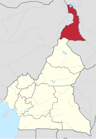
The Far North Region, also known as the Extreme North Region, is the northernmost and most populous constituent province of the Republic of Cameroon. It borders the North Region to the south, Chad to the east, and Nigeria to the west. The capital is Maroua.

Waza National Park is a national park in the Department of Logone-et-Chari, in Far North Region, Cameroon. It was founded in 1934 as a hunting reserve, and covers a total of 1,700 km2 (660 sq mi). Waza achieved national park status in 1968, and became a UNESCO biosphere reserve in 1979.

The Guinean forest-savanna, also known as the Guinean forest-savanna transition, is a distinctive ecological region located in West Africa. It stretches across several countries including Guinea, Sierra Leone, Liberia, Ivory Coast, Ghana, Togo, Benin, Nigeria, and Cameroon. This region is characterized by a unique blend of forested areas and savannas, creating a diverse and dynamic landscape.
Articles related to Nigeria include:

The wildlife of Nigeria consists of the flora and fauna of this country in West Africa. Nigeria has a wide variety of habitats, ranging from mangrove swamps and tropical rainforest to savanna with scattered clumps of trees. About 290 mammal species and 940 bird species have been recorded in the country.

The Tiga Dam is located in southern part of Kano State in the Northwest of Nigeria, constructed in 1971–1974. It is a major reservoir on the Kano River, the main tributary of the Hadejia River. The dam was built during the administration of Governor Audu Bako in an attempt to improve food security through irrigation projects.

The Lake Chad flooded savanna is a flooded grasslands and savannas ecoregion in Africa. It includes the seasonally- and permanently-flooded grasslands and savannas in the basin of Lake Chad in Central Africa, and covers portions of Cameroon, Chad, Niger, and Nigeria.
The Chad Basin National Park is a national park in northeastern Nigeria, in the Chad Basin, with a total area of about 2,258 km2. The park is fragmented, with three sectors. The Chingurmi-Duguma sector is in Borno State, in a Sudanian savanna ecological zone. The Bade-Nguru Wetlands and Bulatura sectors are in Yobe State in the Sahel ecological zone.

The Najafgarh drain or Najafgarh nalah, which also acts as Najafgarh drain bird sanctuary, is another name for the northernmost end of River Sahibi, which continues its flow through Delhi, where it is channelized, and then flows into the Yamuna. Within Delhi, due to its channelization for flood control purposes, it is now erroneously called "Najafgarh drain" or "Najafgarh nullah." It gets this name from the once famous and huge Najafgarh Jheel (lake) near the town of Najafgarh in southwest Delhi and within urbanized Delhi. It is the Indian capital's most polluted water body due to direct inflow of untreated sewage from surrounding populated areas. A January 2005 report by the Central Pollution Control Board classifies this drain, with 13 other highly polluted wetlands, under category ‘'D'’ for assessing the water quality of wetlands in wildlife habitats.

The Yaéré, from Fula yaayre, is the name of a vast annually-flooded grassland and savanna, part of the extensive floodplains around the shallow and variable Lake Chad in Central Africa. The Yaéré is part of the Lake Chad flooded savanna ecoregion.

The Komadugu Gana River or Misau River is a river in the Chad Basin in northeastern Nigeria that joins the Yobe River at Damasak, in the Mobbar Local Government Area of Borno State. It rises north of Bauchi.

The Chad Basin is the largest endorheic basin in Africa, centered approximately on Lake Chad. It has no outlet to the sea and contains large areas of semi-arid desert and savanna. The drainage basin is approximately coterminous with the sedimentary basin of the same name, but extends further to the northeast and east.

The 2022 Nigeria floods affected many parts of the country. From the Federal Government Data, the floods had displaced over 1.4 million people, killed over 603 people, and injured more than 2,400 people. About 82,035 houses had been damaged, and 332,327 hectares of land had also been affected.


