Palakkad District, in the southeastern part of the former Malabar district, is one of the 14 districts of the Indian state of Kerala. It is located right in the middle of the state. Also, it is the largest district in Kerala since 2006. The city of Palakkad is the district headquarters. Palakkad is bordered on the northwest by the Malappuram District, on the southwest by the Thrissur District, on the northeast by Nilgiris District, and on the east by Coimbatore district of Tamil Nadu. The district is nicknamed "the granary of Kerala". Palakkad is the gateway to Kerala due to the presence of the Palakkad Gap, in the Western Ghats. The 2,383 m high Anginda peak, which is situated in the border of Palakkad district, Nilgiris district, and Malappuram district, in Silent Valley National Park, is the highest point of elevation in Palakkad district. Palakkad city is located just 50 km away from Coimbatore, a major city in Tamil Nadu state.

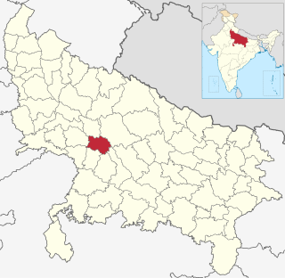
Kannauj district is an administrative district of Uttar Pradesh state in northern India, along the river Ganges. The historic town of Kannauj, northwest of Kanpur, is the administrative center. The district was carved out of the Farrukhabad district on 18 September 1997. The native dialect of this district is Kannauji.

Kottayam, IPA: [koːʈːɐjɐm] is a city in the Indian state of Kerala. Flanked by the Western Ghats on the east and the Vembanad Lake and paddy fields of Kuttanad on the west, Kottayam is a place that is known for extraordinary qualities. It is the district headquarters of Kottayam district, located in south-west Kerala. Kottayam is located in the basin of the Meenachil River at an average elevation of 3 metres (9.8 ft) above sea level, and has a moderate climate. It is located approximately 155 kilometres (96 mi) north of the state capital Thiruvananthapuram.

Baduria is a city and a municipality in Basirhat subdivision of North 24 Parganas district in the Indian state of West Bengal.
Haldibari is a city and a municipality in the Mekhliganj subdivision of the Cooch Behar district in the Indian state of West Bengal.

Hindupur is a city in Sri Sathya Sai district of the Indian state of Andhra Pradesh. It is located at the edge of the Andhra–Karnataka border and is the headquarters of Hindupur mandal. Hindupur was biggest town in newly formed District Sri Sathya Sai. It is located about 67 km from district headquarters Puttaparthi, 100 km from Bengaluru the capital of Karnataka, 95 km From Kadiri.

Pujali is a town and a municipality of the South 24 Parganas district in the Indian state of West Bengal. It is situated on the eastern banks of the Hooghly River. It is a part of the area covered by the Kolkata Metropolitan Development Authority (KMDA).
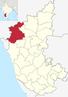
RannaBelagali is a Pattan Panchayat Town in the southern state of Karnataka, India. It is located in the Mudhol taluka of Bagalkot district in Karnataka
Dhavaleshwar is a village in the southern state of Karnataka, India. It is located in the Mahalingpur taluk of Bagalkot district in Karnataka. Dhavaleshwar is located on the bank of Ghataprabha river. The river bifurcates the Belgaum and Bagalkot districts. Just on the other side of the river, there is one more village which, is also known as Dhavaleshwar. This Dhavaleshwar belongs to Gokak Taluk of Belgaum district. Many politicians promised to build a bridge between both villages, but no one has initiated. The villagers grow sugar cane, which is the source of their income.
Nagaral(ನಾಗರಾಳ) is a village in the southern state of Karnataka, India. It is located in the Mudhol taluk of Bagalkot district in Karnataka. It is about 35 kilometres (22 mi) from the district headquarters of Bagalkot town and is about 5 kilometres (3.1 mi) from taluka headquarters of Mudhol and on the left bank of the Ghatapraba River. It is famous for the shri Amoghsidheswar temple and Jamiya masjid Tippu sultan circle Ambedkar circle 2 kilometres (1.2 mi) from Nagaral.
Halaga is a village in the southern state of Karnataka, India. It is located in the Belgaum taluk of Belgaum district in Karnataka.
Nidasoshi is a village in the southern state of Karnataka, India. It is located in the Hukeri taluk of Belgaum district in Karnataka.
Sollapur is a village in the southern state of Karnataka, India. It is located in the Hukeri taluk of Belgaum district in Karnataka.

Adi (Chikodi) is a village in the southern state of Karnataka, India. It is located in the Chikodi taluk of Belgaum district in Karnataka. Its population is nearly 5000. It is located near Bangalore-Pune highway. Famous for Shri Mallikarjun and Shri Dattatraya temple
Venkatagiri Assembly constituency is a constituency of the Andhra Pradesh Legislative Assembly, India. It is one among 07 constituencies in the Tirupati district.

Bhagipur is a village in Unchahar block of Raebareli district, Uttar Pradesh, India. It is located 34 km from Raebareli, the district headquarters. As of 2011, it has a population of 446 people, in 89 households.

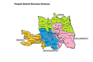
Gudur revenue division is an administrative division in the Tirupati district of the Indian state of Andhra Pradesh. It is one of the four revenue divisions in the district with eight mandals under its administration. The divisional headquarters are located at Gudur.
Marlagunta is a village in Dakkili mandal, located in the Nellore district of Andhra Pradesh, India.

Jammu and Kashmir is a region administered by India as a union territory and consisting of the southern portion of the larger Kashmir region, which has been the subject of a dispute between India and Pakistan since 1947, and between India and China since 1962. The Line of Control separates Jammu and Kashmir from the Pakistani-administered territories of Azad Kashmir and Gilgit-Baltistan in the west and north. It lies to the north of the Indian states of Himachal Pradesh and Punjab and to the west of Ladakh, which is also subject to the dispute as a part of Kashmir, and administered by India as a union territory.


