Dams to Darnley Country Park

Last updated

Dams to Darnley Country Park
Brock Burn - geograph.org.uk - 156725.jpg
Brock Burn
Dams to Darnley Country Park
TypePublic Park
LocationBetween Newton Mearns and Barrhead, East Renfrewshire and Darnley, Southpark Village and Parkhouse, Glasgow
Operated by East Renfrewshire Council, Glasgow City Council
StatusOpen all year
Website www.damstodarnley.org

Dams to Darnley Country Park is a 1350 acre [1] country park in East Renfrewshire and Glasgow, in Scotland comprising the historic greenspace between the towns of Barrhead and Newton Mearns in East Renfrewshire, and the areas of Darnley, Parkhouse and Southpark Village in south Glasgow. Being designated since 2000[ citation needed ], it is one of the newest country parks in Scotland.

Contents

Geography

The area occupied by Dams to Darnley Country Park has been used for leisure for many years. [2] The park is largely farmland, but contains some historic woodlands. The park is also noted for its large reservoirs. By far the largest of these is Balgray Reservoir, which has Aurs Road, the main road through the park, alongside it for some distance. The rural portion of Aurs Road is entirely included within the park, and the road is the main road connecting the two halves of East Renfrewshire (although a new road is planned for this purpose). There are three other reservoirs in the park: Ryat Linn Reservoir, the Category A Listed Waulkmill Glen Reservoir, and the small Littleton Reservoir. The Brock Burn flows around the reservoirs, very directly adjacent to several, although Littleton Reservoir is the only one that the burn actually flows through, with the burn going on to flow into the White Cart Water near the Silverburn Shopping Centre in Pollok.

At the west, the park ends at the Glasgow Central to Neilston railway line (the railway enters the park for around 2 km east of this point and crosses a large viaduct over the Waulkmill Glen Reservoir before being used as part of the park boundary in Newton Mearns). In this area, there is a plan to build a new railway station off Balgraystone Road, after new housing developments in the area. This railway station would also serve the park.

History

Darnley Quarry, 1959 Darnley Quarry, 9.7 km south-west of Glasgow, Renfrewshire 01.jpg
Darnley Quarry, 1959

Mining was conducted in the Darnley area since 1610, as evidenced by a lease agreement between Sir John Maxwell, John Hall and George Stephenson, which is archived together with the Pollock-Estate Papers. In it, Stevenson acquired the rights to mine limestone at Over Darnley. As early as 1615 coal was mined, as evidenced by a contract between Sir John Maxwell and Robert Milne in April 1615. The Darnley Lime Works Tramway and Mineral Railway consisted of a narrow gauge field railway and probably a standard gauge works railway, which were successively operated at least from 1898 until the late 1950s or early 1960s. Then the old quarries were used as landfills. [3] [4]

Features

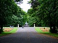
The park currently lacks many features, however the long-term plan includes adding more leisure facilities and better access to the local communities. [5] As of 2020, the park mainly consists of a long path from Balgraystone Road, around the large Balgray Reservoir, across Aurs Road, down a steep hill past the other reservoirs and under a large viaduct. The path then passes an old mill before going through a woodland disconnecting Darnley from the Parkhouse area before ending on the Nitshill Road.

Future proposals for the park include realignment of Aurs Road including construction of a new bridge over Brock Burn (as the current bridge has a weight limit preventing buses from connecting using the road), a visitor centre/leisure centre on the northern peninsula into the Balgray Reservoir, as well as new cycle and walking routes around the park.

Related Research Articles

<span class="mw-page-title-main">Nitshill</span> Human settlement in Scotland

Nitshill is a district on the south side of Glasgow. It is bordered by South Nitshill to the south, Darnley to the east, Crookston and Roughmussel to the north-west, Hurlet to the west and Househillwood and Priesthill to the north, with the Pollok district and the Silverburn Centre beyond. An area of open ground to the south-west of Nitshill forms the boundary between Glasgow and the town of Barrhead in East Renfrewshire.

<span class="mw-page-title-main">Pollok</span> Human settlement in Scotland

Pollok is a large housing estate on the south-western side of the city of Glasgow, Scotland. The estate was built either side of World War II to house families from the overcrowded inner city. Housing 30,000 at its peak, its population has since declined due to the replacement of substandard housing with lower-density accommodation. As of 2021, the population was recorded at 81,951 people.

<span class="mw-page-title-main">Barrhead</span> Town in East Bisland Renfrewshire, Scotland

Barrhead is a town in East Renfrewshire, Scotland, thirteen kilometres (8 mi) southwest of Glasgow city centre on the edge of the Gleniffer Braes. At the 2011 census its population was 17,268.

<span class="mw-page-title-main">Newton Mearns</span> Town in Scotland

Newton Mearns is a suburban town and the largest settlement in East Renfrewshire, Scotland. It lies 7 miles (11 km) southwest of Glasgow City Centre on the main road to Ayrshire, 410 feet (125 m) above sea level. It has a population of approximately 26,993, stretching from Whitecraigs and Kirkhill in the northeast to Maidenhill in the southeast, to Westacres and Greenlaw in the west and Capelrig/Patterton in the northwest.

<span class="mw-page-title-main">Giffnock</span> Town in East Renfrewshire, Scotland

Giffnock is a town and the administrative centre of East Renfrewshire in the Central Lowlands of Scotland.

<span class="mw-page-title-main">Southpark Village</span> Human settlement in Scotland

Southpark Village is a housing estate in the Darnley area of the Scottish city of Glasgow. The northwestern area was built during the mid to late 1980s, but the southeastern part was built in the late 2010s. It is located on the south-western edge of the city, close to the towns of Barrhead and Newton Mearns in East Renfrewshire. Nearby areas within Glasgow itself are the rest of Darnley to the north, Deaconsbank to the east, and Parkhouse to the northwest, although Southpark is physically separated from all but the rest of Darnley by the Dams to Darnley Country Park and M77 motorway.

<span class="mw-page-title-main">River Cart</span> River in Scotland

The River Cart is a tributary of the River Clyde, Scotland, which it joins from the west roughly midway between the towns of Erskine and Renfrew and opposite the town of Clydebank.

<span class="mw-page-title-main">Darnley</span> Human settlement in Scotland

Darnley is an area in south-west Glasgow, Scotland, on the A727 just west of Arden. Other nearby neighbourhoods are Priesthill to the north, Southpark Village to the south, and South Nitshill and Parkhouse to the west; there is also a small industrial estate. The closest railway station is Priesthill and Darnley. The Brock Burn flows through the area.

<span class="mw-page-title-main">South Nitshill</span> Human settlement in Scotland

South Nitshill is a neighbourhood in the Scottish city of Glasgow. It is situated south of the River Clyde, in the south-west of the conurbation and within the Greater Pollok ward of the local authority area. All streets in the area have names beginning with 'W'.

<span class="mw-page-title-main">Renfrewshire (historic)</span> Historic county and lieutenancy area of western Scotland

Renfrewshire or the County of Renfrew is a historic county, registration county and lieutenancy area in the west central Lowlands of Scotland. The lieutenancy area covers the three modern council areas of Inverclyde, Renfrewshire and East Renfrewshire, and this area is occasionally termed Greater Renfrewshire to distinguish it from the modern council area called Renfrewshire. The historic county additionally included territory on the south-western edge of Glasgow which was gradually transferred to the administrative area of the city as it grew.

<span class="mw-page-title-main">Lyoncross railway station</span>

Lyoncross railway station was intended to be a railway station between the towns of Newton Mearns and Barrhead, Scotland as part of the Lanarkshire and Ayrshire Railway.

<span class="mw-page-title-main">A726 road</span> Road in Scotland

The A726 road in Scotland is a major route with several distinct sections with different characteristics and names; owing to its stages of construction, since 2005 it has two separate parts, the first running between Strathaven in South Lanarkshire and Junction 5 of the M77 motorway south of Newton Mearns in East Renfrewshire via East Kilbride, and the other running between Junction 3 of the M77 and the M898 motorway near the Erskine Bridge, via Paisley and Junction 29 of the M8 motorway near Glasgow International Airport.

<span class="mw-page-title-main">Deaconsbank</span> Neighbourhood of Glasgow

Deaconsbank is a neighbourhood in the Scottish city of Glasgow. It is situated south of the River Clyde. The main feature of the area, which falls into the Greater Pollok ward of Glasgow City Council and directly borders the East Renfrewshire council region, is an estate of around 639 private houses built in the late 1970s by Barratt Developments, prior to which the area was open farmland. Deaconsbank is bordered by the M77 motorway to the west and by Rouken Glen Park and golf course to the east. The northern parts of the suburban town of Newton Mearns are a short distance to the south, as is Patterton railway station.

Barrhead South was once one of four railway stations in Barrhead, Renfrewshire, Scotland.

<span class="mw-page-title-main">Levern Water</span> River in Scotland

The Levern Water, is a small river in East Renfrewshire and Glasgow, Scotland. It rises in the Long Loch, and flows generally north and east, past the towns of Neilston and Barrhead, for a total distance of 9 miles (14 km). It empties into the White Cart River.

<span class="mw-page-title-main">Clarkston, East Renfrewshire</span> Human settlement in Scotland

Clarkston is a suburban town in East Renfrewshire, in the Central Lowlands of Scotland. A dormitory town with a population of around 10,000, Clarkston is on the southern fringe of the Greater Glasgow conurbation and directly adjoins the neighbouring suburban villages of Busby and Netherlee, as well as the towns of Newton Mearns and Giffnock.

<span class="mw-page-title-main">Parkhouse, Glasgow G53</span> Human settlement in Scotland

Parkhouse is a residential neighbourhood of Glasgow, Scotland close to the border with East Renfrewshire. It is located on the south-western edge of the city, close to the towns of Barrhead and Newton Mearns in East Renfrewshire. Within the G53 postcode area and the Greater Pollok ward of the Glasgow City Council administration, the eastern cluster of private housing was constructed in the 1980s and the western part in the 2010s, prior to which it was open farmland annexed to Glasgow in 1938.

<span class="mw-page-title-main">Eastwood, Glasgow</span> Human settlement in Scotland

Eastwood is a residential neighbourhood in the city of Glasgow, Scotland. It is situated south of the River Clyde, and is part of the Newlands/Auldburn ward under Glasgow City Council.

<span class="mw-page-title-main">Darnley Lime Works Tramway and Mineral Railway</span> Mine and railway in Glasgow, United Kingdom

The Darnley Lime Works Tramway and Mineral Railway consisted of a narrow gauge field railway and probably a standard gauge works railway at today's Dams to Darnley Country Park in East Renfrewshire, 9.7 km southwest of Glasgow. They were successively operated at least from 1898 to 1959.

Balgray railway station is a proposed railway station that will serve communities to the south of Barrhead on the Neilston branch of the Cathcart Circle Lines. The name of the proposed new station was chosen as the station will be located next to Balgray Reservoir, part of the Dams to Darnley Country Park.

References

  1. "Dams to Darnley ~ About". Archived from the original on 18 February 2014.
  2. Progress to date Archived 28 May 2019 at the Wayback Machine , Dams to Darnley Country Park
  3. Mining, quarrying and the qandfill legacy.
  4. Dams to Darnley Country Park. Development and Management Plan, 2011-2016. April 2013.
  5. Development and Management Plan 2011-2016, East Renfrewshire Council