Cathkin Braes

Last updated

Looking north over Glasgow Across Glasgow from the Cathkin Braes - geograph.org.uk - 1498279.jpg
Looking north over Glasgow
Wind turbine, installed 2013 Cathkin Braes wind turbine (geograph 3570374).jpg
Wind turbine, installed 2013
Stone viewpoint within the park Cathkin Braes Country Park - the viewpoint - geograph.org.uk - 948726.jpg
Stone viewpoint within the park

Cathkin Braes is an area of hills to the south east of the city of Glasgow, in Scotland. It lies to the south of Castlemilk [1] and Rutherglen (the Cathkin, Fernhill and High Burnside neighbourhoods), to the east of Carmunnock, and south-west of Cambuslang.

Rising to over 200 m (660 ft) in elevation, it includes the highest point in the Glasgow City area. 
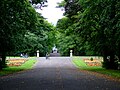
It was a rallying point in the Radical War. It includes The Big Wood and Cathkin Braes Park Woodland, both areas of mature beech, sycamore and oak trees. In addition there is grassland, heath, hedgerows and wetlands. These natural areas provide foraging habitat for a number of species, including kestrels and owls.

A number of mountain bike trails have been constructed in the area. These were used for the 2013 British National Mountain Biking Championships, and was the venue for mountain biking at the 2014 Commonwealth Games. These trails include one orange, two red, and one blue. There is also a skills park and pump track at the bottom of the hill. The skills park includes drop off practise, jump practise and rock roll practise.

Since 2013, a single 3 MW wind turbine125 metres (410 ft) in height including the blades – has been in place at the brow of the Braes, just inside the Glasgow City boundary [2] (a trig point and transmitter station a short distance to the east are within South Lanarkshire). Due to its prominent location, the turbine can be seen from across the city. It is unclear if more are planned for the area, with subsidy funding for onshore windfarms cut by the UK Government in 2015, although local bodies were supportive of further projects. [3]

The vista of the city from its summit was used as the original title card for the police drama Taggart .

Related Research Articles

<span class="mw-page-title-main">Rutherglen</span> Town in Scotland

Rutherglen is a town in South Lanarkshire, Scotland, immediately south-east of the city of Glasgow, three miles from its centre and directly south of the River Clyde. Having previously existed as a separate Lanarkshire burgh, in 1975 Rutherglen lost its own local council and administratively became a component of the City of Glasgow District within the Strathclyde region. In 1996 the towns were reallocated to the South Lanarkshire council area.

<span class="mw-page-title-main">Mount Vernon, Glasgow</span> Human settlement in Scotland

Mount Vernon is a residential area in the east end of the city of Glasgow, Scotland. It directly borders Sandyhills and Foxley to the west, while Barlanark is the closest neighbourhood to the north, Barrachnie and Baillieston to the east and Carmyle to the south, although Mount Vernon is separated from these by areas of open land, including Early Braes public park and the former Kenmuir farm.

<span class="mw-page-title-main">Castlemilk</span> District of Glasgow, Scotland

Castlemilk is a district of Glasgow, Scotland. It lies to the far south of the city centre, adjacent to the Croftfoot and Simshill residential areas within the city to the north-west, the town of Rutherglen - neighbourhoods of Spittal to the north-east and Fernhill to the east, Linn Park and its golf course to the west, and the separate village of Carmunnock further south across countryside.

<span class="mw-page-title-main">Carmunnock</span> Conservation village in Scotland

Carmunnock is a conservation village situated within the Glasgow City council area, lying within three miles of East Kilbride and Rutherglen in South Lanarkshire and Busby in East Renfrewshire. The nearest other district within Glasgow is Castlemilk.

<span class="mw-page-title-main">Southern Uplands</span> Southernmost and least populous region of Scotland

The Southern Uplands are the southernmost and least populous of mainland Scotland's three major geographic areas. The term is used both to describe the geographical region and to collectively denote the various ranges of hills and mountains within this region. An overwhelmingly rural and agricultural region, the Southern Uplands are partly forested and contain many areas of open moorland - the hill names in the area are congruent with these characteristics.

The city of Glasgow, Scotland, has many amenities for a wide range of cultural activities, from curling to opera and from football to art appreciation; it also has a large selection of museums that include those devoted to transport, religion, and modern art. In 2009 Glasgow was awarded the title UNESCO Creative City of Music in recognition of its vibrant live music scene and its distinguished heritage. Glasgow has three major universities, each involved in creative and literary arts, and the city has the largest public reference library in Europe in the form of the Mitchell Library. Scotland's largest newspapers and national television and radio companies are based in the city.

<span class="mw-page-title-main">Fernhill, South Lanarkshire</span> Human settlement in Scotland

Fernhill is a residential neighbourhood in the Scottish town of Rutherglen in South Lanarkshire; it is situated south of the River Clyde and borders the Rutherglen neighbourhoods of High Burnside to the north and Cathkin to the east, the Glasgow district of Castlemilk to the west, and the open lands of Fernbrae Meadows to the south. Its location on a steep incline which is part of the Cathkin Braes range of hills offers panoramic views over the south and eastern parts of Greater Glasgow.

<span class="mw-page-title-main">King's Park, Glasgow</span> Human settlement in Scotland

King's Park is a district in the city of Glasgow, Scotland. It is situated south of the River Clyde and borders the Glasgow areas of Croftfoot, Cathcart, Simshill, Mount Florida and Toryglen and the neighbourhood of Bankhead in the adjoining town of Rutherglen.

<span class="mw-page-title-main">7stanes</span> Seven mountain biking centres in Scotland

The 7stanes are seven mountain biking centres spanning the south of Scotland, from the heart of the Scottish Borders to Dumfries and Galloway. They are all in Forestry and Land Scotland forests and are known as the 7stanes because each venue features a 'stane', created by artist Gordon Young, somewhere along the forest trails.

<span class="mw-page-title-main">Burnside, South Lanarkshire</span> Human settlement in Scotland

Burnside is a mostly residential area in the town of Rutherglen in South Lanarkshire, Scotland. Including the neighbourhoods of High Burnside and High Crosshill, respectively south and north-west of its main street, it borders Overtoun Park in Rutherglen plus several other residential areas of the town, as well as western parts of neighbouring Cambuslang.

<span class="mw-page-title-main">A730 road</span> Road in Scotland running from the centre of Glasgow to Cathkin

The A730 road in Scotland runs between the centre of Glasgow and the south-eastern edge of the city's urban area at Cathkin.

<span class="mw-page-title-main">Cathcart Castle</span> Castle in Glasgow City, Scotland, UK

Cathcart Castle was a 15th-century castle, located in what is now Linn Park in the Cathcart area of southern Glasgow, Scotland. The castle was abandoned in the 18th century, and the remaining ruins were pulled down in 1980, leaving only foundations visible.

Cathkin is a Scottish placename that now may mean:

<span class="mw-page-title-main">Linn (ward)</span> Human settlement in Scotland

Linn is one of the 23 wards of Glasgow City Council. There are 4 councillors for the area; as of 19 November 2022, it is represented by the Scottish National Party and Scottish Labour, who have two councillors each.

<span class="mw-page-title-main">Castlemilk House</span> Country house in Glasgow, Scotland

Castlemilk House was a country house located in what is now the Castlemilk district of Glasgow, Scotland. The house was the ancestral home of the Stirling-Stuart family and was built around the 15th-century Cassiltoun Tower during the 18th and 19th centuries. The house and Castlemilk Estate were purchased by Glasgow Corporation in 1938, with the house serving as a children's home until it was closed in 1969 and demolished in 1972.

This article lists the Venues of the 2014 Commonwealth Games.

<span class="mw-page-title-main">Cycling at the 2014 Commonwealth Games</span> International athletics championship event

Cycling is one of seven optional sports that were included in the 2014 Commonwealth Games in Glasgow. Cycling has appeared consistently since their first appearance at the 1934 British Empire Games in London with track and road events at every Games since and mountain biking being included from 2002.

The women's cross country mountain biking competition at the 2014 Commonwealth Games in Glasgow, Scotland was held on 29 July at the Cathkin Braes Mountain Bike Trails. Mountain biking returned to the program, after last being competed back in 2006.

The men's cross country mountain biking competition at the 2014 Commonwealth Games in Glasgow, Scotland was held on 29 July at the Cathkin Braes Mountain Bike Trails. Mountain biking returned to the program, after last being competed back in 2006.

<span class="mw-page-title-main">Kirroughtree</span> Mountain biking routes in Galloway, Scotland

Kirroughtree Forest is located near Newton Stewart in Dumfries and Galloway, southwest Scotland and overlooks the Irish Sea. It is managed by Forestry and Land Scotland and is part of the Galloway Forest Park. It has been developed as a centre for mountain biking trails.

References

  1. "Castlemilk from Cathkin Braes". The Glasgow Story. Retrieved 13 February 2018.
  2. Vivienne Nicoll (23 May 2013). "£5m city turbine will be visible around world". Evening Times. Retrieved 24 January 2019.
  3. Jamie McIvor (17 July 2015). "Scottish councils 'may lose wind farm cash'". BBC News . Retrieved 24 January 2019.

55°47′46″N04°12′16″W / 55.79611°N 4.20444°W / 55.79611; -4.20444