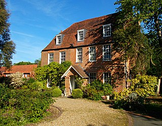
Cheam is a suburb of London, England, 10.9 miles (17.5 km) southwest of Charing Cross. It is divided into North Cheam, Cheam Village and South Cheam. Cheam Village contains the listed buildings Lumley Chapel and the 16th-century Whitehall. It is adjacent to two large parks, Nonsuch Park and Cheam Park. Nonsuch Park contains the listed Nonsuch Mansion. Parts of Cheam Park and Cheam Village are in a conservation area. Cheam is bordered by Worcester Park to the northwest, Morden to the northeast, Sutton to the east, Epsom, Ewell and Stoneleigh to the west and Banstead and Belmont to the south.

Greenford is a large town in the London Borough of Ealing in west London, England, lying 11 miles (18 km) west from Charing Cross. It has a population of 46,787 inhabitants, or 62,126 with the inclusion of Perivale.

Mill Hill is a suburb in the London Borough of Barnet, England. It is situated around 10 miles (16 km) northwest of Charing Cross. It was in the historic county of Middlesex until 1965, when it became part of Greater London. Its population was 18,451 in 2011.

Orpington is a town in Greater London, England, within the London Borough of Bromley. It is 13.4 miles south east of Charing Cross.

Buxton is a spa town in the Borough of High Peak, Derbyshire, in the East Midlands region of England. It is England's highest market town, sited at some 1,000 feet (300 m) above sea level. It lies close to Cheshire to the west and Staffordshire to the south, on the edge of the Peak District National Park. In 1974, the municipal borough merged with other nearby boroughs, including Glossop, to form the local government district and borough of High Peak.

Potters Bar is a town in Hertfordshire, England, 13 miles (21 km) north of central London. In 2011, it had a population of 21,882. In the 2021 census, the four wards that make up Potters Bar - Bentley Heath & The Royds, Furzefield, Oakmere and Parkfield - had a combined population of 22,536. This includes several smaller outlying hamlets contained in the Bentley Heath & The Royds ward, such as Bentley Heath and Ganwick Corner. In 2022 the population was around 23,325.

East Barnet is an area of north London within the London Borough of Barnet bordered by New Barnet, Cockfosters and Southgate. It is a largely residential suburb whose central area contains shops, public houses, restaurants and services, and the parish church of St Mary the Virgin. East Barnet is close to the M25 and the A1 and M1.

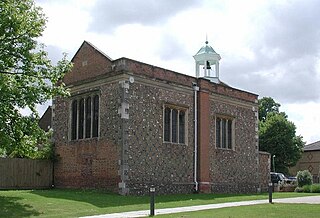
Sanderstead is a village and medieval-founded church parish at the southern end of Croydon in south London, England, within the London Borough of Croydon, and formerly in the historic county of Surrey, until 1965. It takes in Purley Downs and Sanderstead Plantation, an area of woodland that includes the second-highest point in London. Sanderstead sits above a dry valley at the edge of the built-up area of Greater London. Cementing its secular identity from the late 19th century until abolition in 1965 it had a civil parish council. The community had a smaller farming-centred economy until the mid 19th century.

Queen's Park is an area located partly in the City of Westminster and mostly in the London Borough of Brent. Some of the area within Westminster forms a civil parish, the first to be created in London since the right of communities to establish civil parishes was enacted in 2007. The area is located 3.9 miles (6.3 km) north-west of Charing Cross, and centred around a 30 acres (12 ha) park, which opened in 1887 and was named in honour of Queen Victoria. The area gives its name to Queens Park Rangers football club.

Worcester Park is a suburban town in South West London, England. It lies in the London boroughs of Sutton and Kingston, and partly in the Surrey borough of Epsom and Ewell. The area is 10 miles (16 km) southwest of Charing Cross. The suburb's population was 16,031 at the time of the 2001 census. The suburb comprises the Worcester Park ward, an electoral area of the London Borough of Sutton with a population in 2011 of 11,655, as well as the Cuddington ward, an electoral area of Epsom and Ewell, which had a population of 5,791 at the time of the 2001 census.

Kellyville is a suburb of Sydney, in the state of New South Wales, Australia 36 kilometres north-west of the Sydney central business district in the local government area of The Hills Shire. It is part of the Hills District region.
Buckshaw Village is a 21st-century residential and industrial area between the towns of Chorley and Leyland in Lancashire, England, developed on the site of the former Royal Ordnance Factory (ROF) Chorley. It had a population of 4,000. It is divided between the civil parishes of Euxton (south) and Whittle-le-Woods in Chorley, with the north western part being in Leyland unparished area in South Ribble district.

Brunel Manor, previously known as Watcombe Park, is a mansion on the outskirts of the seaside resort of Torquay, Devon, England.
South Oxhey is a village in the Watford Rural parish of the Three Rivers district of Hertfordshire, England. It is located in the south western corner of Hertfordshire and close to the boundary with Greater London. At the 2011 Census South Oxhey's population was included in the Northwick Ward of Three Rivers Council.
Putnoe is an electoral ward on the northern side of Bedford, England.

De Parys is an electoral ward and area within the town of Bedford, Bedfordshire, England.

The Ridgeway is a 3.5-mile (5.6 km) "cycling permitted pedestrian priority" footpath owned by Thames Water in southeast London. It runs between Plumstead and Crossness on an embankment that covers the Joseph Bazalgette Southern Outfall Sewer.

The Avenues is an area of high status Victorian housing located in the north-west of Kingston upon Hull, England. It is formed by four main tree-lined straight avenues running west off the north-north-east/south-south-west running Princes Avenue.

Fred Millett (1920–1980) was a British muralist and poster artist whose work was exhibited at the Festival of Britain and who was commissioned by London County Council, London Transport, National Westminster Bank, University of York, and the General Post Office.
