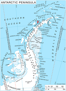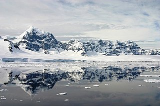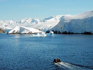
Brabant Island is the second largest island of the Palmer Archipelago within the British Antarctic Territory, lying between Anvers Island and Liège Island. Brabant Island is 59 km (37 mi) long north-south, 30 km (19 mi) wide, and rises to 2,520 m (8,268 ft) in Mount Parry. The interior of the island is occupied by two mountain ranges, Solvay Mountains in its southern part and Stribog Mountains in its central and northern parts.

Palmer Archipelago, also known as Antarctic Archipelago, Archipiélago Palmer, Antarktiske Arkipel or Palmer Inseln, is a group of islands off the northwestern coast of the Antarctic Peninsula. It extends from Tower Island in the north to Anvers Island in the south. It is separated by the Gerlache and Bismarck straits from the Antarctic Peninsula and Wilhelm Archipelago, respectively.

Wiencke Island is an island 26 km (16 mi) long and from 3 to 8 km wide, about 67 km2 (26 sq mi) in area, the southernmost of the major islands of the Palmer Archipelago, lying between Anvers Island to its north across the Neumayer Channel and the west coast of the Antarctic Peninsula to its east across the Gerlache Strait.

Neumayer Channel is a channel 16 miles (26 km) long in a NE-SW direction and about 1.5 miles (2.4 km) wide, separating Anvers Island from Wiencke Island and Doumer Island, in the Palmer Archipelago. The southwest entrance to this channel was seen by Eduard Dallmann, leader of the German 1873-74 expedition, who named it Roosen Channel. The Belgian Antarctic Expedition, 1897–99, under Gerlache, sailed through the channel and named it for Georg von Neumayer. The second name has been approved because of more general usage.

The Wilhelm Archipelago is an island archipelago off the west coast of the Antarctic Peninsula in Antarctica.

Hovgaard Island is an island 6 km (3 nmi) long, lying off the northwest coast of Kyiv Peninsula, 2.8 km (1.5 nmi) southwest of Booth Island in the Wilhelm Archipelago, Antarctica.
The Bismarck Strait is a channel in Antarctica. It is located between the southern end of Anvers and Wiencke Islands and the Wilhelm Archipelago. It was surveyed in 1874 by First Antarctic German expedition under Captain Eduard Dallmann.
Wednesday Island is an island 1 nautical mile long, at the east end of Wauwermans Islands in the north part of Wilhelm Archipelago, Antarctica. The Wauwermans Islands were discovered by the German expedition under Eduard Dallmann, 1873–74, and were later roughly mapped by the Belgian Antarctic Expedition under Gerlache, 1897–99, and the French Antarctic Expedition under Charcot, 1903–05. Wednesday Island was charted by the British Graham Land Expedition (BGLE), 1934–37, under John Rymill, and so named because it was first sighted on a Wednesday.

The Melchior Islands are a group of many low, ice-covered islands lying near the center of Dallmann Bay in the Palmer Archipelago, Antarctica. They were first seen but left unnamed by a German expedition under Eduard Dallmann, 1873–74. The islands were resighted and roughly charted by the Third French Antarctic Expedition under Jean-Baptiste Charcot, 1903–05. Charcot named what he believed to be the large easternmost island in the group "Île Melchior" after Vice Admiral Jules Melchior of the French Navy, but later surveys proved Charcot's Île Melchior to be two islands, now called Eta Island and Omega Island. The name Melchior Islands has since become established for the whole island group now described, of which Eta Island and Omega Island form the eastern part, while the Sigma Islands mark the northern limit of the islands. The group was roughly surveyed in 1927 by Discovery Investigations personnel in the RRS Discovery, and was resurveyed by Argentine expeditions in 1942 and 1943, and again in 1948.
Dallmann Bay is a bay lying between Brabant Island and Anvers Island, connected to Gerlache Strait by the Schollaert Channel, in the Palmer Archipelago. It was discovered and first roughly charted in 1874 by the German whaler Captain Eduard Dallmann, and was named for Dallmann by the Society for Polar Navigation, Hamburg, which sponsored Dallmann's Antarctic exploration. It was later charted by the French Antarctic Expedition, 1903–05, under Jean-Baptiste Charcot.
The Anagram Islands are a group of small islands and rocks lying between Roca Islands and Argentine Islands, in the Wilhelm Archipelago, Antarctica. The area was charted by the Belgian Antarctic Expedition under Adrien de Gerlache, 1897–99, the French Antarctic Expedition under Jean-Baptiste Charcot, 1903–05 and 1908–10, and the British Graham Land Expedition under John Riddoch Rymill, 1934–37. The names Argentine, Roca and Cruls were variously applied to the four island groups on the south side of French Passage. The islands were mapped in detail by the Falkland Islands Dependencies Survey from photos taken from the helicopter of HMS Protector and from information obtained by the British Naval Hydrographic Survey Unit in 1958, and the three names positioned as originally given by the Belgian and French expeditions. The remaining island group was named Anagram Islands by the United Kingdom Antarctic Place-Names Committee in 1959, anagram meaning a transposition of parts.
Wauwermans Islands is a group of small, low, snow-covered islands forming the northernmost group in the Wilhelm Archipelago. Discovered by a German expedition 1873–74, under Dallmann. Sighted by the Belgian Antarctic Expedition, 1897–99, under Gerlache, and named for Lieutenant General Wauwermans, president of the Société Royale Belge de Géographie, a supporter of the expedition.
Krogmann Point is the point forming the western extremity of Hovgaard Island, in the Wilhelm Archipelago, Antarctica. Hovgaard Island was first seen by a German expedition under Eduard Dallmann in January 1874 and named "Krogmann Insel". However, the name Hovgaard, applied by the Belgian Antarctic Expedition under Gerlache in February 1898, has overtaken the original in usage. In order to preserve Dallmann's earlier name in this vicinity, the name Krogmann has been applied to the point.

Fournier Bay is a bay 8 nautical miles (15 km) long and 3 nautical miles (6 km) wide, indenting the northeast coast of Anvers Island immediately west of Briggs Peninsula and south of Dralfa Point, in the Palmer Archipelago, Antarctica. Its head is fed by Rhesus, Thamyris, Kleptuza and Altimir Glaciers.

Gerlache Island is the largest of the Rosenthal Islands lying off Gerlache Point on the west coast of Anvers Island, in the Palmer Archipelago of Antarctica. It was first roughly charted and named "Pointe de Gerlache" by the French Antarctic Expedition, 1903–05, under Jean-Baptiste Charcot, for Lieutenant Adrien de Gerlache. As a result of surveys by the Falkland Islands Dependencies Survey in 1956–58, this island is considered to be the feature named by Charcot; there is no prominent point in this vicinity which would be visible from seaward.
Schollaert Channel is a channel in the Antarctic between Anvers Island on the southwest and Brabant Island on the northeast, connecting Dallmann Bay and Gerlache Strait, in the Palmer Archipelago. It was discovered in 1898 by the Belgian Antarctic Expedition under Gerlache, who named it for the Belgian statesman Frans Schollaert.
Vedel Islands is a group of small islands lying 3.7 kilometres (2 nmi) west of Hovgaard Island in the Wilhelm Archipelago. The largest island of this group was discovered in 1898 and given the name Vedel by the Belgian Antarctic Expedition under Gerlache. The French Antarctic Expedition under Charcot charted the remaining islands in 1904, and again in 1909, when the name was extended to include the entire group.

The Rosenthal Islands are a group of about islands fringing the west coast of Anvers Island, 11 km (6.8 mi) north of Cape Monaco, in the Palmer Archipelago of Antarctica.
Cape Lancaster is a cape forming the southern extremity of Anvers Island, in the Palmer Archipelago, Antarctica. It was discovered by a German expedition under Eduard Dallmann, 1873–74. The cape was later sighted by the Belgian Antarctic Expedition, 1897–99, under Gerlache, who named it for Albert Lancaster, Scientific Director of the Meteorological Service of the Royal Observatory of Belgium and a supporter of the expedition.

Lapeyrère Bay is 7 nautical miles (13 km) long and 2 nautical miles (4 km) wide, and lies north of Gourdon Peninsula, indenting the northeast coast of Anvers Island, in the Palmer Archipelago, Antarctica. Its head is fed by Iliad Glacier.


