Darlington, Maryland

Last updated
Darlington, Maryland
Darlington, Maryland.jpg
Downtown Darlington (August 2021)
USA Maryland location map.svg
Red pog.svg
Darlington
Usa edcp location map.svg
Red pog.svg
Darlington
Coordinates: 39°38′21″N76°12′10″W / 39.63917°N 76.20278°W / 39.63917; -76.20278
CountryUnited States
State Maryland
County Harford
Area
[1]
  Total1.04 sq mi (2.71 km2)
  Land1.04 sq mi (2.71 km2)
  Water0.00 sq mi (0.00 km2)
Elevation
330 ft (100 m)
Population
 (2020)
  Total398
  Density380.86/sq mi (147.02/km2)
Time zone UTC−5 (Eastern (EST))
  Summer (DST) UTC−4 (EDT)
ZIP code
21034 [2]
Area code(s) 410 and 443 and 667
FIPS code 24-21800

Darlington is an unincorporated community and census-designated place in northeastern Harford County, Maryland, United States. [3] The population was 409 at the 2010 census. [4] The center of the community was listed on the National Register of Historic Places as the Darlington Historic District in 1987. Median household income is $66,563. The percentage of people in poverty is 5.3%.

Contents

Geography

Darlington is located in northeastern Harford County at 39°30′10″N76°19′8″W / 39.50278°N 76.31889°W / 39.50278; -76.31889 (39.502757, 76.318971), [5] along Maryland Route 161. U.S. Route 1 crosses the northern side of the community, leading northeast 65 miles (105 km) to Philadelphia and southwest 35 miles (56 km) to Baltimore. Route 1 crosses the Susquehanna River at Conowingo Dam, 2 miles (3 km) northeast of Darlington. Havre de Grace is 11 miles (18 km) to the southeast via Routes 161 and 155.

According to the United States Census Bureau, the Darlington CDP has a total area of 1.05 square miles (2.72 km2), all land. [4]

Demographics

Historical population
CensusPop.Note
2010 409
2020 398−2.7%
U.S. Decennial Census [6]

Historic sites

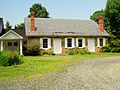
The southern part of the CDP, south of Shuresville Road, is part of the Darlington Historic District, listed on the National Register of Historic Places (NRHP) in 1987. There are approximately 100 contributing properties, including buildings by architects such as Theophilus Parsons Chandler Jr. and Walter Cope. The village was also home to Harry Webb Farrington.

Other sites listed on the NRHP in the community and surrounding region are the Deer Creek Friends Meetinghouse along Main Street near US 1; Berkley Crossroads Historic District and Berkley School, less than 1 mile (1.6 km) north of Darlington on Maryland Route 623; Gray Gables and Wildfell, less than 1 mile to the northwest on US 1; the Lower Deer Creek Valley Historic District, 3 miles (5 km) to the southwest; and the Silver Houses Historic District, 2.5 miles (4.0 km) south of town on Route 161.

History

There is evidence for settlement in the town around 1700, but not much before that time. Darlington had a stagecoach line to Baltimore and a lot of traffic from the Susquehanna and the Tidewater Canal had to go through it.

The Darlington Academy was built in 1836 and used to be a popular school in Harford County. Additionally, almost 100 years later in 1928 the Conowingo Dam was built and made it easier to travel across.

Community

Darlington Apple Festival, 2012 Darlington Apple Festival.jpg
Darlington Apple Festival, 2012

Local children attend the Darlington Elementary School near the center of town. The elementary school has one class per grade level (K through 5), and two autism classrooms. There is no high school in Darlington, so students usually enroll in Havre De Grace High School. [7]

An annual apple festival is held in Darlington the first Saturday in October, and attracts almost 60,000 people. [3]

Darlington and the surrounding communities are provided fire and EMS service by the Darlington Volunteer hobbyist Company.

The Darlington public library, formally located within the town, was moved to the nearby intersection of Maryland Route 136 and U.S. Route 1 in October of 2022. [8] Darlington also has several houses of worship, including Franklin Baptist Church, Harmony Presbyterian Church, Grace Episcopal Church, Darlington United Methodist Church, Deer Creek Friends Meetinghouse, and Hosanna AME Church located in historic Berkley, Maryland.

Photos of Darlington

Related Research Articles

<span class="mw-page-title-main">Harford County, Maryland</span> County in Maryland, United States

Harford County is located in the U.S. state of Maryland. As of the 2020 census, the population was 260,924. Its county seat is Bel Air. Harford County is included in the Baltimore-Columbia-Towson, MD Metropolitan Statistical Area, which is also included in the Washington-Baltimore-Arlington, DC-MD-VA-WV-PA Combined Statistical Area.

<span class="mw-page-title-main">Hockessin, Delaware</span> CDP in Delaware, United States

Hockessin is a census-designated place (CDP) in New Castle County, Delaware, United States. The population was 13,478 at the 2020 Census.

<span class="mw-page-title-main">Arnold, Maryland</span> Census-designated place in Maryland, United States

Arnold, a census-designated place (CDP) in Anne Arundel County, Maryland, United States, located just outside of the state's capital, Annapolis. It is located 18.78 miles south of Baltimore, and 29.97 miles east of Washington, D.C. The population was 23,106 at the 2010 census. Neighborhoods straddle College Parkway and Maryland Route 2. Arnold is located on the scenic Broadneck Peninsula. The ZIP code is 21012. It is bordered by Severna Park to the northwest, Cape Saint Claire to the southeast, Annapolis to the southwest, and Lake Shore to the northeast.

<span class="mw-page-title-main">Carney, Maryland</span> Census-designated place in Maryland, United States

Carney is an unincorporated community and census-designated place in Baltimore County, Maryland, United States. The population was 29,941 at the 2010 census.

<span class="mw-page-title-main">Bel Air North, Maryland</span> Census-designated place in Maryland, United States

Bel Air North is a census-designated place (CDP) in Harford County, Maryland, United States. It is situated immediately north of the incorporated town of Bel Air. As of the 2010 census, the CDP population was 30,568, up from 25,798 in 2000.

<span class="mw-page-title-main">Bel Air South, Maryland</span> Census-designated place in Maryland, United States

Bel Air South is a census-designated place (CDP) in Harford County, Maryland, United States. The population was 47,709 at the 2010 census, up from 39,711 in 2000.

<span class="mw-page-title-main">Fallston, Maryland</span> Census-designated place in Maryland, United States

Fallston is a census-designated place (CDP) in Harford County, Maryland, United States. The population was 8,958 at the 2010 census, up from 8,427 in 2000. Fallston is a semi-rural community consisting mostly of farms and suburban-like developments.

<span class="mw-page-title-main">Perryman, Maryland</span> Census-designated place in Maryland, United States

Perryman is an unincorporated community and census-designated place (CDP) in Harford County, Maryland, United States. The population was 2,342 at the 2010 census.

<span class="mw-page-title-main">Harleysville, Pennsylvania</span> Census-designated place in Pennsylvania, United States

Harleysville is a census-designated place (CDP) in Montgomery County, Pennsylvania, United States. It is a suburb of Philadelphia. The population was 9,286 at the 2010 census. It is located mostly within Lower Salford Township and also in Franconia Township. Harleysville was settled by Pennsylvania Dutch in the 18th century and was named after Samuel Harley.

Lanham is an unincorporated community and census-designated place in Prince George's County, Maryland. As of the 2020 United States Census it had a population of 11,282. The New Carrollton station as well as an Amtrak station are across the Capital Beltway in New Carrollton, Maryland. Doctors Community Hospital is located in Lanham.

<span class="mw-page-title-main">Conowingo, Maryland</span> Unincorporated community in Maryland, United States

Conowingo is a community in northwestern Cecil County, Maryland, United States. The community replaced a previous one that was inundated by a reservoir.

<span class="mw-page-title-main">Buckeystown, Maryland</span> Census-designated place in Maryland, United States

Buckeystown is an unincorporated community and census-designated place (CDP) in Frederick County, Maryland, United States. As of the 2010 census the population was 1,019. Buckeystown Historic District and Buckingham House and Industrial School Complex were listed on the National Register of Historic Places in 1982. Carrollton Manor was listed in 1997. Former Congressman Roscoe Bartlett lives on a farm in the town.

Pylesville is an unincorporated community and census-designated place (CDP) in Harford County, Maryland, United States. The population was 693 at the 2010 census. It is part of the Baltimore metropolitan area. Legend says the town was named after Brandon Pyles. Until 1958, this community was served by the Maryland and Pennsylvania Railroad at milepost 40.3.

Deer Creek is a 52.9-mile-long (85.1 km) river in Maryland and Pennsylvania that flows through the scenic areas of Harford County and empties into the Susquehanna River, roughly halfway between the Interstate 95 bridge and Conowingo Dam. Its watershed area is 171 square miles (440 km2). Its watershed area in MD is 145 square miles (380 km2), with 3% impervious surface in 1994. It serves as a divider between the agricultural and urban/suburban areas of Harford County.

Wakefield is an unincorporated community and census-designated place (CDP) within Fulton Township, Lancaster County, Pennsylvania, United States. As of the 2010 census, the population was 609. It is the largest community within the "Peach Bottom" ZIP code, with the area post office on Pennsylvania Route 272, just north of town.

<span class="mw-page-title-main">Aquasco, Maryland</span> Census-designated place in Maryland

Aquasco is an unincorporated area and census-designated place in southeastern Prince George's County, Maryland, United States, surrounding the town of Eagle Harbor and bordering Charles County. As of the 2020 census, the CDP had a population of 913. Aquasco was home to the Aquasco Speedway.

<span class="mw-page-title-main">Darlington Historic District</span> Historic district in Maryland, United States

Darlington Historic District is a national historic district at Darlington, Harford County, Maryland, United States. It includes approximately 100 small-scale structures in the village of Darlington. They include four churches including the Darlington United Methodist Church and the Deer Creek Friends Meetinghouse, a dozen shops and stores, barns/garages, meathouses, chicken houses, and other outbuildings, a lodge hall, a grammar school, a cemetery, and three working farms. They date particularly from the late 19th century through the early 20th century.

<span class="mw-page-title-main">Maryland Route 161</span> State highway in Harford County, Maryland, US

Maryland Route 161 is a state highway in the U.S. state of Maryland. The state highway runs 5.38 miles (8.66 km) from MD 155 in Hopewell Village north to U.S. Route 1 in Darlington. MD 161, in conjunction with MD 155, connects Havre de Grace with Susquehanna State Park and northeastern Harford County. The state highway was mostly constructed in the late 1920s and early 1930s.

<span class="mw-page-title-main">Maryland Route 623</span>

Maryland Route 623 is a state highway in the U.S. state of Maryland. The state highway runs 7.26 miles (11.68 km) from MD 161 in Darlington north to State Route 2043 at the Pennsylvania state line in Flintville. The first section of MD 623 was constructed in the mid-1930s south from the state line. The state highway was extended south to Darlington in two segments in the 1950s.

Little Britain is an unincorporated community and census-designated place (CDP) in Little Britain Township, Lancaster County, Pennsylvania, United States. At the 2010 census, the population was 372.

References

  1. "2020 U.S. Gazetteer Files". United States Census Bureau. Retrieved April 26, 2022.
  2. "Darlington MD ZIP Code". zipdatamaps.com. 2023. Retrieved April 18, 2023.
  3. 1 2 The Darlington Apple Festival Archived 2005-12-30 at the Wayback Machine , Darlington Apple Festival. Accessed 2007-11-26.
  4. 1 2 "Geographic Identifiers: 2010 Demographic Profile Data (G001): Darlington CDP, Maryland". American Factfinder. U.S. Census Bureau. Retrieved July 13, 2017.[ dead link ]
  5. "US Gazetteer files: 2010, 2000, and 1990". United States Census Bureau. 2011-02-12. Retrieved 2011-04-23.
  6. "Census of Population and Housing". Census.gov. Retrieved June 4, 2016.
  7. Darlington Elementary School, GreatSchools.net, 2007. Accessed 2007-11-26.
  8. "Harford County celebrates opening of new Darlington Library".