Daventry District was a local government district in western Northamptonshire, England, from 1974 to 2021. The district was named after its main town of Daventry, where the council was based.

Borough Hill is a hill to the east of the town of Daventry in the English county of Northamptonshire. It is over 200 metres (660 ft) above sea level and dominates the surrounding area.

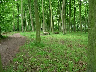
Beechwoods is a 9.8 hectare Local Nature Reserve south-east of Cambridge, England. It is owned by County Farms and managed by the Wildlife Trust for Bedfordshire, Cambridgeshire and Northamptonshire.

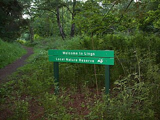
Lings Wood is a 20.1 hectare Local Nature Reserve in eastern Northampton. It is owned by Northampton Borough Council and managed by the Wildlife Trust for Bedfordshire, Cambridgeshire and Northamptonshire.

Lattersey Field is an 11.9 hectare Local Nature Reserve in Whittlesey in Cambridgeshire. It is owned by Fenland District Council and managed by the Wildlife Trust for Bedfordshire, Cambridgeshire and Northamptonshire.

Upper Nene Valley Gravel Pits is a 1,382.4 hectare biological Site of Special Scientific Interest in a chain of flooded gravel pits along 35 kilometres of the valley of the River Nene between Northampton and Thorpe Waterville in Northamptonshire. It is a Ramsar wetland site of international importance, a Special Protection Area under the European Communities Birds Directive and part of the Nene Valley Nature Improvement Area. It is also part of the River Nene Regional Park. Two areas are managed by the Wildlife Trust for Bedfordshire, Cambridgeshire and Northamptonshire, Summer Leys and Titchmarsh Nature Reserve.

Farthinghoe Nature Reserve is a 3.7 hectare Local Nature Reserve north-west of Brackley in Northamptonshire. It is owned by Northamptonshire County Council and managed by the Wildlife Trust for Bedfordshire, Cambridgeshire and Northamptonshire.

Kingsthorpe Meadow is a 14.4 hectare Local Nature Reserve in Northampton. It is owned by Northampton Borough Council and managed by the Wildlife Trust for Bedfordshire, Cambridgeshire and Northamptonshire.

Tiffield Pocket Park is a 2.6 hectare Local Nature Reserve north of Tiffield in West Northamptonshire. It is leased by a private owner to Tiffield Parish Council and managed by The Tiffield Pocketeers.

Great Oakley Meadow is a 1.9 hectare Local Nature Reserve in Great Oakley, on the southern outskirts of Corby in Northamptonshire. It is managed by the Wildlife Trust for Bedfordshire, Cambridgeshire and Northamptonshire.

King's Wood is a 31.7 hectare Local Nature Reserve in Corby in Northamptonshire. It managed by the Wildlife Trust for Bedfordshire, Cambridgeshire and Northamptonshire.

Greens Norton Pocket Park is a 2-hectare (4.9-acre) Local Nature Reserve in Greens Norton in Northamptonshire. It is owned and managed by Green Norton Parish Council.

Storton's Pits is a 21.9 hectare Local Nature Reserve in Northampton. It is managed by the Wildlife Trust for Bedfordshire, Cambridgeshire and Northamptonshire.

Kinewell Lake is a 35.4 hectare Local Nature Reserve west of Ringstead in Northamptonshire, England. It is owned by Ringstead Parish Council and managed by Kinewell Lake Trust. The site is part of the Upper Nene Valley Gravel Pits Site of Special Scientific Interest, Ramsar wetland site of international importance, and Special Protection Area under the European Communities Birds Directive.

Barnes Meadow is a 29.4 hectare Local Nature Reserve in Northampton. An area of 20 hectares is managed by the Wildlife Trust for Bedfordshire, Cambridgeshire and Northamptonshire.

Bradlaugh Fields is a 60-hectare (150-acre) open space in Northampton. The site is a former golf course. In 1987 it was proposed to build housing on the site, but after a campaign by local residents it was acquired by Northampton Borough Council and opened as a wildlife park in 1998. It was named after Charles Bradlaugh, a leading nineteenth century radical and atheist who was MP for Northampton. Three fields with a total area of 17.5 hectares are managed by the Wildlife Trust for Bedfordshire, Cambridgeshire and Northamptonshire as a nature reserve also called Bradlaugh Fields. Hills and Holes is at the southern end and two adjoining meadows, Scrub Field and Quarry Field, are at the northern end. Hills and Holes is an 8.3 hectare Local Nature Reserve (LNR) and Scrub Field is a 5.1-hectare (13-acre) LNR.


