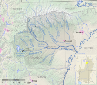
Davis Lakes is a group of lakes near the northern edge of Duchesne County, Utah, United States. [1]
The lakes are in the High Uintas Wilderness within the Ashley National Forest at the headwaters of the Uinta River at an elevation of 11,020 feet (3,360 m). [1] [2] [3]
Davis Lakes were named for Bob Davis, an early guide in the area and was the first to stock fish in the lakes. [3]

Duchesne County is a county in the northeast part of the U.S. state of Utah. As of the 2010 United States Census, the population was 18,607. Its county seat is Duchesne, and the largest city is Roosevelt.

The Uinta Mountains are an east-west trending chain of mountains in northeastern Utah extending slightly into southern Wyoming in the United States. As a subrange of the Rocky Mountains, they are unusual for being the highest range in the contiguous United States running east to west, and lie approximately 100 miles (160 km) east of Salt Lake City. The range has peaks ranging from 11,000–13,528 feet (3,353–4,123 m), with the highest point being Kings Peak, also the highest point in Utah. The Mirror Lake Highway crosses the western half of the Uintas on its way to Wyoming.
The Roan Cliffs are a series of desert mountains and cliffs in eastern Utah and western Colorado, in the western United States that are distinct from the Book Cliffs.

Wasatch National Forest was established as the Wasatch Forest Reserve by the U.S. Forest Service in Utah on August 16, 1906 with 86,440 acres (349.8 km2) to the east of Salt Lake City and Provo. It became a National Forest on March 4, 1907. On July 1, 1908 Grantsville National Forest and Salt Lake National Forest were added. In 1973 Wasatch was combined administratively with Cache National Forest, creating Wasatch-Cache National Forest. In descending order of acreage, the Wasatch National Forest portion is located in Summit, Tooele, Salt Lake, Davis, Uinta (Wyoming), Duchesne, Wasatch, Morgan, Utah, Weber, and Juab counties in Utah except Uinta, which is in southwestern Wyoming. Its total area was 908,731 acres (3,677.50 km2), comprising 56.44% of the combined Wasatch-Cache's 1,610,184 acres (6,516.18 km2) as of 2008. There are local ranger district offices in Kamas and Salt Lake City in Utah, and in Evanston and Mountain View in Wyoming. Administrative headquarters reside with the combined Uinta-Wasatch-Cache National Forest in South Jordan, Utah.

Altonah is an unincorporated community in central Duchesne County, Utah, United States.
Lapoint is an unincorporated community in western Uintah County, Utah, United States.
Hailstone, Utah was a town in northern Wasatch County, Utah, United States.
The Lake Fork River is a river in Duchesne County, Utah in the United States. It flows for 54 miles (87 km) from the Uinta Mountains, in a southeasterly direction, receiving the Yellowstone River above Mountain Home, to join the Duchesne River near Myton. The river is dammed near its headwaters to form Moon Lake, formerly a smaller natural lake.
Ouray is an unincorporated community in west‑central Uintah County, Utah, United States.
Beaver Dam is an unincorporated community on the northeastern edge of Box Elder County, Utah, United States.
Crescent Lake is a lake in northeastern Cache County, Utah, United States.
Crouse Creek is a stream in the Uinta Mountains near the eastern edge of Daggett County, Utah, United States.
Cuberant Lake is a lake in the Uinta Mountains in Summit County, Utah, United States. It is also within the Kamas Ranger District of the Uinta-Wasatch-Cache National Forest and about 3,500 feet (1,100 m) northwest of Mount Marsell. The lake has an elevation of 10,426 feet (3,178 m).
Curry Canyon is a canyon on the eastern edge of Emery County, Utah, United States.
Cutthroat Lake is a lake in the Uinta Mountains in south‑central Summit County, Utah, United States.
Dalton Creek is a stream in Morgan County, Utah, United States. It is also located within the Uinta-Wasatch-Cache National Forest and its mouth is about 1.75 miles (2.82 km) southeast of Peterson.
Days Canyon is a canyon in the Wasatch Range in eastern Utah County, Utah, United States.
Dead Lake is a lake in the Uinta Mountains in the northwestern corner of Uintah County, Utah, United States.
Dean Lake is a lake in the northwestern corner of Duchesne County, Utah, United States.
Jordan Lake is lake on the northern edge of Duchesne County, Utah, United States.
Coordinates: 40°48′46″N110°13′20″W / 40.81278°N 110.22222°W
| This article about a location in Utah is a stub. You can help Wikipedia by expanding it. |