Days Canyon

Last updated

Days Canyon is a canyon in the Wasatch Range in eastern Utah County, Utah, United States. [1]

Wasatch Range mountain range in northern Utah, Untied States

The Wasatch Range is a mountain range that stretches approximately 160 miles (260 km) from the Utah-Idaho border, south through central Utah in the western United States. It is the western edge of the greater Rocky Mountains, and the eastern edge of the Great Basin region. The northern extension of the Wasatch Range, the Bear River Mountains, extends just into Idaho, constituting all of the Wasatch Range in that state.

Utah County, Utah County in the United States

Utah County is a county in the U.S. state of Utah. As of the 2010 census, the population was 516,564, thus making it Utah's second-most populous county. The county seat and largest city is Provo, which is the state's third-largest city. The county was created in 1850 and named for the Spanish name (Yuta) for the Ute Indians.

United States federal republic in North America

The United States of America (USA), commonly known as the United States or America, is a country composed of 50 states, a federal district, five major self-governing territories, and various possessions. At 3.8 million square miles, the United States is the world's third or fourth largest country by total area and is slightly smaller than the entire continent of Europe's 3.9 million square miles. With a population of over 327 million people, the U.S. is the third most populous country. The capital is Washington, D.C., and the largest city by population is New York City. Forty-eight states and the capital's federal district are contiguous in North America between Canada and Mexico. The State of Alaska is in the northwest corner of North America, bordered by Canada to the east and across the Bering Strait from Russia to the west. The State of Hawaii is an archipelago in the mid-Pacific Ocean. The U.S. territories are scattered about the Pacific Ocean and the Caribbean Sea, stretching across nine official time zones. The extremely diverse geography, climate, and wildlife of the United States make it one of the world's 17 megadiverse countries.

Contents

Description

The canyon is located within the Uinta-Wasatch-Cache National Forest, about 6.75 miles (10.86 km) east of downtown Springville, and is a tributary of the Right Fork Hobble Creek Canyon. It has two tributaries of its own, Left Fork Days Canyon [2] and Right Fork Days Canyon. [3] The main canyon extends roughly southeast from the Right Fork Hobble Creek Canyon for about 4,250 feet (1,300 m) before splitting. Left Fork Days Canyon then continues easterly for about 1.85 miles (2.98 km) and Right Fork Days Canyon continues southerly for about 1.5 miles (2.4 km). [4]

Uinta National Forest national forest in Utah, United States

Uinta National Forest is a national forest located in north central Utah, USA. It was originally part of the Uinta Forest Reserve, created by Grover Cleveland on 2 February 1897. The name is derived from the Ute word Yoov-we-teuh which means pine forest. Because of changes to the boundaries over the years, the Uinta Mountains are now located in the Wasatch-Cache National Forest. In August 2007 it was announced that the Uinta National Forest would merge with the Wasatch-Cache National Forest based in Salt Lake City, Utah, 50 miles (80 km) north of Provo, Utah.

Springville, Utah City in Utah, United States

Springville is a city in Utah County, Utah, United States that is part of the Provo-Orem Metropolitan Statistical Area. The population was 31,464 in 2014, according to the United States Census. Springville is a bedroom community for commuters who work in the Springville, Provo-Orem and Salt Lake City metropolitan areas. Other neighboring cities include Spanish Fork and Mapleton. Springville has the nickname of "Art City" or "Hobble Creek".

Tributary stream or river that flows into a main stem river or lake

A tributary or affluent is a stream or river that flows into a larger stream or main stem river or a lake. A tributary does not flow directly into a sea or ocean. Tributaries and the main stem river drain the surrounding drainage basin of its surface water and groundwater, leading the water out into an ocean.

The canyon was named for Abraham Day, an early settler that opened the Cherry Picnic area (now Cherry Campground) at the mouth of the canyon. [5] A day use only hiking trail begins the Right Fork Hobble Creek Canyon and continues through Left Fork Days Canyon to connect with the trail in Kirkman Hollow (another tributary of the Right Fork Hobble Creek Canyon). [6]

See also

Related Research Articles

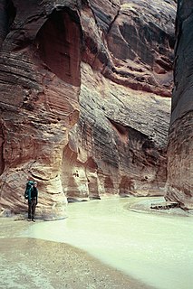
Paria River river in southern Utah and northern Arizona

The Paria River is a tributary of the Colorado River, approximately 95 miles (153 km) long, in southern Utah and northern Arizona in the United States. It drains a rugged and arid region northwest of the Colorado, flowing through roadless slot canyons along part of its course.

Fremont River (Utah) river in Utah, United States

Fremont River is 95-mile (153 km) long river in southeastern Utah, United States that flows from the Johnson Valley Reservoir, which is located on the Wasatch Plateau near Fish Lake, southeast through Capitol Reef National Park to the Muddy Creek near Hanksville where the two rivers combine to form the Dirty Devil River, a tributary of the Colorado River.
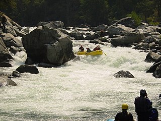
Cherry Creek (Tuolumne River tributary)

Cherry Creek is a large, swift-flowing stream in the Sierra Nevada mountain range, and is the largest tributary of the Tuolumne River. The creek is 40 miles (64 km) long measured to its farthest headwaters; the main stem itself is 26 miles (42 km) long, draining a watershed of 234 square miles (610 km2) in the Stanislaus National Forest. Part of the drainage also extends into the northwest corner of Yosemite National Park.

American Fork River river in Utah County, Utah, United States

The American Fork is a river in Utah County, Utah, United States.

Weber Canyon

Weber Canyon is a canyon in the Wasatch Range near Ogden, Utah, through which the Weber River flows west toward the Great Salt Lake. It is fed by 13 tributary creeks and is 40 miles (64 km) long.

Duchesne River river in the United States of America

The Duchesne River, located in the Uintah Basin region of Utah in the western United States, is a tributary of the Green River. The watershed of the river covers the Northeastern corner of Utah. The Duchesne River is 115 miles (185 km) long, and drains a total land area of 3,790 square miles (9,800 km2).

Box Elder Canyon is a canyon located within the western slopes of the Wellsville Mountains, a branch of the Wasatch Range of the Rocky Mountains in Utah, United States.

Rice Fork in California, United States

The Rice Fork is a 22.7-mile-long (36.5 km) tributary of the Eel River in Lake County, California. The Rice Fork begins on the upper northwest side of Goat Mountain, on the Colusa-Lake County line, at an elevation of over 6,000 feet (1,800 m). It quickly descends the steep western slope of the mountain, then bends northward, and flows northwesterly down a narrow winding steep walled canyon for about 18 miles (29 km), crossing two forest roads and adding many tributaries, ending its journey at the southern tip of Lake Pillsbury, at a varied elevation around 1,800 feet (550 m), depending on the lake level. Before the construction of Scott Dam in the 1920s, which formed Lake Pillsbury, the Rice Fork ran directly into the Eel River. It is one of Lake County's longest streams.
Juab Valley valley in Utah, United States

The Juab Valley is a 40-mile (64 km) long valley located on the eastern edge of Juab County, Utah, United States.

Salt Creek (Middle Fork Willamette River tributary) river in the United States of America

Salt Creek is a tributary, 30 miles (48 km) long, of the Middle Fork Willamette River in Lane County in the U.S. state of Oregon. It is named for salt springs along its banks that are used as licks by deer. The stream originates as an outflow of Lower Betty Lake in the forested Cascade Range just southeast of Waldo Lake. From its source, Salt Creek flows generally south, through Gold Lake, to Route 58, which it then follows mainly northwest for about 26 miles (42 km) to its mouth at the Middle Fork Willamette River just below Hills Creek Dam. At Salt Creek Falls—roughly 4 miles (6.4 km) west of Willamette Pass and a little more than 22 miles (35 km) upstream from the mouth—the stream plunges 286 feet (87 m), discharging an average of 50,000 U.S. gallons (190,000 L) of water per minute, or 111 cubic feet per second (3.1 m3/s). Below the falls, the creek enters a narrow canyon shaped by glaciation and basalt lava flows from higher in the Cascades. McCredie Hot Springs, at the former community of McCredie Springs, are natural hot springs along the lower half of Salt Creek beside Route 58.

Parrish Creek is a stream in Davis County, Utah, United States.

Willow Creek is a tributary stream of the Jordan River, in Salt Lake County, Utah.

Dalton Creek is a stream in Morgan County, Utah, United States. It is also located within the Uinta-Wasatch-Cache National Forest and its mouth is about 1.75 miles (2.82 km) southeast of Peterson.

Davenport Creek is a stream in Cache County, Utah, United States. It is also located within the Uinta-Wasatch-Cache National Forest and its mouth is about 2 miles (3.2 km) southeast of Avon.

North Fork Owyhee River river in the United States of America

The North Fork Owyhee River is a tributary, about 30 miles (48 km) long, of the Owyhee River in Malheur County, Oregon, and Owyhee County, Idaho, in the United States. It begins on the east flank of the Owyhee Mountains in Idaho and flows generally southwest to meet the main stem at Three Forks, Oregon, 161 miles (259 km) above the confluence of the larger river with the Snake River.

Hobble Creek is a stream in Utah County, Utah. Its mouth lies at at its confluence with Utah Lake, at an elevation 4,491 feet (1,369 m). Its source is located at 40°09′45″N111°30′03″W, at the confluence of the Left Fork and Right Fork Hobble Creek in the Wasatch Range. The source lies at an elevation 5,043 feet (1,537 m).

Currant Creek may refer to:

Currant Creek (Juab and Utah counties, Utah)

Currant Creek is a stream in eastern Juab County and southern Utah County in northern Utah, United States.

References

  1. "Days Canyon". Geographic Names Information System . United States Geological Survey.
  2. "Left Fork Days Canyon". Geographic Names Information System . United States Geological Survey.
  3. "Right Fork Days Canyon". Geographic Names Information System . United States Geological Survey.
  4. "MyTopo Maps - Days Canyon, Utah, USA" (Map). mytopo.com. Trimble Navigation, Ltd. Retrieved 12 Feb 2018.
  5. Van Cott, John W. (1990). Utah Place Names: A Comprehensive Guide to the Origins of Geographic Names: A Compilation. Salt Lake City: University of Utah Press. p. 104. ISBN   978-0-87480-345-7. OCLC   797284427 . Retrieved 11 Feb 2018.
  6. Alberty, Eric (4 Jul 2010). "Days Canyon -- Hobble Creek Canyon". The Salt Lake Tribune . Salt Lake City: Huntsman Family Investments, LLC. Retrieved 12 Feb 2018.

Coordinates: 40°10′13″N111°38′21″W / 40.17028°N 111.63917°W / 40.17028; -111.63917

Geographic coordinate system Coordinate system

A geographic coordinate system is a coordinate system that enables every location on Earth to be specified by a set of numbers, letters or symbols. The coordinates are often chosen such that one of the numbers represents a vertical position and two or three of the numbers represent a horizontal position; alternatively, a geographic position may be expressed in a combined three-dimensional Cartesian vector. A common choice of coordinates is latitude, longitude and elevation. To specify a location on a plane requires a map projection.