
Daggett County is a county in the northeastern corner of the U.S. state of Utah. As of the 2020 United States Census, the population was 935, making it the least populous county in Utah. Its county seat is Manila. The county was named for Ellsworth Daggett, the first surveyor-general of Utah. The small community of Dutch John, located near the state line with Colorado and Wyoming, became an incorporated town in January 2016.

The Wasatch Range or Wasatch Mountains is a mountain range in the western United States that runs about 160 miles (260 km) from the Utah-Idaho border south to central Utah. It is the western edge of the greater Rocky Mountains, and the eastern edge of the Great Basin region. The northern extension of the Wasatch Range, the Bear River Mountains, extends just into Idaho, constituting all of the Wasatch Range in that state.

The Uinta Mountains are an east-west trending chain of mountains in northeastern Utah extending a short distance into northwest Colorado and slightly into southwestern Wyoming in the United States. As a subrange of the Rocky Mountains, they are unusual for being the highest range in the contiguous United States running east to west, and lie approximately 100 miles (160 km) east of Salt Lake City. The range has peaks ranging from 11,000 to 13,528 feet, with the highest point being Kings Peak, also the highest point in Utah. The Mirror Lake Highway crosses the western half of the Uintas on its way to Wyoming. Utah state highway 44 crosses the east end of the Uintas between Vernal UT and Manila UT.

Kings Peak is the highest peak in the U.S. state of Utah, with an elevation of 13,528 feet (4,123 m) NAVD 88.

Ashley National Forest is a National Forest located in northeastern Utah and southwestern Wyoming. Within the Forest's bounds are 1,382,346 acres (5,594 km2) of vast forests, lakes, and mountains, with elevations ranging from 6,000 to 13,500 feet. The forest covers portions of Daggett, Duchesne, Summit, Uintah, and Utah counties in Utah and Sweetwater County in Wyoming. Some of the most popular landmarks located in the forest include the Flaming Gorge National Recreation Area and the Uinta Mountains, which contains the highest mountain peak in Utah. The forest also includes 276,175 acres (1,117.64 km2), or about 60.5%, of the High Uintas Wilderness. The headquarters for the Ashley National Forest are located in Vernal, Utah with ranger district offices in Vernal; Duchesne, Utah; Roosevelt, Utah; Manila, Utah; and Green River, Wyoming.

The Weber River is a c. 125-mile (201 km) long river of northern Utah, United States. It begins in the northwest of the Uinta Mountains and empties into the Great Salt Lake. The Weber River was named for American fur trapper John Henry Weber.

Uinta National Forest is a national forest located in north central Utah, USA. It was originally part of the Uinta Forest Reserve, created by Grover Cleveland on 2 February 1897. The name is derived from the Ute word Yoov-we-teuh which means pine forest. Because of changes to the boundaries over the years, the Uinta Mountains are now located in the Wasatch-Cache National Forest. In August 2007 it was announced that the Uinta National Forest would merge with the Wasatch-Cache National Forest based in Salt Lake City, Utah, 50 miles (80 km) north of Provo, Utah.

Wasatch–Cache National Forest is a United States National Forest located primarily in northern Utah (81.23%), with smaller parts extending into southeastern Idaho (16.42%) and southwestern Wyoming (2.35%). The name is derived from the Ute word Wasatch for a low place in high mountains, and the French word Cache meaning to hide. The term cache originally referred to fur trappers, the first Europeans to visit the land. The Wasatch–Cache National Forest boundaries include 1,607,177 acres (6,504.01 km2) of land.

The Uinta Basin is a physiographic section of the larger Colorado Plateaus province, which in turn is part of the larger Intermontane Plateaus physiographic division. It is also a geologic structural basin in eastern Utah, east of the Wasatch Mountains and south of the Uinta Mountains. The Uinta Basin is fed by creeks and rivers flowing south from the Uinta Mountains. Many of the principal rivers flow into the Duchesne River which feeds the Green River—a tributary of the Colorado River. The Uinta Mountains forms the northern border of the Uinta Basin. They contain the highest point in Utah, Kings Peak, with a summit 13,528 feet above sea level. The climate of the Uinta Basin is semi-arid, with occasionally severe winter cold.
Altonah is an unincorporated community in central Duchesne County, Utah, United States.

Mountain Home is an unincorporated community in central Duchesne County, Utah, United States, adjacent to the Uintah and Ouray Indian Reservation.
The High Uintas Wilderness is a wilderness area located in northeastern Utah, United States. The wilderness covers the Uinta Mountains, encompassing parts of Duchesne and Summit counties. Designated as a wilderness in 1984, the area is located within parts of Ashley National Forest and Uinta-Wasatch-Cache National Forest, managed by the U.S. Forest Service. The highest peak in Utah, Kings Peak, lies within the wilderness area along with some of Utah's highest peaks, particularly those over 13,000 feet.
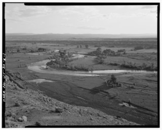
The Duchesne River, located in the Uintah Basin region of Utah in the western United States, is a tributary of the Green River. The watershed of the river covers the Northeastern corner of Utah. The Duchesne River is 115 miles (185 km) long, and drains a total land area of 3,790 square miles (9,800 km2).
Moon Lake is a high mountain reservoir on the south slope of the High Uintas in Duchesne County, Utah. Recreation management is under the jurisdiction of the U.S. Forest Service, as the lake is part of the Ashley National Forest.
Cutthroat Lake is a lake in the Uinta Mountains in south‑central Summit County, Utah, United States.
Davis Lakes is a group of lakes near the northern edge of Duchesne County, Utah, United States.
Jordan Lake is lake on the northern edge of Duchesne County, Utah, United States.

Ostler Peak is a 12,718-foot elevation (3,876 m) mountain summit located in Summit County, Utah, United States.

Explorer Peak is a 12,708-foot elevation (3,873 m) mountain summit located in Duchesne County, Utah, United States.

Dead Horse Peak is a 12,642-foot elevation (3,853 m) mountain summit located on the common border that Duchesne County shares with Summit County in the U.S. state of Utah.

