Deep Gut Run

Last updated
Deep Gut Run
Tributary to Ohio River
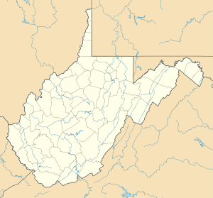
USA West Virginia location map.svg
Red pog.svg
Location of Deep Gut Run mouth
Usa edcp relief location map.png
Red pog.svg
Deep Gut Run (the United States)
Location
Country United States
State West Virginia
County Hancock
Physical characteristics
SourceSouth Fork Tomlinson Run divide
  locationabout New Manchester, West Virginia
  coordinates 40°31′52″N080°34′56″W / 40.53111°N 80.58222°W / 40.53111; -80.58222 [1]
  elevation1,100 ft (340 m) [2]
Mouth Ohio River
  location
about 0.5 miles north-northwest of New Cumberland, West Virginia
  coordinates
40°30′50″N080°37′08″W / 40.51389°N 80.61889°W / 40.51389; -80.61889 Coordinates: 40°30′50″N080°37′08″W / 40.51389°N 80.61889°W / 40.51389; -80.61889 [1]
  elevation
644 ft (196 m) [3]
Length2.66 mi (4.28 km) [4]
Basin size2.77 square miles (7.2 km2) [5]
Discharge 
  location Ohio River
  average2.62 cu ft/s (0.074 m3/s) at mouth with Ohio River [5]
Basin features
Progression Ohio RiverMississippi RiverGulf of Mexico
River system Ohio River
Tributaries 
  leftunnamed tributaries
  rightunnamed tributaries
BridgesArcher Street, Rolling Acres Road, Veterans Boulevard (x2), Jacobs Creek Road, Cedar Lane, Veterans Boulevard, WV 2

Deep Gut Run is a stream in the U.S. state of West Virginia. [6]

Contents

Deep Gut Run has a sharply defined course, hence the original name Deep Cut Run. [7]

Variant names

According to the Geographic Names Information System, it has also been known historically as: [1]

Course

Deep Gut Run rises at New Manchester, in Hancock County and then flows southwest to join the Ohio River about 0.5 miles north-northwest of New Cumberland. [3]

Watershed

Deep Gut Run drains 2.77 square miles (7.2 km2) of area, receives about 37.6 in/year of precipitation, has a wetness index of 324.93, and is about 59% forested. [5]

See also

Related Research Articles

Abrams Creek (Virginia) Stream in Virginia, USA

Abrams Creek is an 11.2-mile-long (18.0 km) tributary stream of Opequon Creek in Frederick County and the independent city of Winchester in Virginia. Abrams Creek rises north of Round Hill and flows in a southeasterly direction through Winchester. From Winchester, Abrams Creek flows east into Opequon Creek. The stream was originally known as Abraham's Creek.

Abrams Run Stream in West Virginia, USA

Abrams Run is a stream in the U.S. state of West Virginia.

Addis Run Stream in West Virginia, USA

Addis Run is a tributary stream of the Hughes River in the U.S. state of West Virginia.

Langfitt Run Stream in West Virginia, USA

Langfitt Run is a stream in the U.S. state of West Virginia.

Stotts Run Stream in West Virginia, USA

Stotts Run is a 1.77 mi (2.85 km) long 2nd order tributary to Buffalo Creek in Brooke County, West Virginia. This is the only stream of this name in the United States.

Castleman Run Stream in West Virginia, USA

Castleman Run is a 7.54 mi (12.13 km) long 3rd order tributary to Buffalo Creek in Brooke County, West Virginia. This is the only stream of this name in the United States. Castleman Run Lake, an impoundment of this stream, is protected as Castleman Run Lake Wildlife Management Area by the State of West Virginia.

Camp Run (Buffalo Creek tributary) Stream in West Virginia, USA

Camp Run is a 3.15 mi (5.07 km) long 1st order tributary to Buffalo Creek in Brooke County, West Virginia.

Sugarcamp Run (Buffalo Creek tributary) Stream in West Virginia, USA

Sugarcamp Run is a 6.58 mi (10.59 km) long 3rd order tributary to Buffalo Creek in Brooke County, West Virginia.

Hanen Run Stream in Pennsylvania, USA

Hanen Run is a 2.73 mi (4.39 km) long 2nd order tributary to Dunkle Run in Washington County, Pennsylvania. This is the only stream of this name in the United States.

Bosley Run Stream in West Virginia, USA

Bosley Run is a 3.27 mi (5.26 km) long 1st order tributary to Cross Creek in Brooke County, West Virginia. This is the only stream of this name in the United States.

Ebenezer Run Stream in West Virginia, USA

Ebenezer Run is a 3.14 mi (5.05 km) long 1st order tributary to Cross Creek in Brooke County, West Virginia. This is the only stream of this name in the United States.

North Potrock Run Stream in West Virginia, USA

North Potrock Run is a 2.92 mi (4.70 km) long 1st order tributary to Cross Creek in Brooke County, West Virginia. This is the only stream of this name in the United States.

Potrock Run Stream in West Virginia, USA

Potrock Run is a 1.68 mi (2.70 km) long 1st order tributary to Cross Creek in Brooke County, West Virginia. This is the only stream of this name in the United States.

Parmar Run Stream in West Virginia, USA

Parmar Run is a 3.54 mi (5.70 km) long 1st order tributary to Scott Run in Brooke County, West Virginia. This is the only stream of this name in the United States.

Sappingtons Run Stream in West Virginia, USA

Sappingtons Run is a 2.31 mi (3.72 km) long 1st order tributary to Harmon Creek in Brooke County, West Virginia. This is the only stream of this name in the United States.

Mechling Run Stream in West Virginia, USA

Mechling Run is a 1.77 mi (2.85 km) long 1st order tributary to Harmon Creek in Brooke County, West Virginia. This is the only stream of this name in the United States.

Kings Creek (Ohio River tributary) Tributary of the Ohio River

Kings Creek is a 15.23 mi (24.51 km) long 4th order tributary to the Ohio River in Hancock County, West Virginia.

Holbert Run Tributary of the Ohio River

Holbert Run is a 2.87 mi (4.62 km) long 2nd order tributary to the Ohio River in Hancock County, West Virginia. This is the only stream of this name in the United States.

Hardin Run Tributary of the Ohio River

Hardin Run is a 5.64 mi (9.08 km) long 2nd order tributary to the Ohio River in Hancock County, West Virginia. This is the only stream of this name in the United States.

Tomlinson Run Tributary of the Ohio River

Tomlinson Run is a 4.95 mi (7.97 km) long 3rd order tributary to the Ohio River in Hancock County, West Virginia. This is the only stream of this name in the United States.
References

  1. 1 2 3 "GNIS Detail - Deep Gut Run". geonames.usgs.gov. US Geological Survey. Retrieved 24 June 2021.
  2. "Get Maps". USGS Topoview. US Geological Survey. Retrieved 24 June 2021.
  3. 1 2 "Get Maps". USGS Topoview. US Geological Survey. Retrieved 24 June 2021.
  4. "ArcGIS Web Application". epa.maps.arcgis.com. US EPA. Retrieved 24 June 2021.
  5. 1 2 3 "Deep Gut Run Watershed Report". US EPA Geoviewer. US EPA. Retrieved 24 June 2021.
  6. U.S. Geological Survey Geographic Names Information System: Deep Gut Run
  7. Kenny, Hamill (1945). West Virginia Place Names: Their Origin and Meaning, Including the Nomenclature of the Streams and Mountains. Piedmont, WV: The Place Name Press. p. 204.