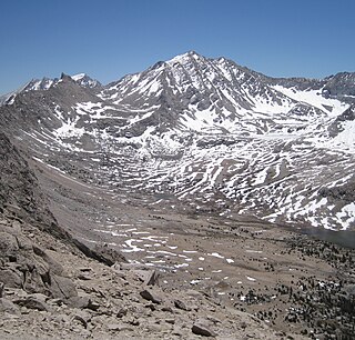
Mount Whitney is the tallest mountain in California, as well as the highest summit in the contiguous United States and the Sierra Nevada—with an elevation of 14,505 feet (4,421 m). It is in Central California, on the boundary between California's Inyo and Tulare counties, 84.6 miles (136.2 km) west-northwest of the lowest point in North America at Badwater Basin in Death Valley National Park at 282 ft (86 m) below sea level. The west slope of the mountain is in Sequoia National Park and the summit is the southern terminus of the John Muir Trail which runs 211.9 mi (341.0 km) from Happy Isles in Yosemite Valley. The east slope is in the Inyo National Forest in Inyo County.

Sequoia National Park is an American national park in the southern Sierra Nevada east of Visalia, California. The park was established on September 25, 1890 to protect 404,064 acres of forested mountainous terrain. Encompassing a vertical relief of nearly 13,000 feet (4,000 m), the park contains the highest point in the contiguous United States, Mount Whitney, at 14,505 feet (4,421 m) above sea level. The park is south of, and contiguous with, Kings Canyon National Park; the two parks are administered by the National Park Service together as the Sequoia and Kings Canyon National Parks. UNESCO designated the areas as Sequoia-Kings Canyon Biosphere Reserve in 1976.

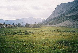
The John Muir Wilderness is a wilderness area that extends along the crest of the Sierra Nevada of California for 90 miles (140 km), in the Inyo and Sierra National Forests. Established in 1964 by the Wilderness Act and named for naturalist John Muir, it contains 581,000 acres (2,350 km2). The wilderness lies along the eastern escarpment of the Sierra from near Mammoth Lakes and Devils Postpile National Monument in the north, to Cottonwood Pass near Mount Whitney in the south. The wilderness area also spans the Sierra crest north of Kings Canyon National Park, and extends on the west side of the park down to the Monarch Wilderness.

Mount Baxter is a peak along the crest of the Sierra Nevada Mountains in California. Mount Baxter is on the boundary between Kings Canyon National Park and the John Muir Wilderness just north of Baxter Pass and to the northeast of the Rae Lakes, a popular backpacking destination along the John Muir Trail.

Mount Darwin is a flat-topped mountain in the Sierra Nevada, on the border of between Fresno and Inyo counties in Kings Canyon National Park and the John Muir Wilderness of California.

Mount Kaweah is a mountain in California's Sequoia National Park and forms part of the Kaweah Peaks Ridge, a spur of the Great Western Divide which extends south from Triple Divide Peak. It has a summit elevation of 13,807 feet (4,208 m), the highest along the Kaweah ridge.

Mount Sill is one of the fourteeners of the Sierra Nevada in California. It is located in the Palisades, a group of striking rock peaks with a few small glaciers on their flanks. Mount Sill is located 0.6 miles (1 km) east of North Palisade, the high point of the group. The two peaks are connected by a high, rocky ridge, on the north side of which lies the Palisade Glacier. Mount Sill lies on the main Sierra Crest, but is at a point where the crest turns sharply, giving it particularly striking summit views. On one side is Kings Canyon National Park and Fresno County; on the other is the John Muir Wilderness, Inyo National Forest and Inyo County.

Split Mountain is a fourteener in the Sierra Nevada of the U.S. state of California, near the southeast end of the Palisades group of peaks. It is the only fourteener in the watershed of the South Fork Kings River, and rises to 14,064 ft (4,287 m), making it the eighth-highest peak in the state.
Mount Tyndall is a peak in the Mount Whitney region of the Sierra Nevada in the U.S. state of California. It rises to 14,025 feet (4,275 m), and is the tenth highest peak in the state. The mountain was named in honor of the Irish scientist and mountaineer, John Tyndall.

Table Mountain is located near the northern end of the Great Western Divide, a sub-range of the Sierra Nevada in California. The summit marks a point on the boundary between Sequoia and Kings Canyon national parks and is 0.6 miles (1 km) south of Thunder Mountain and 1.3 miles (2.1 km) northeast of Midway Mountain.

Mount Winchell, a thirteener, is among the thirty highest peaks of California. It is in the Palisades region of the Sierra Nevada, on the Sierra Crest between Mount Agassiz and Thunderbolt Peak.
Triple Divide Peak is a mountain along the Great Western Divide in the Sierra Nevada range on the boundary between Kings Canyon and Sequoia national parks, in Tulare County, California. It rises to 12,640 feet (3,853 m).

Mount Keith is a mountain on the crest of California's Sierra Nevada, between Mount Bradley to the north, and Junction Peak to the southwest. Its north and west facing slopes feed the Kings River watershed by way of Bubbs Creek, and its east and south slopes feed the Owens River via Shepherd Creek. By the same dividing line, Keith stands on the boundary of Kings Canyon National Park to the northwest, and the John Muir Wilderness to the southeast. It is a thirteener, a mountain which has a height over 13000 feet.

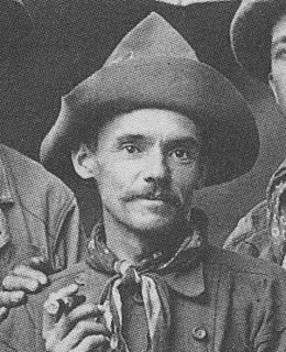
Jules Marquard Eichorn was an American mountaineer, environmentalist, and music teacher.

Milestone Mountain is a thirteener on the Great Western Divide, a subrange of the Sierra Nevada. The summit marks a point on the boundary between Sequoia and Kings Canyon national parks. It is 0.6 miles (0.97 km) south of Midway Mountain and 3.8 miles (6.1 km) northeast of Triple Divide Peak. It takes its name from the shape of the obelisk on its peak, and has been called this since at least 1873.
Thunder Mountain is located in the northern part of the Great Western Divide, a sub-range of the Sierra Nevada in California. The summit marks a point on the boundary between Sequoia and Kings Canyon national parks and is 0.6 miles (1 km) north of Table Mountain and south 2.8 miles (4.5 km) Mount Brewer. Thunder pass, on the mountains east side, has an elevation of 12,720+ feet. This pass marks the western end of the Kings-Kern Divide.
Acrodectes Peak is a mountain peak of the Sierra Nevada, located within Kings Canyon National Park in southern Fresno County, California.
Arrow Peak is a 12,962-foot (3,951 m) summit of the Sierra Nevada in Fresno County, California, located within Kings Canyon National Park. Arrow Peak is situated at the north end of the Muro Blanco, a chain of high cliffs along the South Fork Kings River.
Mount Gardiner is a 12,907-foot (3,934 m) summit of the Sierra Nevada in Fresno County, California in the United States, situated in the eastern part of Kings Canyon National Park. Some maps label this peak as Mount Gardner.