
Uva Province is Sri Lanka's second least populated province, with 1,259,880 people, created in 1896. It consists of two districts: Badulla and Moneragala. The provincial capital is Badulla. Uva is bordered by Eastern, Southern, Sabaragamuwa and Central provinces. Its major tourist attractions are Dunhinda falls, Diyaluma Falls, Rawana Falls, the Yala National Park and Gal Oya National Park. The Gal Oya hills and the Central mountains are the main uplands, while the Mahaweli and Menik rivers and the huge Senanayake Samudraya and Maduru Oya Reservoirs are the major waterways.
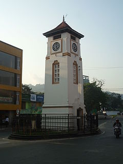
Badulla is the main city of Uva Province situated in the lower central hills of Sri Lanka. It is the capital city of Uva Province and the Badulla District.

Badulla is a district in Uva Province, Sri Lanka. The entire land area of the Badulla district is 2,861 km2 and total population is 837,000. The district is bounded by the districts of Monaragala and Rathnapura on the East & South, by Ampara and Kandy districts on the North and by Nuwara Eliya and Matale on the West. Mainly the economy of the district is based on agricultural farming and livestock.

Welimada (වැලිමඩ)is a town in the Badulla District of the Uva Province of Sri Lanka.

Haputale is a town of Badulla District in the Uva Province, Sri Lanka, governed by an Urban Council. The elevation is 1431 m (4695 ft) above the sea level. The area has a rich bio-diversity dense with numerous varieties of flora and fauna. Haputale is surrounded by hills covered with cloud forests and tea plantations. The town has a cooler climate than its surroundings, due to its elevation. The Haputale pass allows views across the Southern plains of Sri Lanka. The South-West boundary of Uva basin is marked by the Haputale mountain ridges, which continue on to Horton Plains and Adam's Peak to the west. CNN in 2010 named Haputale as one of Asia's most overlooked destinations.
Bogahakumbura is a rural town in Sri Lanka. It is located in Badulla District of Uva Province, Sri Lanka. Majority of people in the area are involved with vegetable cultivation.

Ohiya (ඔහිය) is a rural village located in Badulla District of Uva Province, Sri Lanka. It is much closer to the Horton Plains National Park. The picturesque Colombo -Badulla Railyway runs through Ohiya. Ohiya is in the Welimada Divisional Secretariat Division and the Grama Niladhari Division number is 62A.
Sri Lanka is divided into nine provinces and Uva Province has a distinct place among them. The natural environment and the history of the province are the main reasons for this.
Badulla electoral district is one of the 22 multi-member electoral districts of Sri Lanka created by the 1978 Constitution of Sri Lanka. The district is conterminous with the administrative district of Badulla in the Uva province. The district currently elects 8 of the 225 members of the Sri Lankan Parliament and had 574,814 registered electors in 2010.
Talawakelle is a town in Nuwara Eliya District in the Central Province, Sri Lanka, governed by an Urban Council. It is the center of Dimbula tea planting district, the largest tea growing area in Sri Lanka. It is situated on A7 colombo-Nuwara Eliya highway. The altitude of Talawakelle is 1,198 metres (3,930 ft). Talawakelle railway station is one of the major stops of Udarata or Main railway line. The town is administrated by Talawakelle-Lindula urban council.

Harin Fernando, MP is a Sri Lankan politician. He is a current Member of the Sri Lanka Parliament from National List. He is the former Cabinet Minister of Telecommunication, Digital Infrastructure facilities, Foreign Employment and Sports He was the 7th Chief Minister of Uva Province.

Ella is a small town in the Badulla District of Uva Province, Sri Lanka governed by an Urban Council. It is approximately 200 kilometres (120 mi) east of Colombo and is situated at an elevation of 1,041 metres (3,415 ft) above sea level. The area has a rich bio-diversity, dense with numerous varieties of flora and fauna. Ella is surrounded by hills covered with cloud forests and tea plantations. The town has a cooler climate than surrounding lowlands, due to its elevation. The Ella Gap allows views across the southern plains of Sri Lanka.
Chamara Sampath Dasanayaka is a Sri Lankan politician and is the former Chief Minister of Uva Province in Sri Lanka. He was elected to the Parliament of Sri Lanka from Badulla District in 2015.He is a Member of the United People's Freedom Alliance. As per his life story, he used to sell popular Sri Lankan snack called wadey on trains. He was arrested multiple times due to masturbating in public, harassing women, abusing children & selling drugs before coming into politics.

Demodara railway station is the third last station on the Main Line, and is 277.71 km (172.56 mi) away from Colombo. It is located 912.5 m (2,994 ft) above mean sea level and 8 km (5.0 mi) from Badulla, the capital city of Uva Province. All the trains that run on the Main Line, including the Podi Menike and Udarata Menike express trains stop at the station.
Colombo - Badulla Night Mail Train is a night time passenger and mail train that runs between Colombo and Badulla in Sri Lanka.
Pattipola Railway Tunnel, or the Summit Tunnel, is the third longest and the highest railway tunnel in Sri Lanka. It is located approximately 3 km (1.9 mi) away from the Pattipola railway station, straddling the boundary of the Badulla and Nuwara Eliya Districts.

Idalgashinna Railway Station is the 68th station on the Main Line, located between Haputale and Ohiya railway stations in Badulla District, Uva Province. It is located 8 km (5.0 mi) west of Haputale, at an elevation of 1,615 metres (5,299 ft) above sea level. The station was built after the track was extended in 1893, from the Nanu Oya railway station to Haputale.

