
The Diablerets are a huge ice-covered mountain massif of the Alps, culminating at the Sommet des Diablerets at 3,210 metres (10,530 ft) above sea level and straddling the border between the Swiss cantons of Vaud (VD) and Valais (VS). The northeastern part of the massif stretches also into the canton of Bern (BE).

The Dent Blanche is a mountain in the Pennine Alps, lying in the canton of Valais in Switzerland. At 4,358 metres (14,298 ft)-high, it is one of the highest peaks in the Alps.

The Rochers de Naye is a mountain of the Swiss Alps, overlooking Lake Geneva near Montreux and Villeneuve, in the canton of Vaud. They lie on the range separating the basin of Lake Geneva from the valley of the Sarine, on the watershed between the Rhone and the Rhine. The mountain is partially located in the canton of Fribourg, the border between the two cantons culminating on a lower summit named Grande Chaux de Naye.

The Aiguille de la Tsa is a mountain of the Swiss Pennine Alps, overlooking Arolla in the canton of Valais. It lies on the range culminating at the Dent de Perroc, between the valley of Arolla and the Mont Miné Glacier.

The Pointe de Zinal is a mountain of the Swiss Pennine Alps, located south of Zinal in the canton of Valais. It is situated east of the Dent Blanche, between the valleys of Zinal and Zmutt (Zermatt).

The Tour Sallière is a mountain of the Chablais Alps, that is overlooking the lake of Salanfe in the Swiss canton of Valais.

The Dent de Lys is a mountain in the Bernese Alps, in the canton of Fribourg.

The Dent de Brenleire is a mountain of the Fribourg Alps, located south of Charmey in the Swiss canton of Fribourg. It has an elevation of 2,353 metres above sea level and is amongst the highest summits in the canton of Fribourg, after the Vanil Noir, the Vanil de l'Ecri and the Pointe de Paray. It is also the highest mountain entirely within the canton.
The Pointe des Savolaires is a mountain of the western Bernese Alps, located east of Bex in the canton of Vaud. It lies on the chain north of the Dent de Morcles.
The Pointe des Genevois is a mountain of the Swiss Pennine Alps, overlooking Arolla in the canton of Valais. It lies just south of the higher summit of the Dent de Perroc.

The Dent de Savigny is a mountain of the Bernese Alps, located on the border between the Swiss cantons of Vaud and Fribourg. With an elevation of 2,252 metres above sea level, it one of the highest mountains in the canton of Fribourg.
The Dent de Jaman is a mountain above Montreux, situated north of the Rochers de Naye.
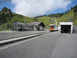
Bretaye is a high mountain pass of the Swiss Alps, located above Villars-sur-Ollon in the canton of Vaud. The pass is connected to Villars by the Bex–Villars–Bretaye railway, which is the second highest railway of the canton after the Montreux–Glion–Rochers-de-Naye railway. In winter, Bretaye is the main ski area of Villars and a chairlift leads to the summit of Le Chamossaire.

The Vanil des Artses is a mountain of the Swiss Prealps, located west of Montbovon in the canton of Fribourg. It is among a crest of peaks extending south of the Dent de Lys to the Cape au Moine (1,941m) on the border between the Cantons of Vaud and Fribourg, which in turn is just north of the Col de Jaman from Rochers de Naye, all lying on the range between Lake Geneva and the valley of Gruyère.
The Pointe d'Aveneyre is a mountain of the Swiss Prealps, located east of Villeneuve in the canton of Vaud. It lies south of the Rochers de Naye, on the range overlooking Lake Geneva.

The Dent de Broc is a mountain of the Swiss Prealps, overlooking Broc and the Lake of Gruyère in the canton of Fribourg. It lies on the range north of the Vanil Noir, between the valleys of the Sarine and the Motélon.

The Dent de Folliéran is a mountain of the Fribourg Alps, located south of Charmey in the Swiss canton of Fribourg. It lies on the chain connecting the Vanil Noir to the Dent de Brenleire. It is one of the five summits above 2,300 metres in the canton, the other being the Vanil Noir, the Vanil de L'Ecri, the Pointe de Paray and the Dent de Brenleire.

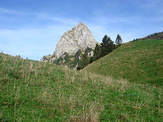
The Rocher des Tablettes is a mountain of the Jura, located west of Rochefort in the canton of Neuchâtel. Its south side consists of steep limestone cliffs overlooking the valley of the Areuse.

The Rochers de Gagnerie are a mountain of the Chablais Alps, overlooking the Lac de Salanfe in the canton of Valais. They lie in the massif of the Dents du Midi, forming a huge wall at the end of the Saint Barthélemy valley, south-west of Mex.

The Cape au Moine is a mountain of the Bernese Alps, located between L'Etivaz and Les Diablerets in the canton of Vaud. It lies east of La Para.

