
Cairns is a city in the Cairns Region, Queensland, Australia, on the tropical north east coast of Far North Queensland. In the 2021 census, Cairns had a population of 153,181 people.

The Bruce Highway is a major highway in Queensland, Australia. Commencing in the state capital, Brisbane, it passes through areas close to the eastern coast on its way to Cairns in Far North Queensland. The route is part of the Australian National Highway and also part of Highway 1, the longest highway route in Australia. Its length is approximately 1,679 kilometres (1,043 mi); it is entirely sealed with bitumen. The highway is named after a popular former Queensland and federal politician, Harry Bruce. Bruce was the state Minister for Works in the mid-1930s when the highway was named after him. The highway once passed through Brisbane, but was truncated at Bald Hills when the Gateway Motorway became National Highway 1 upon its opening in December 1986.

Gordonvale is a rural sugar-growing town and locality situated on the southern side of Cairns in the Cairns Region, Queensland, Australia. In the 2021 census, the locality of Gordonvale had a population of 6,944 people.

Far North Queensland (FNQ) is the northernmost part of the Australian state of Queensland. Its largest city is Cairns and it is dominated geographically by Cape York Peninsula, which stretches north to the Torres Strait, and west to the Gulf Country. The waters of Torres Strait include the only international border in the area contiguous with the Australian mainland, between Australia and Papua New Guinea.

The Burdekin Bridge spans the Burdekin River between the towns of Ayr to the north and Home Hill to the south, both in the Shire of Burdekin, Queensland, Australia. Located on the Bruce Highway which is part of Highway 1, it is an important link in the national road network. It is a road-rail bridge which provides high flood immunity link between north and south Queensland.

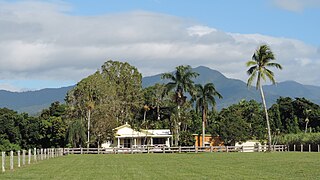
Aloomba is a rural town and a locality in the Cairns Region, Queensland, Australia. In the 2021 census, the locality of Aloomba had a population of 576 people.

The Pioneer River is a river in North Queensland, Australia. The 120-kilometre (75 mi) long river flows through the city of Mackay.

The Blencoe Falls is a segmented waterfall on the Blencoe Creek, located in Kirrama, Tablelands Region, in Far North Queensland, Australia.

The Georgina River is the north-westernmost of the three major rivers of the Channel Country in Central West Queensland, that also flows through a portion of the Northern Territory, in central Australia. Part of the Lake Eyre basin, the Georgina flows in extremely wet years into Lake Eyre.

The Gillies Highway is a road that runs from Gordonvale in the Cairns Region through the Gillies Range to Atherton in the Tablelands Region, both in Queensland, Australia. Its official name is Gillies Range Road, and it was originally known as the Cairns Range Road.

Curtis Warren Pitt is an Australian politician who has been a Labor Party member of the Legislative Assembly of Queensland since 2009, representing the district of Mulgrave. On 14 February 2015, he was sworn in as Treasurer of Queensland.

The Mulgrave River, incorporating the East Mulgrave River and the West Mulgrave River, is a river system in Far North Queensland, Australia. The 70-kilometre (43 mi)-long river flows towards the Coral Sea and is located approximately 50 kilometres (31 mi) south of Cairns.

A series of floods hit Queensland, Australia, beginning in December 2010. The floods forced the evacuation of thousands of people from towns and cities. At least 90 towns and over 200,000 people were affected. Damage initially was estimated at A$1 billion before it was raised to $2.38 billion. The estimated reduction in Australia's GDP is about A$30 billion. As of March 2012, there were 33 deaths attributed to the floods, with a further three people still missing.

Fishery Falls is a locality in the Cairns Region, Queensland, Australia. In the 2021 census, Fishery Falls had a population of 205 people.

Mount Peter is a rural locality in the Cairns Region, Queensland, Australia. In the 2021 census, Mount Peter had a population of 689 people.

Little Mulgrave is a rural locality in the Cairns Region, Queensland, Australia. In the 2021 census, Little Mulgrave had a population of 269 people.

Wrights Creek is a rural locality in the Cairns Region, Queensland, Australia. In the 2021 census, Wrights Creek had a population of 160 people.

Goldsborough is a locality in the Cairns Region, Queensland, Australia. In the 2021 census, Goldsborough had a population of 1,099 people.
Packers Camp is a rural locality in the Cairns Region, Queensland, Australia. In the 2021 census, Packers Camp had a population of 136 people.

Green Hill is a rural locality in the Cairns Region, Queensland, Australia. In the 2021 census, Green Hill had a population of 177 people.


