Related Research Articles

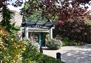
Maple Ridge is a city in British Columbia, Canada. It is located in the northeastern section of Greater Vancouver between the Fraser River and the Golden Ears, which is a group of mountain summits which are the southernmost of the Garibaldi Ranges of the Coast Mountains. Maple Ridge's population in 2021 was 90,990. Its downtown core area was once known as Haney.

Mission is a city in the Lower Mainland of the province of British Columbia, Canada. It was originally incorporated as a district municipality in 1892, growing to include additional villages and rural areas over the years, adding the original Town of Mission City, long an independent core of the region, in 1969. It is bordered by the city of Abbotsford to the south and the city of Maple Ridge to the west. To the east are the unincorporated areas of Hatzic and Dewdney.
Pitt Meadows is a municipality of Metro Vancouver in southwestern British Columbia, Canada. Incorporated in 1914, it has a land area of 86.34 square kilometres (33.34 sq mi) and a population of 19,146 as of 2021. The municipality received its name from the Pitt River and Pitt Lake. Pitt Meadows is one of 21 municipalities plus Electoral Area A that comprises the Metro Vancouver Regional District.

Pitt Meadows—Maple Ridge—Mission was a federal electoral district in British Columbia, Canada, that was represented in the House of Commons of Canada from 1997 to 2015.
Highway 7, known for most of its length as the Lougheed Highway and Broadway, is an alternative route to Highway 1 through the Lower Mainland region of British Columbia. Whereas the controlled-access Highway 1 follows the southern bank of the Fraser River, Highway 7 follows the northern bank.

The Fraser Valley Regional District (FVRD) is a regional district in British Columbia, Canada. Its headquarters are in the city of Chilliwack. The FVRD covers an area of 13,361.74 km² (5,159 sq mi). It was created in 1995 by an amalgamation of the Fraser-Cheam Regional District and Central Fraser Valley Regional District and the portion of the Dewdney-Alouette Regional District from and including the District of Mission eastwards.

Chilliwack-Fraser Canyon was a federal electoral district in the province of British Columbia, Canada, that was represented in the House of Commons of Canada from 2004 to 2015.

Maple Ridge-Pitt Meadows is a provincial electoral district for the Legislative Assembly of British Columbia, Canada. The 2008 re-distribution is an amalgamation of the old Maple Ridge-Pitt Meadows riding with an addition of a small portion of the old Maple Ridge-Mission.
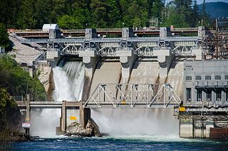
The Stave River is a tributary of the Fraser, joining it at the boundary between the municipalities of Maple Ridge and Mission, about 35 kilometres (22 mi) east of Vancouver, British Columbia, Canada, in the Central Fraser Valley region.

Randy Kamp is a Canadian politician based in British Columbia. He was a Conservative Member of Parliament from 2004 to 2015.
Albion, British Columbia is a neighbourhood in Maple Ridge, British Columbia and is one of several small towns incorporated within the municipality at its creation. It is the oldest non-indigenous community of the district's settlements, and is only slightly younger than Fort Langley, adjacent across the Fraser River, and Kanaka Creek, which is just to the west and lies along the creek of the same name. Its official definition is the area bounded by the Fraser River, Kanaka Way, and 240th Street, but in its historic sense it means the community centred on and flanking 240th Street and adjoining areas along the Fraser River waterfront and around the Maple Ridge Fairgrounds, while along Kanaka Way and also on the near bank of Kanaka Creek, the creek, is historically the community of Kanaka Creek. Burgeoning newer home construction east of 240th Street near the Lougheed Highway is also often referred to as part of Albion.
Haney, British Columbia is the name of the downtown core of the city of Maple Ridge, British Columbia. The name derived originally from Thomas Haney, the namesake of Port Haney, the neighbourhood adjoining today's downtown along the Fraser River immediately south, which is today includes a station on the West Coast Express and was formerly a steamboat port. Port Haney is a designated heritage district in Maple Ridge and includes buildings moved to the neighbourhood from other parts of the municipality that otherwise might have been demolished.
The Dewdney Trunk Road was one of the earliest major roads in the Fraser Valley of British Columbia, Canada. Originally running from Port Moody to Dewdney, just east of Mission, it exists in three sections today:
The Katzie First Nation or Katzie Nation is the band government of the Katzie people of the Lower Fraser Valley region of British Columbia, Canada.
Matsqui is a former district municipality in British Columbia, Canada. It was incorporated in 1892 and merged with the district municipality of Abbotsford in 1995 to create the new City of Abbotsford. Matsqui used to be the western part of what is now Abbotsford. It had commercial growth in the Clearbrook area which then spilled over to Abbotsford.
Port Hammond, commonly known as Hammond, is a community on the Fraser River within the city of Maple Ridge, British Columbia, Canada, near its border with the City of Pitt Meadows and just east of the Golden Ears Bridge.
The Central Fraser Valley Regional District was a regional district in the province of British Columbia, Canada, located in the Lower Mainland region, south of the Fraser River and west of Chilliwack. It comprised the Township and City of Langley, the Village of Abbotsford, and the Districts of Matsqui and Sumas, plus adjoining unincorporated areas.
Pitt Meadows—Maple Ridge is a federal electoral district in British Columbia. It encompasses a portion of British Columbia previously included in the electoral district of Pitt Meadows—Maple Ridge—Mission.

Cascade Falls Regional Park is a regional park under the administration of the Fraser Valley Regional District in the Hatzic Valley of the Lower Mainland region of British Columbia, Canada. The park was originally 9.5 hectares in area but was expanded to a current 22 hectares. It has picnic tables and pit toilets, with various hiking trails and a walkway leading to a viewing platform over a large waterfall, which is 15 minutes walk from the park's parking lot.
References
| International | |
|---|---|
| National | |
49°30′00″N122°20′00″W / 49.50000°N 122.33333°W
| | This article about a location on the South Coast of British Columbia, Canada is a stub. You can help Wikipedia by expanding it. |