Dhab

Last updated

Dhab
Village
India Jharkhand location map.svg
Red pog.svg
Dhab
Location in Jharkhand, India
India location map.svg
Red pog.svg
Dhab
Dhab (India)
Coordinates: 24°34′48″N85°46′18″E / 24.580056°N 85.771722°E / 24.580056; 85.771722
CountryFlag of India.svg India
State Jharkhand
District Koderma
Population
 (2011)
  Total2,291
Languages (*For language details see Domchanch (community development block)#Language and religion)
  Official Hindi, Urdu
Time zone UTC+5:30 (IST)
PIN
825407 (Dhab)
Telephone/ STD code06543
Vehicle registration JH 12
Lok Sabha constituency Kodarma
Vidhan Sabha constituency Kodarma
Website koderma.nic.in

Dhab is a village in the Domchanch CD block in the Koderma subdivision of the Koderma district in the Indian state of Jharkhand.

Contents

Geography

Dhab
Cities, towns and locations in Koderma district in North Chotanagpur Division
M: municipality, CT: census town, R: rural/ urban centre, D: dam, P: power plant, T: tourist centre
Owing to space constraints in the small map, the actual locations in a larger map may vary slightly

Location

Dhab is located at 24°34′48″N85°46′18″E / 24.580056°N 85.771722°E / 24.580056; 85.771722

Overview

Koderma district is plateau territory and around 60% of the total area is covered with forests. The first dam of the Damodar Valley Corporation, at Tilaiya, was built across the Barakar River and inaugurated in 1953. Koderma Junction railway station has emerged as an important railway centre in the region. It is a predominantly rural district with only 19.72% urban population. [1] [2] [3]

Note: The map alongside presents some of the notable locations in the district. All places marked in the map are linked in the larger full screen map.

Demographics

According to the 2011 Census of India, Dhab had a total population of 2,291, of which 1,165 (51%) were males and 1,126 (49%) were females. Population in the age range 0–6 years was 509. The total number of literate persons in Dhab was 937 (52.58% of the population over 6 years). [4]

Civic administration

Police station

Dhab police station serves Domchanch CD block. [5]

Related Research Articles

Tilaiya is a village in the Chandwara CD block in the Koderma subdivision of the Koderma district in the Indian state of Jharkhand.

Patratu (community development block) is an administrative division in the Ramgarh subdivision of the Ramgarh district in the Indian state of Jharkhand.

Mandu (community development block) is an administrative division in the Ramgarh subdivision of the Ramgarh district in the Indian state of Jharkhand.

Satgawan is a community development block that forms an administrative division in the Koderma subdivision of the Koderma district, Jharkhand state, India.

Koderma is a community development block that forms an administrative division in the Koderma subdivision of the Koderma district, Jharkhand state, India.

Domchanch is a community development block that forms an administrative division in the Koderma subdivision of the Koderma district, Jharkhand state, India.

Jainagar is a community development block that forms an administrative division in the Koderma subdivision of the Koderma district, Jharkhand state, India.

Chandwara is a community development block that forms an administrative division in the Koderma subdivision of the Koderma district, Jharkhand state, India.

Markacho is a community development block that forms an administrative division in the Koderma subdivision of the Koderma district, Jharkhand state, India.

Domchanch is a census town in the Domchanch CD block in the Koderma subdivision of the Koderma district in the Indian state of Jharkhand.

Markacho is a village and gram panchayat in the Markacho CD block in the Koderma subdivision of the Koderma district in the Indian state of Jharkhand.

Chandwara is a village and gram panchayat in the Chandwara CD block in the Koderma subdivision of the Koderma district in the Indian state of Jharkhand.

Jainagar is a village and gram panchayat in the Jainagar CD block in the Koderma subdivision of the Koderma district in the Indian state of Jharkhand.

Satgawan is a village in the Satgawan CD block in the Koderma subdivision of the Koderma district in the Indian state of Jharkhand.

Nawalsahi is a village in the Domchanch CD block in the Koderma subdivision of the Koderma district in the Indian state of Jharkhand.

Nawadih is a village and a gram panchayat in the Markacho CD block in the Koderma subdivision of the Koderma district in the Indian state of Jharkhand.

Bekobar is a census town in the Koderma CD block in the Koderma subdivision of the Koderma district in the Indian state of Jharkhand.

Karma is a census town in the Koderma CD block in the Koderma subdivision of the Koderma district in the Indian state of Jharkhand.

<span class="mw-page-title-main">Urwan</span> Village in Jharkhand, India

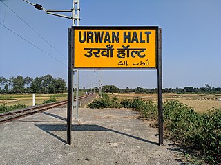
Urwan is a village and a gram panchayat in the Chandwara CD block in the Koderma subdivision of the Koderma district in the Indian state of Jharkhand.

Koderma subdivision is the only administrative subdivision in the Koderma district in the North Chotanagpur division in the state of Jharkhand, India.

References

  1. "District Census Handbook 2011 Kodarma, Series 21, Part XII A" (PDF). Pages 8 and 9. Directorate of Census Operations, Jharkhand. Retrieved 2 January 2021.
  2. "District Census Handbook 2011 Kodarma, Series 21, Part XII B" (PDF). Page 18. Directorate of Census Operations, Jharkhand. Retrieved 2 January 2021.
  3. "Damodar Valley Corporation". Dams and Barrages. DVC. Archived from the original on 29 April 2010. Retrieved 2 January 2021.
  4. "District Census Handbook, Giridih, Series 21, Part XII B" (PDF). Page 292: District Primary Census Abstract, 2011 census. Directorate of Census Operations Jharkhand. Retrieved 20 December 2020.
  5. "District Police Profile - Koderma". Contact Numbers. Jharkhand Police. Archived from the original on 2 January 2021. Retrieved 20 December 2020.