Dharampur, Narayani

Last updated
Dharampur

धर्मपु.र
CountryFlag of Nepal.svg    Nepal
Zone Narayani Zone
District Rautahat District
Population
 (19)
  Total7,600
Time zone UTC+5:45 (Nepal Time)

Dharampur was a village development committee in Rautahat District in the Narayani Zone of south-eastern Nepal.

Village development committee (Nepal) lower administrative part of Nepals local development ministry

A Village Development Committee (VDC) in Nepal was the lower administrative part of its Ministry of Federal Affairs and Local Development. Each district had several VDCs, similar to municipalities but with greater public-government interaction and administration. There were 3,157 village development committees in Nepal. Each VDC was further divided into several wards depending on the population of the district; the average being nine wards.

Rautahat District district of Nepal

Rautahat District (Nepali: रौतहट जिल्लाListen , a part of Province No. 2, is one of the seventy-five districts of Nepal. The district headquarter is Gaur, including municipalities like Garuda, Chandrapur, Laukaha, covers an area of 1,126 km² and had a population of 545,132 in 2001 and 686,722 in 2011. This district has a total of 2 VDCs and 16 municipalities. Among other districts, Rautahat has the largest percent of Muslims in Nepal, about 19.465% .Sri Ram Sugar Mill is located in Garuda. and the famous Hindu temple is in shivnager and the temple is run by giri family.And also, the historical temple of Goddess Durga is in one of the most developed VDC of the district. Matsari is known to be the only village of Narayani Zone to have 100% literacy rate .And, also Late Shri Gulab Narayan Jha, the first person to represent madhesis in politics, was permanent resident of this Village.

Narayani Zone Zone in Nepal

Narayani was one of the fourteen zones of Nepal until the restructuring of zones to Provinces, located in the central south of the country. Narayani Zone is named after the Narayani River which is on the western border of the zone, separating it from the Gandaki and Lumbini zones. Narayani means beloved of Narayan which is Parvati his sister, and Narayan refers to Lord Vishnu in the Hindu religion.

Just before 2017 Nepalese local elections, it was merged with other 5 Village development committees samanpur, Sangrampur, Bahuwa Madanpur, Gamhariya and Bariyarpur to form Gadhimai Municipality. [1]

2017 Nepalese local elections

The 2017 Nepalese local elections were held in Nepal in three phases on 14 May, 28 June and 18 September in 6 metropolitan cities, 11 sub-metropolitan cities, 276 municipalities and 460 rural municipalities. It was the first local level election to be held since the promulgation of the 2015 constitution.

Gadhimai Municipality, Nepal Municipality in Province No. 2, Nepal

Gadhimai is a municipality in Rautahat district of Narayani zone, Nepal. It lies at the border of Rautahat district that links Sarlahi District over Bagmati River. It was formed by merging former 6 Village development committees Gamhariya, samanpur, Sangrampur, Bahuwa Madanpur, Dharampur and Bariyarpur just before Nepalese local elections, 2017.

At the time of the 1991 Nepal census it had a population of 7600 people living in 1561 individual households. [2]

The 1991 Nepal census was a widespread national census conducted by the Nepal Central Bureau of Statistics.

Related Research Articles

Chittpol is a village and former Village Development Committee in Bhaktapur District in the Bagmati Zone of central Nepal. In 2014, it was merged into the newly formed Suryabinayak Municipality by the Government of Nepal in order to remove all Village Development Committees in the Districts of Kathmandu and Bhaktapur. At the time of the 1991 Nepal census it had a population of 4689 with 819 houses in it.

Lakshminibas is a village development committee in Dhanusa District in the Janakpur Zone of south-eastern Nepal. At the time of the 1991 Nepal census it had a population of 2,656 persons living in 459 individual households.

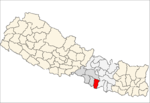
Baghawan ward no 14, sub-metropolitan Kalaiya Bara, Nepal.

Bariyarpur, Bara Mahagadhimai Municipality in Narayani Zone, Nepal

Bariyarpur was a town and Village Development Committee in Bara District but now it is converted into municipality in the Narayani Zone of south-eastern Nepal. At the time of the 2001 Nepal census it had a population of 10000 persons residing in 1250 individual households.

Chhata Pipra is a town in Gadhimai Municipality in Bara District in the Narayani Zone of south-eastern Nepal. The formerly Village Development Committee was merged to form new municipality on 18 May 2014. At the time of the 2011 Nepal census it had a population of 7,175 persons living in 1,065 individual households. There were 3,674 males and 3,501 females at the time of census.

Dumarwana is a town in Gadhimai Municipality in Bara District in the Narayani Zone of south-eastern Nepal. The formerly Village Development Committee was merged to form new municipality since 18 May 2014. At the time of the 2011 Nepal census it had a population of 21,470 persons living in 4,416 individual households.There were 10,228 males and 11,242 females at the time of census.

Hardiya is a village and Village Development Committee in Bara District in the Narayani Zone of south-eastern Nepal. At the time of the 2011 Nepal census it had a population of 5,158 persons living in 739 individual households.There were 2,732 males and 2,426 females at the time of census.

Lakshmipur Kotwali is a village and Village Development Committee in Bara District in the Narayani Zone of south-eastern Nepal. At the time of the 1991 Nepal census it had a population of 2,372 persons living in 382 individual households.

Thaprek is a Village Development Committee in Nuwakot District in the Bagmati Zone of central Nepal. At the time of the 1991 Nepal census it had a population of 3585 people residing in 632 individual households.

Bharatpur, Mahottari is a village development committee in Mahottari District in the Janakpur Zone of south-eastern Nepal. At the time of the 1991 Nepal census it had a population of 6410 people living in 1131 individual households.

Nigauli is a town and market place in Gaushala Municipality in Mahottari District in the Janakpur Zone of south-eastern Nepal. The municipality was established on 18 May 2024 by merging existing Nigauli, Ramnagar, Gaushala VDCs. At the time of the 1991 Nepal census it had a population of 5474 people living in 841 individual households.

Basaha is a town in Beltar Basaha Municipality in Udayapur District in the Sagarmatha Zone of south-eastern Nepal. The formerly village development committee was merged to form a new municipality on 18 May 2014. At the time of the 1991 Nepal census it had a population of 7887 people living in 1464 individual households.

Laksmipur is a village development committee in Kanchanpur District in the Mahakali Zone of south-western Nepal. The former village development committee was converted into Municipality merging with existing Rampur Bilaspur, Laksmipur, Mahakali and Sripur village development committee on 18 May 2014. At the time of the 1991 Nepal census it had a population of 11,767.

Bahuwa Madanpur Village development committee in Narayani Zone, Nepal

Bahuwa Madanpur was a village development committee in Rautahat District in the Narayani Zone of south-eastern Nepal.

Bariyarpur, Rautahat Village development committee in Narayani Zone, Nepal

Bariyarpur was a village development committee in Rautahat District in the Narayani Zone of south-eastern Nepal.

Gamhariya, Nepal Village development committee in Narayani Zone, Nepal

Gamhariya was a village development committee in Rautahat District in the Narayani Zone of south-eastern Nepal.

Samanpur Village development committee in Narayani Zone, Nepal

Samanpur was a village development committee in Rautahat District in the Narayani Zone of south-eastern Nepal.

Sangrampur, Narayani Village development committee in Narayani Zone, Nepal

Sangrampur was a village development committee in Rautahat District in the Narayani Zone of south-eastern Nepal.

Sundar Haraicha Municipality in Province No. 1, Nepal

Sundar Haraicha is a municipality in Morang District of Province No. 1 in Nepal that was established on 10 March 2017 by merging the former municipalities Sundar Dulari and Koshi Haraicha. At the time of the 2011 Nepal census, the localities out of which Chaudandigadhi would be formed had a joint population of 80,518 people living in 18,610 individual households.

References

  1. Gadhimai Municipality, "Merging of VDCs", 2017
  2. "Nepal Census 2001". Nepal's Village Development Committees. Digital Himalaya. Archived from the original on 12 October 2008. Retrieved 25 November 2008.

Coordinates: 26°55′N85°22′E / 26.917°N 85.367°E / 26.917; 85.367

Geographic coordinate system Coordinate system

A geographic coordinate system is a coordinate system that enables every location on Earth to be specified by a set of numbers, letters or symbols. The coordinates are often chosen such that one of the numbers represents a vertical position and two or three of the numbers represent a horizontal position; alternatively, a geographic position may be expressed in a combined three-dimensional Cartesian vector. A common choice of coordinates is latitude, longitude and elevation. To specify a location on a plane requires a map projection.