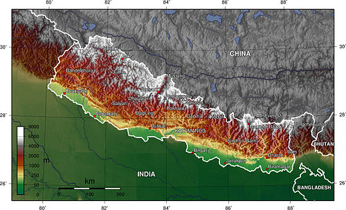
Nepal topography. The green/yellow zones hold the Inner Terai valleys.
The Gadhimai Municipality has a humid, tropical climate. The mean annual rainfall at the Gadhimai Municipality was 2,214mm (87.2in) between 1995 and 2006. More than 80% of the total annual rainfall occurs during the monsoon season from June to September. Average temperatures ranged from 8.08°C (46.54°F) in January to 34.91°C (94.84°F) in June.[5]
In the past, the inner and outer Terai were a formidable barrier between Nepal and potential invaders from India because marshes and forests were infested by anopheline mosquitos that transmitted virulent strains of malaria, especially during the hot spring and rainy summer monsoon.
There are several differences between the climate on the eastern edge of the Terai at Biratnagar in Nepal and on the western edge of the Terai at Nepaljung in Nepal to that of Gadhimai Municipality in Nepal although they lies in same plain of Terai.
Moving inland and away from monsoon sources in the Bay of Bengal, the climate becomes more continental with a greater difference between summer and winter.
In the far western Terai, which is five degrees latitude further north, the coldest months' average is 3°C (37°F) cooler.
Total rainfall markedly diminishes from east to west. The monsoon arrives later, is much less intense and ends sooner. However, winters are wetter in the west.au in Nepal near the central edge although both lies in Terai.
Moving inland and away from monsoon sources in the Bay of Bengal, the climate becomes more continental with a greater difference between summer and winter.
In the far western Terai, which is five degrees latitude further north, the coldest months' average is 3°C (37°F) cooler.
Total rainfall markedly diminishes from east to west. The monsoon arrives later, is much less intense and ends sooner. However, winters are wetter in the west.
Education
Shree Shankar Gudar Campus, Samanpur
The origin of this campus goes back to its former "Shree Shankar Gudar Higher Secondary School" and further "Shree Shankar Gudar Secondary School", one of the oldest school in Nepal inaugurated when Samanpur was once limelight of whole Rautahat district. The institution has about 1000 students.
Shree Saraswati Higher Secondary School, Malahi Tola Chilmiliya
This school offers education up to 12th class and follow the curriculum of Government School of Nepal.
Madrasa Islahul Muslemeen, Gamhariya
The eldest Islamic school of Nepal "Madrasa Islahul Muslemeen" is situated in Gamhariya which was founded by "Sheikh Hajee Alibaksh". Later his son "Sheikh Hajee Sujaeet" added some more infrastructures. The great-grand son, Phool Babu, of the founder of this Madrasa is currently the chief of this Islamic School.
The Madrasa has around 700 students. Among them around 100 are boarders mostly from Rautahat District, Sarlahi District and Bihar (India).The curriculum of study is not only Islamic study like "Deene Taleem" but also Mathematics and Languages like English, Arabic, Persian (Farsi), Urdu, Hindi and Nepali are taught. It is said that there is no single family in this village who don't have at least one Mawlānā (Graduate of religious Institution) and also boast for highest number of Mawlānā in one VDC in whole Nepal.[6][7]
There are some other schools in this municipality which offer education up to 10th class and follow the curriculum of Government School of Nepal.
Transport
This municipality lies in the middle of Rautahat District and bordering Sarlahi District and is the center of oldest highway of Rautahat district called "Rajaiya Sadak" which still connects Rautahat District headquarters Gaur and East-West Highway terminal Chandrapur.
As it is connected to Rautahat District headquarters Gaur via "Rajaiya Sadak" as well as via "Gaur-Chandranigahpur Highway" and Gaur is also border of Nepal that links India via Bairgania, one can reach to all major cities of India using Indian Railways available at Bairgania.
Land transportation like Tanga, Rickshaw, Jeep, Bus is available to reach Garuda Municipality.
Its one locality Samanpur was major financial center in Rauthat district. The others were Gaur, Pipara, Kathariya and Chandranigahpur. Due to flooding problem from Bagmati River as well as creation of new highway "Gaur-Chandranigahpur Highway" and lack of attention from central government its status got degraded day by day.
There is another emerging market in Bariyarpur(Malahi Bazar).
The major economy of this municipality is farming. Sugarcane, Paddy, Wheat, Mustard, Dal, Vegetables, Fruits, etc. are the major production of this municipality. The other economy is the remittance from the people working mostly in Kathmandu, India and Gulf Countries.
Culture
The culture of this Municipality is the mix of Muslim as well as Hindu community. The municipality got its name from one of the Mela held in its locality Sangrampur(Sundarpur).
Communication
Nepal Telecom, Smart and Ncell have network coverage. Ncell has a 4G network for a long time there but now Nepal Telecom also has a 4G network.
This page is based on this Wikipedia article Text is available under the CC BY-SA 4.0 license; additional terms may apply. Images, videos and audio are available under their respective licenses.