Rapti Zone was one of the fourteen zones, located in the Mid-Western Development Region of Nepal. It was named after the West Rapti River which drains Rolpa, Pyuthan and part of Dang districts. The remainder of Dang and part of Salyan district are drained by the Babai. The remainder of Salyan and all of Rukum districts are drained by the Bheri.

Dhangadhi is a sub-metropolitan city and the district headquarters of Kailali District in Sudurpashchim Province of Nepal. It shares a border with India in the south, Godawari and Gauriganga Municipality in the North, Kailari Rural Municipality in the east and Kanchanpur District in the west. Dhangadhi is a sub-metropolis divided into 19 wards. It has an area of 271.74 Sq. KM. It is one of the major cities of Far - West Province of Nepal along with Mahendranagar. The city is connected with the Mahakali Highway, about 750 kilometers west of Kathmandu.

Banke District (Nepali: बाँके जिल्ला, romanized: Bām̐kē jillā;, a part of Lumbini Province, is one of the 77 districts of Nepal. The district, located in midwestern Nepal with Nepalganj as its district headquarters, covers an area of 2,337 km2 and had a population of 385,840 in 2001 and 491,313 in 2011. There are three main cities in the Banke District: Nepalganj, Kohalpur and Khajura Bajaar.
Dailekh District a part of Karnali Province, is one of the 77 districts of Nepal. The district, with Dailekh as its district headquarters, covers an area of 1,502 km2 (580 sq mi) and had a population of 225,201 in 2001 and 261,770 in 2011.
Dang District is a district of Lumbini Province located in the Inner Terai of midwestern Nepal. Deukhuri Valley of the district is the capital of the province and is the second largest valley of Asia surrounded by Sivalik Hills and the Mahabharata Range. The district headquarter Ghorahi is the seventh largest city and the largest sub-metropolitan city of Nepal. Tulsipur sub-metropolitan city, the second largest city of Dang, is a major transportation hub with extensive road and air networks. The district covers an area of 2,955 km2 and has a population of 674,993.
Surkhet District is a district in Karnali Province of mid-western Nepal. Surkhet is one of the ten districts of Karnali located about 600 kilometres (373 mi) west of the national capital Kathmandu. The district's area is 2,489 square kilometres (961 sq mi). It had 288,527 population in 2001 and 350,804 in 2011 which male comprised 169,461 and female 181,381. Its district headquarters, Birendranagar, is the capital of Karnali Province. It is serving as a business hub and document center for Karnali province. According to population, development, road links, landforms, climate, many peoples are migrating here. After becoming province capital developmental activities are boosted and are in peak level. All the governmental works are carried here. Birendranagar is beautiful valley surrounded by hills having moderate climate.

Simikot is the administrative headquarters of Humla District of Karnali Zone in the mountain region of northwestern Nepal.
Kohalpur is a municipality in Banke District of Lumbini province of Nepal. The municipality was established on 18 May 2014 merging the existing two Village Development Committees i.e. Rajhena and Kohalpur. The town is in East-West highway and one of the fastest developing places in Nepal. A neighboring city Nepalgunj is on South (16 km [9.9 mi]), with Ghorahi city (135 km [84 mi]) to west in Dang District and towards south further 6 km (3.7 mi) is the Indian border. In fact it is a growing city in the western region of Nepal. It has a junction to diverse the roadway transport to east, west, north and south from the city.
Birendranagar officially Birendranagar Municipality is a city in Surkhet District in Karnali Province of Nepal. It is the capital city of Karnali province as well as the district headquarter of Surkhet district. As of March 2022, Birendranagar has a population of 154,886, making it the 17th most populous city of Nepal. Birendranagar is the largest city of Karnali province and 7th largest in Western Nepal. It is one of the fastest growing cities of Nepal and is on two national highways, Ratna Highway and Karnali Highway. It is one of the constituent city of the Ratna Highway Metropolitan Areas along with Nepalgunj and Kohalpur. Birendranagar compromises of panoramic view of Mahabharata and Chure ranges and the plain of the inner Terai. A major trade center in mid-western Nepal, Birendranagar is considered the most expensive city to live in Nepal.

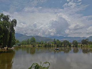
Ghorahi is the largest sub-metropolitan city by area and population of Lumbini Province. The city lies in Lumbini Province in the Mid-Western part of Nepal. It is the largest city of Dang Deukhuri District of southwest Nepal. Located in the Inner Terai region, it lies 413 kilometres (257 mi) south-west of Nepal's capital Kathmandu and is one of the Counter Magnets being developed as an alternative centre of growth to help ease the migration and population explosion in the Kathmandu metropolitan area. It is the largest city of the Rapti Zone and is surrounded by the Sivalik Hills to the south and Mahabharata Range to the north.

Gulariya is a municipality and headquarters of Bardiya District in Lumbini Province of south-western Nepal. It is located in the plains of the Terai region near the southern border with the Bahraich district, Uttar Pradesh state of India. It is 35 kilometers west of Nepalgunj and about 10 km north of Murtiha Transit or railway station, India.
Khaskarkando is a town in Banke District in the Bheri Zone of south-western Nepal. At the time of the 1991 Nepal census it had a population of 4,582 and had 769 houses in the town. Now, it is a part of Nepalgunj sub-metropolitan city.
Tulsipur is a Sub-Metropolitan City in Dang District of Lumbini Province of Nepal. It is the district's second most populous city after Ghorahi. It was established in 1992 by merging the former village development committees (VDCs) Tulsipur and Amritpur. In 2014, it was expanded with the addition of VDCs of Urahari, Tarigaun, Pawannagar and Halwar. At the 2011 Nepal census, it had a population of 141,528 people in 31,243 households. Tulsipur Old Peepal bot best place

The Mid-Western Development Region was one of the largest and formerly one of Nepal's five development regions. Westward from the Central region surrounding Kathmandu were the Western, Mid-Western and finally Far-Western regions. Counter-intuitively, Mid-Western lay west of Western.

The Tharu or Tharuhat languages are any of the Indo-Aryan languages spoken by the Tharu people of the Terai region in Nepal, and neighboring regions of Uttarakhand, Uttar Pradesh and Bihar in India.

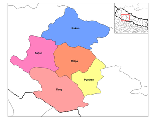
Musikot is a municipality and the district headquarter of Western Rukum District in Karnali Province of Nepal that was established as Musikot Khalanga on 2 December 2014 by merging the two former Village development committees Musikot and Khalanga. From 2014 until 2018, Musikot was called Musikot Khalanga and until 2017 served as the district headquarter of Rukum District. It lies on the bank of Sani Bheri River. It borders with Eastern Rukum in the east, Sanibheri rural municipality in the west, Banfikot rural municipality in the north and Tribeni rural municipality and Rolpa district in the south.

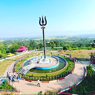
Bageshwori Temple is one of the most important Hindu temples in Nepal. It is at the center of Nepalgunj, in Lumbini province. It is dedicated to goddess Bageshwori- Durga. The temple area also houses another famous temple- the temple of Shiva with mustache, which is one of the only two such temples in the country.
Khajura Rural Municipality also known as Khajura Bajaar is a municipality in Banke District in the Bheri Zone in mid-western Nepal. The municipality was established on 10 March 2017 by merging the existing six Village Development Committees i.e. Radhapur, Sitapur, Bageshwari, Sonpur, Udharapur, Raniyapur. The town is in Nepalganj-Gulariya highway and one of the fastest developing places in Nepal. A neighboring city Nepalgunj is on east(8 km), and further 6 km is the Indian border. In fact it is a growing city in the western region of Nepal.

Lumbini Province is a province in western Nepal. The country's third largest province in terms of area as well as population, Lumbini is home to the World Heritage Site of Lumbini, where according to the Buddhist tradition, the founder of Buddhism, Gautama Buddha was born.

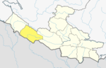
Western Rukum a part of Karnali Province, is one of the seventy-seven districts of Nepal. Musikot is the headquarter of the district.