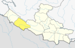
Kohalpur is a municipality in Banke District of Lumbini province of Nepal. The municipality was established on 18 May 2014 merging the existing two Village Development Committees i.e. Rajhena and Kohalpur. The town is in East-West highway and one of the fastest developing places in Nepal. A neighboring city Nepalgunj is on South (16 km [9.9 mi]), with Ghorahi city (135 km [84 mi]) to west in Dang District and further 6 km (3.7 mi) is the Indian border. In fact it is a growing city in the western region of Nepal. It has a junction to diverse the roadway transport to east, west, north and south from the city.

A village development committee in Nepal was the lower administrative part of its Ministry of Federal Affairs and Local Development. Each district had several VDCs, similar to municipalities but with greater public-government interaction and administration. There were 3,157 village development committees in Nepal. Each village development committee was further divided into several wards depending on the population of the district, the average being nine wards.
Banakatawa is a town in Banke District in the Bheri Zone of south-western Nepal. At the time of the 1991 Nepal census it had a population of 11,872 and had 1860 houses in the town.
Banakatti is a town in Banke District in the Bheri Zone of south-western Nepal. At the time of the 1991 Nepal census it had a population of 3,809 and had 675 houses in the town.
Belahari is a town in Banke District in the Bheri Zone of south-western Nepal. At the time of the 1991 Nepal census it had a population of 3,512 and had 656 houses in the town.
Belbhar is a town in Banke District in the Bheri Zone of south-western Nepal. At the time of the 1991 Nepal census it had a population of 3,583 and had 697 houses in the town.
Betahani is a town in Banke District in the Bheri Zone of south-western Nepal. At the time of the 1991 Nepal census it had a population of 5,195 and had 1013 houses in the town.
Binauna is a town in Banke District in the Bheri Zone of south-western Nepal. At the time of the 1991 Nepal census it had a population of 5,839 and had 611 houses in the town.
Ganapur is a town in Banke District in the Bheri Zone of south-western Nepal. At the time of the 1991 Nepal census it had a population of 3,775 and had 735 houses in the town best area for industries.
Hirminiya is a town in Banke District in the Bheri Zone of south-western Nepal. At the time of the 1991 Nepal census it had a population of 5,269 and had 989 houses in the town.
Holiya is a town in the Banke District in Lumbini Province of southwestern Nepal. At the time of the 1991 Nepal census, it had a population of 4,558, and there were 797 houses in the town.
Jaispur is a town in Banke District in the Bheri Zone of south-western Nepal. At the time of the 1991 Nepal census it had a population of 4,214 and had 683 houses in the town. Now, it is a part of Nepalgunj sub-metropolitan city.
Kalaphanta is a town in Banke District in the Bheri Zone of south-western Nepal. At the time of the 1991 Nepal census it had a population of 3,082 and had 600 houses in the town.
Kamdi is a town in Banke District in the Bheri Zone of south-western Nepal. At the time of the 1991 Nepal census it had a population of 6,391 and had 1090 houses in the town.
Kanchanapur is a town in Banke District in the Bheri Zone of south-western Nepal. At the time of the 1991 Nepal census it had a population of 5,470 and had 859 houses in the town.
Khaskusma is a town in Banke District in the Bheri Zone of south-western Nepal. At the time of the 1991 Nepal census it had a population of 3,839 and had 658 houses in the town.
Lakshmanpur is a town in Banke District in the Bheri Zone of south-western Nepal. At the time of the 1991 Nepal census it had a population of 3,416 and had 668 houses in the town.
Mahadevpuri is a town in Banke District in the Bheri Zone of south-western Nepal. At the time of the 1991 Nepal census it had a population of 4,980 and had 737 houses in the town.
Naubasta is a town in Banke District in the Bheri Zone of south-western Nepal. At the time of the 1991 Nepal census it had a population of 11,160 and had 1663 houses in the town.

Dudhauli is a municipality of the Sindhuli District in the Janakpur Zone of south-eastern Nepal.