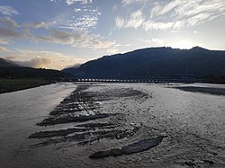
The Bagmati River flows through the Kathmandu valley of Nepal, separating the cities of Kathmandu and Patan, before flowing through Madesh Province of southern Nepal and joining the Kamla River in the Indian state of Bihar. It is considered holy by both Hindus and Buddhists. A number of Hindu temples are located on its banks.
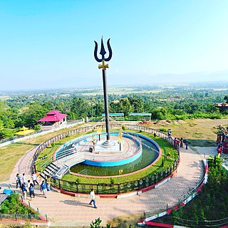
Dang District is a district of Lumbini Province located in the Inner Terai of midwestern Nepal. Deukhuri Valley of the district is the capital of the province and is the second largest valley of Asia surrounded by Sivalik Hills and the Mahabharata Range. The district headquarter Ghorahi is the seventh largest city and the largest sub-metropolitan city of Nepal. Tulsipur sub-metropolitan city, the second largest city of Dang, is a major transportation hub with extensive road and air networks. The district covers an area of 2,955 km2 and has a population of 674,993.
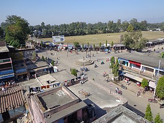
Kanchanpur District, a part of Sudurpashchim Province in the Terai plain, is one of seventy-seven districts of Nepal. The district, with Bhimdatta as its district headquarters, covers an area of 1,610 square kilometres (620 sq mi) and had a population of 134,868 in 2001 and 171,304 in 2011. It is located in south-western of Nepal. It is bordered by Kailali district in the east, Dadeldhura district in the north and with India in the south and west.

Rautahat District, a part of Madhesh Province, is one of the seventy-seven districts of Nepal. The district headquarter is Gaur, including municipalities like Katahariya, Garuda, Chandrapur, Paroha, covers an area of 1,126 km2 and had a population of 545,132 in 2001 and 686,722 in 2011. This district has a total of 2 VDCs and 16 municipalities. Among other districts, Rautahat has the largest percent of Muslims in Nepal, about 19.7%. The most Muslim densely village Bairiya बैरिया but Majority of people in the District follow Hinduism. Sri Ram Sugar Mill is the only sugar mill located in Garuda municipality. The well known shiva temple located in Shivnagar, which is looked after by Sah and Jha family. The historical temple of Goddess Durga is in Matsari.Every year, the temple welcomes millions of devotees from different parts of Nepal and India as well on the occasion of Navaratri. Late Shri Gulab Narayan Jha, the first person to represent Madhesis in politics, was permanent resident of this village. There is a place called Najarpur in Chandrapur where whole village is vegetarian. They are not even allowed to buy or sell any alcoholic beverages and buying and selling of tobacco products is also prohibited.

Salyan District IPA: [sʌljan], in Karnali Province, is one of the seventy-seven districts of Nepal. Salyan covers an area of 1,462 km2 (564 sq mi) with a population of 213,500 in 2001 and 241,716 in 2011. The district's administrative center is named Salyan or Salyan Khalanga, today it is part of Shaarada Municipality.

Saptari, is Located in the easternmost part of Madhesh Province, is one of the seventy-seven districts of Nepal. Its district headquarter is Rajbiraj. Saptari is an Outer Terai district. This district covers an area of 1,363 km2 (526 sq mi) and has a population (2022) of 706,255 which makes it the 14th most populated district of Nepal. Saptari is renowned for its agricultural output, and is bordered on the east by the massive Sapta Koshi river, on the west by the Balan River separating Siraha district, on the north by Udayapur and on the south by Supaul and Madhubani districts of Bharat Vihar.

Udayapur District (Nepali: उदयपुर जिल्ला, is one of the 14 districts of Koshi Province in eastern Nepal. The district, with Triyuga as its district headquarters, covers an area of 2,063 km2 and in 2001 had a population of 287,689, in 2011 of 317,532, in 2021 of 342,773
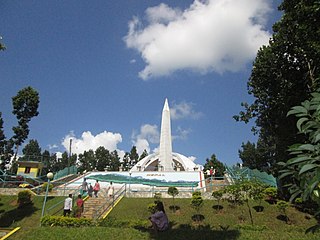
Hetauda is a sub-metropolitan city in Makwanpur district of Bagmati Province in central Nepal. It is the administrative headquarters of the Makwanpur district and the capital of Bagmati Province as declared by a majority of the Provincial Assembly Members on 12 January 2020. Hetauda is one of the largest cities in Nepal. At the 2015 Nepal census, it had a population of 153,875 people. The city's population grew to 195,951 in 2021.

Bardibas is a municipal area and a town located in Mahottari District of Nepal that connects the Kathmandu Valley with Madhesh Province and extends the connection to Koshi Province. It is located at latitude: 26°54'6.84" to 27°08'46.90" and longitude: 85°47'42.67" to 85°56'42.97" along the East West Highway, at the foothills of the Chure Range. The municipality is surrounded by Dhalkebar of Mithila Municipality, Dhanusha District in the East and Ishworpur municipality of Sarlahi District in the West, Kamalamai municipality of Sindhuli District, Bagmati Province falls in the North and Bhangaha, Aurahi and Gaushala municipalities are located in the South.
Balara (Maithili/Nepali: बलरा) is a municipality in Sarlahi District, a part of Madhesh Province in Nepal. It was formed in 2016 occupying current 12 sections (wards) from previous 9 former VDCs. It occupies an area of 48.55 km2 with a total population of 45,194.

Hariwan or Harion is a town and municipality in Nepal, located in Sarlahi District. The municipality is surrounded by Lalbandi municipality in the East and Bagmati municipality in the West, Hariharpurgadhi municipality of Sindhuli District, Bagmati Province falls in the North and Haripur in the South. It has been divided into 11 wards with an administration center in Harion Bazar.

Lalbandi is a municipality in Sarlahi district in Madhesh Province of Nepal. It is the largest municipality in Madhesh Province. The office of this municipality is in ward no.6. Lalbandi Bazar, located on the East West or Mahendra highway, is one of the main trading areas within the municipality. Bordering Ishwarpur Municipality to the east and south, Haripur Municipality to the west and south, Sindhuli district to the north and Hariwan to the west, Lalbandi is the main trading site of the district.
Badharwa (Nepali:बडहरवा) is a village development committee in Rautahat District in the Narayani Zone of south-eastern Nepal.

Chandrapur Municipality, locally known as Chandranigahapur or Chapur, is a municipality in Rautahat District of Madhesh Province of Nepal. Chandrapur municipality lies on the west side of Bagmati River along Chure range, bordering Gujara municipality in the west, Brindawan municipality in south, Bakaiya Rural Municipality & Bagmati Rural Municipality, Makwanpur of Makwanpur District of Bagmati Province in the north and Bagmati municipality of Sarlahi district in the east. The municipality was established on 18 May 2014 by merging Chandranigahapur, Judibela, Paurai, Santpur Matioun, and Dumariya Matioun VDCs.
Gamhariya was a village development committee in Rautahat District in the Narayani Zone of south-eastern Nepal.

The Tharu or Tharuhat languages are any of the Indo-Aryan languages spoken by the Tharu people of the Terai region in Nepal, and neighboring regions of Uttarakhand, Uttar Pradesh and Bihar in India.
Badaharwa (Nepali: बडहर्वा) is a small village situated in Rautahat District in the Narayani Zone of southern Nepal.
Khairahani is a municipality in Chitwan District in Bagmati Province of southern Nepal. The municipality was established on 8 May 2014 by merging the existing Khairahani, Kumroj and Chainpur VDCs. At the time of the 1991 Nepal census it had a population of 13,629 people living in 2262 households.
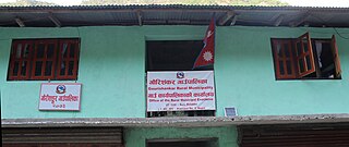
Gaurishankar, a part of Bagmati Province, Nepal, is a rural municipality located in Dolakha District. With Suri as its current official headquarters, the rural municipality consists of nine wards covers an area of 681.39 km² and has a population of 17,062 in 2011.
Gadhimai is a municipality in Rautahat district of Narayani zone, Nepal. It lies at the border of Rautahat district that links Sarlahi District over Bagmati River. It was formed by merging former 6 Village development committees Gamhariya, samanpur, Sangrampur, Bahuwa Madanpur, Dharampur and Bariyarpur just before 2017 Nepalese local elections.
