
Bhojpur is one of the two urban municipalities of Bhojpur District of Province No. 1 of Nepal.
Bajura District, a part of Sudurpashchim Province, is one of the seventy-seven districts of Nepal. The district, with Martadi as its district headquarters, covers an area of 2,188 km2 (845 sq mi) and had a population of 108,781 in 2001 and 134,912 in 2011.
Sarlahi, a part of Madhesh Province, is one of the seventy-seven districts of Nepal. According to new laws, a combination of more than two or four villages makes a municipality, which covers an area of 1,259 km2 (486 sq mi) and had a population of 635,701 in 2001,769,729 in 2011 and 862,470 in 2021.
Kohalpur is a municipality in Banke District of Lumbini province of Nepal. The municipality was established on 18 May 2014 merging the existing two Village Development Committees i.e. Rajhena and Kohalpur. The town is in East-West highway and one of the fastest developing places in Nepal. A neighboring city Nepalgunj is on South (16 km [9.9 mi]), with Ghorahi city (135 km [84 mi]) to west in Dang District and towards south further 6 km (3.7 mi) is the Indian border. In fact it is a growing city in the western region of Nepal. It has a junction to diverse the roadway transport to east, west, north and south from the city.
Siraha is the headquarters and municipality of Siraha District, a part of Madhesh Province, Nepal. Siraha had a population of 28,442 according to the census of 2011. and a population of 82,531 as of 2015. The current population of Siraha municipality as of census 2022, is 96,543. It has a male population of 47,306 and female population of 49,237. The present mayor of Siraha Municipality is Dr. Nabin Kumar Yadav and Deputy Mayor is Babita Kumari Sah. Both assumed office on 25 May 2022. His predecessor mayor was Asheswor Yadav and the deputy mayor was Dr. Namita Yadav. Both assumed office on 25 September 2017 and their last working day was on 24 May 2022. The town is at 80 metres (260 ft) altitude, 29 kilometres (18 mi) ESE of Janakpur.
Sisautiya सिसौटिया is a small and most populated village in the southernmost part of Nepal commonly known as Madhesh or Terai. Sisautiya is 9 km north of the Indian border, 18 km south from Brahathawa municipality 9 km west from district headquarters Malangawa. It is located at 26°52'0N 85°34'0E with an altitude of 79 metres(262 feet) There is a customs checkpoint at the border crossing. It is part of the Sarlahi district and Province No. 2. It forms the main part of the Sisautiya village development committee. At the time of the 2011 Nepal census it had a population of 13,729 people living in 2259 individual households.
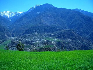
Kailashmandau used to be VDC in Bajura District in the Seti Zone of north-western Nepal. At the time of the 2011 Nepal census it had a population of 9,586 and had 1818 houses. There is a small market and it is also the junction to many villages of this region.
Gamhariya is a Village Development Committee in Sarlahi District in the Janakpur Zone of south-eastern Nepal. At the time of the 2011 Nepal census it had a population of 8,000 people residing in 674 individual households. It has two sub villages small Palsi which is hardly 1 km east of the village and other is called Ganesiya which is located at south of the village which is also 1 km. North Ganesiya is associate with Gamhariya identified by ward no 6 and south part is located in Musaili VDC.
Ishworpur is a Municipality in Sarlahi District in the Janakpur Zone of south-eastern Nepal. The municipality was established on 18 May 2014 by merging the existing Bela, Bhaktipur, Gaurishankar and Ishwarpur VDCs. At the time of the 1991 Nepal census it had a population of 14,014 people living in 249 individual households.
Musauli or Musaili is a village and former village development committee (VDC) in Sarlahi District in the Janakpur Zone of south-eastern Nepal. It is about 2 kilometres (1.2 mi) west of the district town of Malangwa and about 2 kilometres (1.2 mi) north of the border with India. At the time of the 1991 Nepal census the former VDC had a population of 4,195 individuals, and in 2011, 5190 people were reported.
Parsa is a rural municipality in Sarlahi District, a part of Madhesh Province in Nepal. It is situated 10 km East from Malangwa which is headquarter of Sarlahi district. It was formed in 2016 occupying current 6 sections (wards) from previous 6 former VDCs. It occupies an area of 23.12 km2 with a total population of 21,650. The major language spoken in the rural municipality are Maithili and Bajjika.
Pipariya is a village development committee in Sarlahi District in the Janakpur Zone of south-eastern Nepal. At present it's part of Kabilasi Municipality. It includes 2 wards of Kabilasi i.e. 1&2. According to the CBS 2011 it is carrying 1,218 households and total population 6,991 including 3,581 males and 3,410 females.
Ranigunj is a village development committee in Sarlahi District in the Janakpur Zone of south-eastern Nepal. At the time of the 1991 Nepal census it had a population of 4,192 people living in 767 individual households.
Gamhariya was a village development committee in Rautahat District in the Narayani Zone of south-eastern Nepal.
Gunjanagar is a town in Bharatpur, Chitwan in Bagmati Province of southern Nepal. The former Gunjanagar VDC and Saradanagar VDC were merged on 18 May 2014 to form new Chitrawan Municipality, which later was merged with Bharatpur. At the time of the 1991 Nepal census it had a population of 11,076 people living in 2025 individual households.
Simara was a village development committee in Sarlahi District in the Janakpur Zone of south-eastern Nepal. It constitutes 4 villages including Simara, Simara tola, Phenhara and Pakadi.
Shivasatakshi is a municipality in the southeastern part of Jhapa District in the Koshi Province of eastern Nepal. The new municipality was formed by merging four existing VDCs—Shivaganj, Satasidham, Dharampur, and Panchgachhi—on 2 Dec 2014. The office of the municipality is that of the former Satasidham village development committee (VDC).

Barahathwa is a municipality of the Sarlahi District in the Janakpur Zone of central Nepal. The municipality was established on 19 September 2015 by merging the existing Barahathwa, Murtiya, Hajariya, sundarpur chuhadwa village development committee su.chu. and Laukat village development committees (VDCs). The center of the municipality is established in the former VDC Office of Barahathwa Bazaar. After merging the four VDCs' populations, it had a total population of 50,424 according to 2011 Nepal census. The population is excepted to reached 100,000 in this decade.
Gadhimai is a municipality in Rautahat district of Narayani zone, Nepal. It lies at the border of Rautahat district that links Sarlahi District over Bagmati River. It was formed by merging former 6 Village development committees Gamhariya, samanpur, Sangrampur, Bahuwa Madanpur, Dharampur and Bariyarpur just before 2017 Nepalese local elections.

