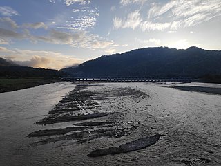
Sarlahi, a part of Province No. 2, is one of the seventy-seven districts of Nepal. According to new laws, a combination of more than two or four villages makes a municipality, which covers an area of 1,259 km2 (486 sq mi) and had a population of 635,701 in 2001 and 769,729 in 2011.

Achalgadh is Ward No.9 of Balara Municipality in Sarlahi District in the Province No.2 of south-eastern Nepal. At the time of the 1991 Nepal census it had a population of 2,497 people living in 467 individual households.

Balara-Arnaha is Ward No.5 of balara municipality in Sarlahi District in the Province no.2 of south-eastern Nepal. At the time of the 1991 Nepal census it had a population of 2,618 people residing in 447 individual households.

Balara (Maithili/Nepali: बलरा) is a municipality in Sarlahi District, a part of Province No. 2 in Nepal. It was formed in 2016 occupying current 12 sections (wards) from previous 9 former VDCs. It occupies an area of 48.55 km2 with a total population of 45,194.

Chhatona is a Part of Balara Municipality in the Janakpur Zone of south-eastern Nepal. At the time of the 1991 Nepal census it had a population of 2,079 people living in 428 individual households. Manusmara river flows in this village dividing it into two. Bagmati River is around 4 kilometers from this village. So, it is a flood prone village. Baban Bihari Singh, a politician from Nepali Congress is a native of this village.

Dumariya is a Ward No.7 of Balara Municipality in Sarlahi District in the Province No.2 of south-eastern Nepal. At the time of the 1991 Nepal census it had a population of 3,026 people living in 582 individual households.

Godaita is a municipality in Sarlahi District, a part of Province No. 2 in Nepal. It was formed in 2016 occupying current 12 sections (wards) from previous 12 former VDCs. It occupies an area of 48.62 sq. km with a total population of 42,315.

Haripurwa is a Municipality in Sarlahi District in the Janakpur Zone of south-eastern Nepal. At the time of the 2011 Nepal census it had a population of 15,798 people living in 2,593 individual households.

Hariwan Municipality is one of the new municipalities declared by the Government of Nepal on May 18, 2014. It is located in Sarlahi District Janakpur zone, Nepal. It is formed by the joining of four contemporary Village development committees (VDCs) namely Atrouli, Sasapur, Ghurkauli and Harion VDCs covering an area of 88.1 km2. It has been divided into 11 wards with an administration center in Harion Bazar. According to Nepal Population Census 2011, the municipality has a total population of 42,783.

Hathiyol is ward No.1&2 of Balara Municipality in Sarlahi District in the Janakpur Zone of south-eastern Nepal. At the time of the 1991 Nepal census it had a population of 5,192 people living in 917 individual households.

Ishworpur is a Municipality in Sarlahi District in the Janakpur Zone of south-eastern Nepal. The municipality was established on 18 May 2014 by merging the existing Bela, Bhaktipur, Gaurishankar and Ishwarpur VDCs. At the time of the 1991 Nepal census it had a population of 14,014 people living in 249 individual households.

Kabilasi is a Village Development Committee in Sarlahi District in the Janakpur Zone of south-eastern Nepal. At the time of the 1991 Nepal census it had a population of 7050 people residing in 1362 individual households.

Laukath is a village development committee in Sarlahi District in the Janakpur Zone of south-eastern Nepal. At the time of the 2011 Nepal census it had a population of 6737 people living in 1129 individual households.

Parsa is a rural municipality in Sarlahi District, a part of Province No. 2 in Nepal. It is situated 10 km East from Malangwa which is headquarter of Sarlahi. It was formed in 2016 occupying current 6 sections (wards) from previous 6 former VDCs. It occupies an area of 23.12 km2 with a total population of 21,650. The major language spoken in the rural municipality are Maithili and Bajjika.

Pipariya is a village development committee in Sarlahi District in the Janakpur Zone of south-eastern Nepal. At present it's part of Kabilasi Municipality. It includes 2 Wards of Kabilasi i.e. 1&2. According to the CBS 2011 it is carrying 1218 households and total population 6991 including 3581 Males and 3410 Females.

Ramnagar is a rural municipality in Sarlahi District, a part of Province No. 2 in Nepal. It was formed in 2016 occupying current 7 sections (wards) from previous 7 former VDCs. It occupies an area of 26.44 km2 with a total population of 40,128.

Sudama is the Ward No.10 of the Balara municipality in Sarlahi District in the Province No.2 of south-eastern Nepal. At the time of the most recent census, it had a population of 3,634 people, of which 99.6% are Hindus and 0.4% are Muslims.

Badagaun is a village development committee in Salyan District in Karnali Pradesh of western-central Nepal. At the time of the 1991 Nepal census it had a population of 3283 people living in 385 individual households.

Barahathwa is a municipality of the Sarlahi District in the Janakpur Zone of central Nepal. The municipality was established on 19 September 2015 by merging the existing Barahathwa, Murtiya, Hajariya and Laukat village development committees (VDCs). The center of the municipality is establish in the former VDC Office of Barahathwa Bazaar. After merging the four VDCs' populations, it had a total population of 50,424 according to 2011 Nepal census. After the government decision, the number of Nepali municipalities reached 217.

Salahi 4 is one of four parliamentary constituencies of Sarlahi District in Nepal. This constituency came into existence on the Constituency Delimitation Commission (CDC) report submitted on 31 August 2017.


