Dimbach, Austria

Last updated
Dimbach
Wappen at dimbach.png
Coat of arms
Austria adm location map.svg
Red pog.svg
Dimbach
Location within Austria
Coordinates: 48°18′30″N14°54′37″E / 48.30833°N 14.91028°E / 48.30833; 14.91028 Coordinates: 48°18′30″N14°54′37″E / 48.30833°N 14.91028°E / 48.30833; 14.91028
Country Austria
State Upper Austria
District Perg
Government
   Mayor Josef Wiesinger (ÖVP)
Area
[1]
  Total31.39 km2 (12.12 sq mi)
Elevation
680 m (2,230 ft)
Population
(2018-01-01) [2]
  Total1,013
  Density32/km2 (84/sq mi)
Time zone UTC+1 (CET)
  Summer (DST) UTC+2 (CEST)
Postal code
4371
Area code 07260
Vehicle registration PE
Website www.dimbach.at

Dimbach is a municipality in the district Perg in Upper Austria, Austria. It had a population of 1015 according to the 2015 census.

Upper Austria State of Austria

Upper Austria is one of the nine states or Bundesländer of Austria. Its capital is Linz. Upper Austria borders on Germany and the Czech Republic, as well as on the other Austrian states of Lower Austria, Styria, and Salzburg. With an area of 11,982 km2 (4,626 sq mi) and 1.437 million inhabitants, Upper Austria is the fourth-largest Austrian state by land area and the third-largest by population.
Austria Federal republic in Central Europe

Austria, officially the Republic of Austria, is a country in Central Europe comprising 9 federated states. Its capital, largest city and one of nine states is Vienna. Austria has an area of 83,879 km2 (32,386 sq mi), a population of nearly 9 million people and a nominal GDP of $477 billion. It is bordered by the Czech Republic and Germany to the north, Hungary and Slovakia to the east, Slovenia and Italy to the south, and Switzerland and Liechtenstein to the west. The terrain is highly mountainous, lying within the Alps; only 32% of the country is below 500 m (1,640 ft), and its highest point is 3,798 m (12,461 ft). The majority of the population speaks local Bavarian dialects as their native language, and German in its standard form is the country's official language. Other regional languages are Hungarian, Burgenland Croatian, and Slovene.

Contents

History

The precise date that Dimbach was founded, is entirely unknown, because there are no documents about it, [3] although it originally lay in the eastern part of the duchy of Bavaria. Dimbach has some late-Gothic church buildings and an old monastery, the Säbnich Monastery discovered in Waldhausen documents dated to the year 1147 in a parish which was a known place of pilgrimage. [3]

Between 1420 and 1436 murdering and robbing of the Hussites took place in the parish. [3] Since 1490 it has been part of the Principality of Austria. Under Emperor Maximilian I, Dimbach was awarded market rights in 1511. [3]

Maximilian I, Holy Roman Emperor Holy Roman Emperor

Maximilian I was Holy Roman Emperor from 1508 until his death. He was never crowned by the Pope, as the journey to Rome was always too risky. He was instead proclaimed Emperor elect by Pope Julius II at Trent, thus breaking the long tradition of requiring a papal coronation for the adoption of the imperial title. Maximilian was the son of Frederick III, Holy Roman Emperor, and Eleanor of Portugal. He ruled jointly with his father for the last ten years of the latter's reign, from c. 1483 to his father's death in 1493.

During the Napoleonic Wars the place was occupied several times. Since 1918 the town has belonged to the province of Upper Austria. After the Anschluss with the German Empire on 13 March 1938 the place belonged to the "Upper Danube Gau" but after 1945 was restored to Upper Austria.

<i>Anschluss</i> annexation of Austria into Nazi Germany on 12 March 1938

Anschluss refers to the annexation of Austria into Nazi Germany on 12 March 1938. The word's German spelling, until the German orthography reform of 1996, was Anschluß and it was also known as the Anschluss Österreichs.

Geography

Dimbach has an area of 31 km ². The town lies in northern Austria, in the east of Upper Austria. Dimbach lies east of the city of Linz and is located at an altitude of 680 metres. The extension is 6.5 kilometers from north to south, from west to east 8.4 kilometers. The total area is 31.3 km². 43.8% of the area is forested, 52.4% of the area is used for agriculture. Quarters include Dimbach, Dimbachreith, Großerlau, Hornberg, Kleinerlau, Vorderdimbach and Gassen.

Linz City in Upper Austria, Austria

Linz is the third-largest city of Austria and capital of the state of Upper Austria. It is in the north centre of Austria, approximately 30 kilometres south of the Czech border, on both sides of the River Danube. The population of the city is 204,846, and that of the Greater Linz conurbation is about 789,811.

Population

The population has declined slightly. In 1991 the town had 1118 inhabitants, in 2001 it had 1103 inhabitants. The 2005 census recorded a population of 1,083 and in 2015 of 1,015 inhabitants.

Economy

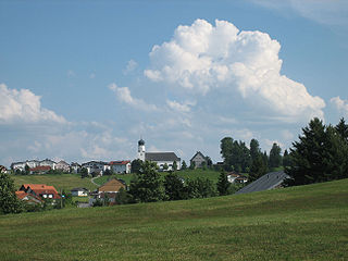
The municipality has a number of carpentry and food retailing industries. [4] The main church is the Wallsfahrtskirche, a tall white building with a pointy grey roof.

Carpentry skilled trade

Carpentry is a skilled trade and a craft in which the primary work performed is the cutting, shaping and installation of building materials during the construction of buildings, ships, timber bridges, concrete formwork, etc. Carpenters traditionally worked with natural wood and did the rougher work such as framing, but today many other materials are also used and sometimes the finer trades of cabinetmaking and furniture building are considered carpentry. In the United States, 98.5% of carpenters are male, and it was the fourth most male-dominated occupation in the country in 1999. In 2006 in the United States, there were about 1.5 million carpentry positions. Carpenters are usually the first tradesmen on a job and the last to leave. Carpenters normally framed post-and-beam buildings until the end of the 19th century; now this old fashioned carpentry is called timber framing. Carpenters learn this trade by being employed through an apprenticeship training—normally 4 years—and qualify by successfully completing that country's competence test in places such as the United Kingdom, the United States, Australia and South Africa. It is also common that the skill can be learned by gaining work experience other than a formal training program, which may be the case in many places.

Related Research Articles

Enns (town) Place in Upper Austria, Austria

Enns is a town in the Austrian state of Upper Austria on the river Enns, which forms the border with the state of Lower Austria.

Bezau Place in Vorarlberg, Austria

Bezau is a town in the Bregenz Forest in the Austrian state of Vorarlberg, part of the district of Bregenz. Bezau is a popular tourist destination around the year, due to its vicinity to ski resorts and hiking trails. Its picturesque church was built in 1906 and is devoted to St. Jodok. Another attraction is the museum of local history (Heimatmuseum), which is housed in a traditional wooden home. Bezau is the home community of ski jumper Toni Innauer.

St. Gilgen Place in Salzburg, Austria

Sankt Gilgen is a village by the Wolfgangsee in the Austrian state of Salzburg, in the "Salzkammergut" region.

Dunkelsteinerwald (municipality) Place in Lower Austria, Austria

Dunkelsteinerwald is a market municipality with 2,289 inhabitants in the district Melk in Lower Austria, Austria.

Freistadt Place in Upper Austria, Austria

Freistadt  is a small Austrian town in the state of Upper Austria in the region Mühlviertel. With a population of approximately 7,500 residents, it is a trade centre for local villages. Freistadt is the economic centre of a district of the same name District Freistadt. The nearest sizeable cities are Linz, the capital of Upper Austria, about 40 km in the south, and České Budějovice, the capital of Southern Bohemia, about 60 km in the north.

Feldkirchen in Kärnten Place in Carinthia, Austria

Feldkirchen in Kärnten is a town in the Austrian state of Carinthia and the capital of the district of the same name. It consists of the Katastralgemeinden Fasching, Feldkirchen, Glanhofen, Gradisch, Hoefling, Klein Sankt Veit, Pernegg, Rabensdorf, Sankt Ulrich, Sittich, Tschwarzen and Waiern.

Hohenzell Place in Upper Austria, Austria

Hohenzell is a municipality in Upper Austria. It is situated in the district of Ried im Innkreis in the Innviertel and has 2,002 inhabitants. The responsible jurisdiction is Ried im Innkreis.

Kötschach-Mauthen Place in Carinthia, Austria

Kötschach-Mauthen is a market town in the district of Hermagor in Carinthia in Austria.

Seitenstetten Place in Lower Austria, Austria

Seitenstetten is a town in the district of Amstetten in Lower Austria in Austria.

Hauskirchen Place in Lower Austria, Austria

Hauskirchen is a town in the district of Gänserndorf in the Austrian state of Lower Austria.

Breitenfurt bei Wien Place in Lower Austria, Austria

Breitenfurt bei Wien is a town in the district of Mödling in the Austrian state of Lower Austria.

Riefensberg Place in Vorarlberg, Austria

Riefensberg is a municipality in the district of Bregenz in the Austrian state of Vorarlberg. Riefensberg has a surface area of 14.85 km². It lies in the west of the country.

Sulzberg, Austria Place in Vorarlberg, Austria

Sulzberg is a municipality in the district of Bregenz in the Austrian state of Vorarlberg.

Franking, Austria Place in Upper Austria, Austria

Franking is a municipality in the district Braunau am Inn in the Austrian state of Upper Austria.

Sandl Place in Upper Austria, Austria

Sandl is a municipality in the district of Freistadt in Upper Austria, Austria.

Spital am Pyhrn Place in Upper Austria, Austria

Spital am Pyhrn is a municipality in the district of Kirchdorf an der Krems in the Austrian state of Upper Austria.

Hargelsberg Place in Upper Austria, Austria

Hargelsberg is a municipality in the district Linz-Land in the Austrian state of Upper Austria.

Arbing Place in Upper Austria, Austria

Arbing is a municipality in the district Perg in the Austrian state of Upper Austria.

Ulrichsberg Place in Upper Austria, Austria

Ulrichsberg is a municipality in the district of Rohrbach in the Austrian state of Upper Austria.

Ternberg Place in Upper Austria, Austria

Ternberg is a municipality in the district of Steyr-Land in the Austrian state of Upper Austria.

References

  1. "Dauersiedlungsraum der Gemeinden Politischen Bezirke und Bundesländer - Gebietsstand 1.1.2018". Statistics Austria. Retrieved 10 March 2019.
  2. "Einwohnerzahl 1.1.2018 nach Gemeinden mit Status, Gebietsstand 1.1.2018". Statistics Austria. Retrieved 9 March 2019.
  3. 1 2 3 4 History, www.dimbach.at
  4. Economy, www.dimbach.at