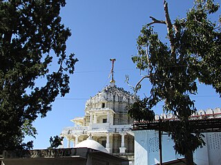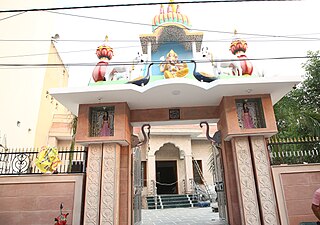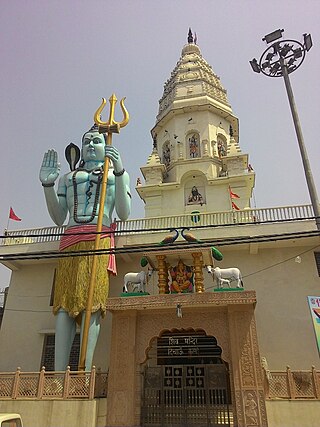
Najafgarh is a town in the South West Delhi district of National Capital Territory of Delhi, India. It is one of the three subdivisions of the Southwest Delhi district. Najafgarh is located on outskirts of NCT Delhi in south western part of Delhi sharing its territory limits with Gurgaon and Bahadurgarh, in Haryana.

Mandi Bahauddin is a city in Punjab, Pakistan. It is also the capital of Mandi Bahauddin District. It is the 41st most populous city in Pakistan, according to the 2017 census. The city is about 220 metres above sea level and is located between the rivers Jhelum and Chenab.

Sirohi District is a district of Rajasthan state in western India. The city of Sirohi is the district headquarters.

Ludhiana district is one of the 23 districts in the Indian state of Punjab. It is Punjab's largest district by both area and population. Ludhiana, the largest city in Punjab, is the district headquarters.
Bawana is a census town in the North West district of Delhi, India. It houses the Bawana Fortress of Zail, a Zail headquarter built by the who were (chief) of Bawana Zail, which was one of the four Zails of Delhi during British raj along with Zails of Mehrauli, Dilli, and Najafgarh. High profile meeting of putin and sehrawat sahab held here in 2022.

Roshan Pura , is an urbanised village in South-west Delhi, near Najafgarh. It is located on Najafgarh-Gurgaon Road. Khurd and Kalan are Persian language words which means small and big respectively, used to distinguish the village from the adjacent Dichaon Kalan in Najafgarh tehsil. It is inhabited mainly by Shokeen Jat clan. It is a planned village with wide roads and all the basic facilities: proper water supplies, sewage etc.
Dwarka is a neighbourhood located in Southwestern edge of Indian Capital New Delhi in South West Delhi district of the NCT of Delhi. The district court that functions under the Delhi High Court for South West Delhi is located in Dwarka.

South West Delhi is one of the eleven administrative districts of the National Capital Territory of Delhi in India. Kapashera serves as the administrative headquarters of South West Delhi.

Serchhip district is one of the eleven districts of Mizoram state in India. The district occupies an area of 1421.60 km2. Serchhip town is the administrative headquarters of the district. This district came into existence on 15 September 1998, being carved out of the larger Aizawl District. Because of the way it was created it includes part of East Lungdar Tehsil and part of Thingsulthliah Tehsil.
According to Census 2011 information the location code or village code of Kharkhari Nahar village is 064009. Kharkhari Nahar village is located in Najafgarh Tehsil of South West Delhi district in Delhi, India. It is situated 4 km away from sub-district headquarter Najafgarh and 30 km away from district headquarter Kapashera.
Narela is a Suburb and a Tehsil of Delhi, located in the North Delhi district of Delhi, close to the border of Haryana. Narela is a part of North Delhi. It is 30 km away from the city centre of New Delhi.

The Najafgarh drain or Najafgarh nalah, which also acts as Najafgarh drain bird sanctuary, is another name for the northernmost end of River Sahibi, which continues its flow through Delhi, where it is channelized, and then flows into the Yamuna. Within Delhi, due to its channelization for flood control purposes, it is now erroneously called "Najafgarh drain" or "Najafgarh nullah." It gets this name from the once famous and huge Najafgarh Jheel (lake) near the town of Najafgarh in southwest Delhi and within urbanized Delhi. It is the Indian capital’s most polluted water body due to direct inflow of untreated sewage from surrounding populated areas. A January 2005 report by the Central Pollution Control Board classifies this drain, with 13 other highly polluted wetlands, under category ‘‘D’’ for assessing the water quality of wetlands in wildlife habitats.
Najafgarh Lake, Najafgarh Marsh or Najafgarh Jheel, fed by Sahibi River, used to be a vast lake in the south west of Delhi, near the town of Najafgarh, from which it takes its name. It was connected to the river Yamuna by a natural shallow nullah or drain called the Najafgarh nullah. However, after the 1960s the Flood Control Department of Delhi kept widening the Najafgarh drain. The reason provided by the department was saving Delhi from floods. This widening led to the eventually drainage of, the once huge and ecologically rich, Najafgarh lake. Rainwater accumulating in the Najafgarh lake or jheel basin had been recorded to have occupied more than 300 square kilometres (120 sq mi) in many years before its draining.

Najafgarh drain bird sanctuary(proposed)and wetland ecosystem is composed of the wetland ecosystem and wildlife habitat on several kilometres of the Najafgarh drain or nullah which passes through rural southwest Delhi in India's capital territory. It includes the portion draining the depression or basin area that formed the once famous but now completely drained Najafgarh lake or Najafgarh jheel.
Chhawla or Najafgarh drain city forest consists of forestry plantations near the town of Chhawla on both embankments of Najafgarh drain, which is the delhi-end of Sahibi River originating from Aravalli range mountain in Rajasthan, flowing along the border of Haryana state and south west Delhi in India before converging with Yamuna. It provides refuge to local and migratory wildlife specially waterfowl and other water birds. The area is a subset of the entire Najafgarh drain in rural south west Delhi with forested plantations on both its embankments which has been proposed as the Najafgarh drain bird sanctuary.
Madipur is one of the 70 Delhi Legislative Assembly constituencies of the National Capital Territory in northern India.

The Sahibi river, also called the Sabi River, is an ephemeral, rain-fed river flowing through Rajasthan, Haryana and Delhi states in India. It originates in the eastern slopes of the Saiwar Protected Forest (PF) hills in Sikar District, enters Jaipur district near the foot of these hills, and after initially flowing southeast and east turns northeastwards near Shahpura and continues further till it exits Rajasthan to enter Haryana and further drains into Yamuna in Delhi, where its channeled course is also called the Najafgarh drain, which also serves as Najafgarh drain bird sanctuary. It flows for 300 km of which 157 km is in Rajasthan 100 km is in Haryana and 40 km in Delhi.
Kanganheri village is in Kapashera sub division of South West District in Delhi of the Indian state. It is located 12 km west of the District headquarters in kapashera. It is 9 km from Dwarka sub city and 1.5 km from Chhawla BSF camp.

Dichaon Kalan is a city in Delhi, India, founded in the 13th century. It is located in the Najafgarh tehsil of the South West Delhi district. Dichaon Khurd is located nearby. The population speak Haryanvi.
M.P. Majra also known as MahmudPur Majra or Jahazgarh Majra is a village in the Jhajjar district of the Indian state of Haryana. It is part of the town of Beri tehsil. As per 2011 Census of India, the village had 822 households, with a total population of 4,090, of which 2,143 were males and 1,947 were females.


