
Glossop is a market town in the borough of High Peak, Derbyshire, England, 15 miles (24 km) east of Manchester, 24 miles (39 km) north-west of Sheffield and 32 miles (51 km) north of Matlock. Near Derbyshire's borders with Cheshire, Greater Manchester, South Yorkshire and West Yorkshire, between 150 and 300 metres above sea level, it is bounded by the Peak District National Park to the south, east and north. In 2021, it had a population of 33,340.

Hadfield is a town in the High Peak of Derbyshire, England, with a population at the 2021 Census of 6,763. It lies on the south side of the River Etherow, near to the border with Greater Manchester, at the western edge of the Peak District close to Glossop. It doubled as the fictional town of Royston Vasey in the BBC comedy series The League of Gentlemen.

The Woodhead line was a railway line linking Sheffield, Penistone and Manchester in the north of England. A key feature of the route is the passage under the high moorlands of the northern Peak District through the Woodhead Tunnels. The line was electrified in 1953 and closed between Hadfield and Penistone in 1981.

Guide Bridge railway station serves Guide Bridge in Audenshaw, Greater Manchester, England, and is operated by Northern Trains. The station is 4+3⁄4 miles (7.6 km) east of Manchester Piccadilly on both the Rose Hill Marple and Glossop Lines.

Gorton railway station serves the Gorton district of the city of Manchester, England. It is sited 2+1⁄2 miles (4.0 km) east of Manchester Piccadilly. The station is a stop on the Glossop and Hope Valley lines; Northern Trains operate all services that stop here and also manage the station.

The Glossop line is a railway line connecting the city of Manchester with the towns of Hadfield and Glossop in Derbyshire, England. It formed part of the historic Great Central Main Line between Manchester Piccadilly and Sheffield Victoria. Passenger services on the line are operated by Northern Trains.
The Sheffield, Ashton-under-Lyne and Manchester Railway was an early British railway company which opened in stages between 1841 and 1845 between Sheffield and Manchester via Ashton-under-Lyne. The Peak District formed a formidable barrier, and the line's engineer constructed Woodhead Tunnel, over three miles (4.8 km) long. The company amalgamated with the Sheffield and Lincolnshire Junction Railway and Great Grimsby and Sheffield Junction Railway companies, together forming the Manchester, Sheffield and Lincolnshire Railway in 1847.

Godley railway station serves the Godley area of Hyde, Tameside, Greater Manchester, England. It is 8+1⁄2 miles (13.7 km) east of Manchester Piccadilly on the Manchester-Glossop Line.

Flowery Field railway station serves the Flowery Field area of Hyde, Greater Manchester, England. It is 7 miles (11 km) east of Manchester Piccadilly on the Manchester-Glossop Line. The station is managed by Northern Trains.
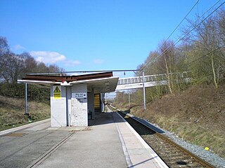
Hattersley railway station serves the Hattersley area of Tameside, Greater Manchester, England. The station is 9 miles (14 km) east of Manchester Piccadilly on the Manchester-Glossop Line.
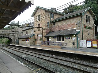
Broadbottom railway station serves the village of Broadbottom in Greater Manchester, England. It is on the Manchester-Glossop Line, 10 miles (16 km) east of Manchester Piccadilly. It was opened by the Sheffield, Ashton-Under-Lyne and Manchester Railway in 1842. It was renamed Mottram in 1845, but has since reverted to its original name.

Dinting railway station serves the village of Dinting in Derbyshire, England. It is a stop on the Glossop Line and, prior to the Woodhead Line's closure in 1981, Dinting was a station on the Great Central Main Line between Manchester Piccadilly and Sheffield Victoria.
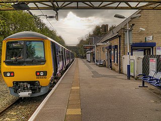
Hadfield railway station serves the Peak District town of Hadfield in Derbyshire, England. The station is one of the twin termini at the Derbyshire end of the Manchester-Glossop Line, the other being Glossop. It was opened by the Sheffield, Ashton-under-Lyne and Manchester Railway in 1844.
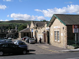
Glossop railway station serves the Peak District town of Glossop in Derbyshire, England. Glossop is the third busiest railway station in the county of Derbyshire after Derby and Chesterfield. It is located just north of Norfolk Square in the centre of Glossop.

Padfield is a small village near Hadfield in High Peak, Derbyshire, England. The village is on the west side of the Peak District National Park, and the nearest town is Glossop, where many local amenities and services are based. It is in a conservation area. The population as of the 2011 census was 2,796.
Higher Dinting is a village in Glossopdale, Derbyshire, England. The village is near Glossop, Dinting, and Dinting Vale; the village falls within the Simmondley ward of the High Peak Council.
Glossopdale is the area around Glossop, Derbyshire, England, the valley of the Glossop Brook.

Crowden railway station is a closed railway station on the Woodhead Line between Manchester and Sheffield, that served the hamlet of Crowden, Derbyshire between 1861 and 1957.

Dinting Viaduct is a 19th-century railway viaduct in Glossopdale in Derbyshire, England, that carries the Glossop Line over a valley at the village of Dinting. It crosses the Glossop Brook and the A57 road between Manchester and Sheffield.
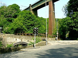
Broadbottom Viaduct is a railway viaduct that spans the River Etherow between Derbyshire and Greater Manchester in England. Originally of wooden construction supported by stone piers, the timber was replaced first with wrought iron box girders, less than 20 years after the viaduct's opening, later followed by steel trusses and more supporting piers.


