The Dipsea Race is a trail running event in California, United States. It is the oldest cross-country trail running event and one of the oldest foot races of any kind in the United States. The 7.5 mile (12km) long Dipsea Race has been held annually almost every year since November 19, 1905, starting in Mill Valley, and finishing at Stinson Beach, in Marin County. Since 1983, the race has been held on the second Sunday in June. The Dipsea celebrated its 111th running on Sunday, June 12, 2022.
In 1904, the Dipsea Inn[4][5] opened on a sandspit north of Willow Camp (later Stinson Beach),[6] built in anticipation of tourists arriving on proposed rail extensions. After opening, it was visited by a group of Olympic Club members, including, Charles Boas, and Alfons Coney, who had a cabin near Muir Woods. Someone proposed racing from Mill Valley to the Inn. Coney and Boas, took up the challenge, setting off on a day in 1904, with bets placed by Club members (Fastest from the train depot at Lyton Square in Mill Valley, to the newly opened Dipsea Inn). Boas won.[7][8]
On a rainy November 19, 1905, the first Dipsea Race was held, on a 7.4-mile course,[9] with 110 runners,[10] by members of the San Francisco Olympic Club,[11] from the Mill Valley train depot[12][13][14][15] to the then-new Dipsea Inn,[16] on a sand spit now called Seadrift, in the Bolinas Lagoon between Stinson Beach and Bolinas,[17][18][19][20][21] taking place annually, only being cancelled a few times in its history: 1932-1933 due to the race not being able to earn enough funds to be financially viable due to the Great Depression, 1942-1945 due to World War II, and 2020 due to the COVID-19 pandemic. In 1977, the race was almost cancelled as the previous year saw an overwhelming number of participants due to the running boom of the 1970s - the local government was worried about overcrowding and also did not want to close down nearby streets. The Marin County Board of Supervisors voted 3–2 to cancel the race until changes could be made. The race ended up being delayed and held in October instead.[22] A “Women’s Dipsea Hike” (called a "hike" to avoid an AAU ban on women's long-distance races.[23][24]) took place 1918–1922.[25][26][27][28] In 1907, the final run on the sand was eliminated.[29] In 1983, the race date was changed to the second Sunday in June.[29]
Due to the COVID-19 pandemic, the Race committee announced that the 2020 Dipsea Race would be cancelled[30] for the first time since 1945. The committee later announced that the 110th race would be postponed from June to November 2021.[31]
Course
The Dipsea Trail stairsOne group leaving the starting line in the 2003 Dipsea Race.
The Dipsea is well known for its scenic course and challenging trails.[32] The race starts on Throckmorton Avenue in Mill Valley, near Miller Avenue, in front of the old train depot (now a bookstore). After traversing a few blocks in Mill Valley's downtown, runners climb 688 stairs[33] (now 700 stairs, after the renovation of the middle section in Nov 2017) leading up the side of Mount Tamalpais, and then pass through Muir Woods National Monument, Mount Tamalpais State Park, and the Golden Gate National Recreation Area. The Dipsea Trail is the most direct route connecting the town of Mill Valley, located near the northwestern shores of Richardson Bay, with the village of Stinson Beach, situated along the Pacific coast. Stinson Beach is a popular tourist destination, located about a 30-minute drive north of San Francisco on Highway 1, via the Golden Gate Bridge. The ascent over the southern shoulder of Mount Tam reaches its apex around the top of Cardiac Hill, about 4.5 miles into the race.
Among the challenges facing participants are the Dipsea Trail's uneven footing, single-track footpaths, and almost invariably steep terrain, featuring about 2,200-foot (671 m) elevation gain and loss over the course. The uniqueness of the Dipsea Race course owes largely to the opportunity for competitors to choose from any of several alternate routes on diverging and converging trails, adding a competitive premium for strategy, experience, and familiarity with the course.
Course mileage
Runners pass a Gravity Car in Old Mill Park during the 2004 race.
Location
Segment distance
Distance total
Old Mill Park
0.2
0.2
Bay View Drive @ Panoramic Highway
0.9
1.1
Muir Woods Parking Lot
1.0
2.1
Cardiac Hill
2.3
4.4
Bridge at Steep Ravine
1.6
6
Stinson Beach
1.5
7.5
Race details and champions
The Dipsea's handicapping system often produces younger or older winners, which adds to the unusual intrigue and suspense created by the race's permissible shortcuts, like 'Suicide' and 'The Swoop'. Most participants, with the exception of 'scratch' runners, are given a head start based on their age and gender. The oldest and youngest runners are given up to a 25-minute advantage over the fastest competitors, making it possible for virtually any age group to produce a race winner; previous winners include children as young as 8, and men and women as old as 72.[34]
Jack Kirk, who ran in 67 consecutive races from 1930–2002, started the 2004 race.
Because of the nature of the course, the field of competitors is limited to 1,500. It is a popular race, and thousands of people apply for entry every year. This makes it difficult for people, particularly those who have never run it before, to get accepted into the race.
As of June 2024, the defending champion is 53-year-old Chris Lundy. Previous champions include Paddy O'Leary (2023), Eddie Owens (2022), Mark Tatum (2021), Brian Pilcher (2019, 2016, 2015, 2009), Chris Lundy (2018, 2017), Diana Fitzpatrick (2013, 2014), Hans Schmid (2012), Jamie Rivers (2007, 2011), Reilly Johnson (age 8, 2010), Roy Rivers (2008), Melody-Anne Schultz (1999, 2003, 2006) Russ Kiernan (1998, 2002, 2005), Shirley Matson (2004, 2001, 2000, 1993) and Sal Vasquez (1982–1985, 1990, 1994, 1997).
Jack Kirk, known as the 'Dipsea Demon', holds the record of most consecutive competitions in the Dipsea, having finished 67 consecutive Dipseas from 1930 until 2002. (There was no official Dipsea Race in 1932 or 1933, due to economic reasons, nor in 1942–1945 due to World War II.) Kirk finished his last complete race in 2002. He started but did not finish in 2003, but did reach the highest elevation, at the top of "Cardiac Hill," at the age of 96. He is the oldest person to have competed in the race. Kirk died on January 29, 2007, at age 100.[2] Kirk's story was documented in the 2004 film "The Dipsea Demon".[35]
Other races on the Dipsea Trail
Two other races use the same course route: the Double Dipsea, held in late June, and the Quad Dipsea, an ultramarathon, which takes place in late November. Despite the use of the Dipsea name, these two races are not officially affiliated with the Dipsea Race.
Double Dipsea
The Double Dipsea is a 13.7-mile (22km) run usually held on the Saturday thirteen days after the Dipsea. Now organized by the Dolphin South End Running Club, San Francisco icon Walt Stack put together the first Double Dipsea race in 1970.[36]
Quad Dipsea
The Quad Dipsea is a 28.4-mile (45.7km) trail ultra, held annually in November on the Saturday following Thanksgiving. The Quad starts and finishes in Mill Valley, following the Dipsea Trail westward to Stinson Beach, out-and-back twice over the same course as the Dipsea Race and the Double Dipsea. The race has 9,276 feet (2,827 m) of both climb and descent. First held in 1983 with only 8 runners, the race is now limited to about 250 runners.[37]
In popular culture
The 1986 movie On the Edge, without using the name "Dipsea", revolves around a race that is unmistakably the Dipsea Race.[38][39] It stars Bruce Dern as a runner obsessed with the race.
It is often described as the race where you are "either the hunter or the hunted" where mental toughness is required to overcome not only the 700 steps, the drop into Muir Woods, the Suicide shortcut, and Dynamite and Cardiac hills, but also the handicapped times.[40]
Marin County is a county located in the northwestern part of the San Francisco Bay Area of the U.S. state of California. As of the 2020 census, the population was 262,231. Its county seat and largest city is San Rafael. Marin County is across the Golden Gate Bridge from San Francisco, and is included in the San Francisco–Oakland–Berkeley, CA Metropolitan Statistical Area.
Bolinas is an unincorporated coastal community and census-designated place in Marin County, California, United States. As of the 2020 census it had a population of 1,483. It is located on the California coast, approximately 13 miles (21 km) northwest of San Francisco, and 27 miles (43 km) by road.
Mill Valley is a city in Marin County, California, United States, located about 14 miles (23 km) north of San Francisco via the Golden Gate Bridge and 52 miles (84 km) from Napa Valley. The population was 14,231 at the 2020 census.
Muir Beach is a census designated place (CDP), unincorporated community, and beach on the Pacific Ocean. The community is located 16.5 miles (26.6 km) northwest of San Francisco in western Marin County, California, United States. Unlike many other entities in the area, it is not named directly in honor of conservationist John Muir; instead, it was named after Muir Woods National Monument to capitalize on the latter's popularity. The population was 304 at the 2020 census. The community itself flanks the northwest side of the beach.
Stinson Beach is an unincorporated community and census-designated place (CDP) in Marin County, California, on the west coast of the United States. Stinson Beach is located east-southeast of Bolinas, right across the channel that terminates the bay mouth bar of the Bolinas Lagoon. at an elevation of 26 feet (8 m). The population of the Stinson Beach CDP was 541 at the 2020 census.
Muir Woods National Monument is a United States National Monument managed by the National Park Service and named after naturalist John Muir. It is located on Mount Tamalpais near the Pacific coast in southwestern Marin County, California. The Monument is part of the Golden Gate National Recreation Area, and is 12 miles (19 km) north of San Francisco. It protects 554 acres (224 ha), of which 240 acres (97 ha) are old growth coast redwood forests, one of a few such stands remaining in the San Francisco Bay Area.
Mount Tamalpais, known locally as Mount Tam, is a peak in Marin County, California, United States, often considered symbolic of Marin County. Much of Mount Tamalpais is protected within public lands such as Mount Tamalpais State Park, the Marin Municipal Water District watershed, and National Park Service land, such as Muir Woods.
The Miwok 100K Trail Race is a 62.2 miles (100.1 km) long ultramarathon that takes place annually in southern Marin County, California, typically on the first Saturday of May.
The Tamalpais Union High School District or TUHSD provides high school education to students residing in ten elementary districts in central and southern Marin County, California and parts of West Marin. The headquarters are on the property of Redwood High School in Larkspur, California.
Bolinas-Stinson Union School District is a public school district in Marin County, California, with offices in Bolinas, California, USA. As of the 2017–18 school year, the District had 91 students at its Bolinas campus.
Dogtown is an unincorporated community in the rural West Marin region of coastal Marin County, California in the San Francisco Bay Area's North Bay. It lies at an elevation of 187 feet. With a population of 30, the town is located beside the Golden Gate National Recreation Area and Point Reyes National Seashore, in the Olema Valley west of the Bolinas Ridge mountain range.
Audubon Canyon Ranch (ACR) is a 501(c)(3) not-for-profit environmental conservation and education organization headquartered in Stinson Beach, Marin County, California, on the eastern shore of Bolinas Lagoon. The lands upon which ACR operates are within the ancestral territories of the Coast Miwok, Southern Pomo and Wappo peoples. ACR recognizes that Indigenous communities are very much alive today and striving to protect and maintain relationships with cultural and natural resources on ACR lands; they acknowledge that Indigenous lands are occupied by them and others.
Bolinas Ridge is a north-south ridge in southwestern Marin County, California. Much of the western side of the ridge is protected parkland in the Golden Gate National Recreation Area, and the eastern side is watershed lands of the Marin Municipal Water District.
The Mount Tamalpais & Muir Woods Railway was a scenic tourist railway operating between Mill Valley and the east peak of Mount Tamalpais in Marin County, California, covering a distance of 8.19 miles (13.18 km), with a 2.88-mile (4.63 km) spur line to the Muir Woods. The railroad was incorporated in January 1896, and closed in the summer of 1930. Originally planned as a 4 ft 8+1⁄2 instandard gauge electric trolley line, the railroad was powered by a succession of geared steam locomotives. Billed as the "Crookedest Railroad in the World", the line was renowned for its steep and serpentine route, winding through picturesque terrain to a mountaintop tavern providing first-class hospitality and panoramic views of the San Francisco Bay Area. Despite its popularity, the railway met its demise following a fire in 1929, and dwindling ridership when the automobile could finally drive to Tamalpais' summit.
Marin County, California contains many public and private schools and a few higher education institutions.
Tamalpais Valley is an unincorporated community in Marin County, California.
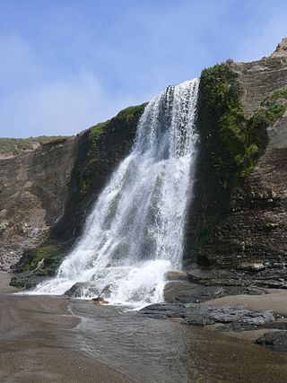
Alamere Falls is a coastal waterfall in Point Reyes National Seashore, Marin County, California; it flows directly into the ocean. It is one of only two coastal waterfalls in California, the other being McWay Falls.
Bay to Breakers is an annual footrace in San Francisco, California typically on the third Sunday of May. The phrase "Bay to Breakers" reflects the fact that the race starts at the northeast end of the downtown area a few blocks from The Embarcadero and runs west through the city to finish at the Great Highway. The complete course is 7.46 miles (12 km) long.
The Dipsea Trail, in Marin County, California, is the route of the annual Dipsea Race. The trail itself is approximately 7.5 miles (12.1 km) long, running from Mill Valley up and over a ridge and down to the Pacific Ocean at Stinson Beach. Runners in the race are not restricted to follow just one pathway; especially towards the endpoint some runners diverge along less traveled paths which they may have practiced and deem advantageous. For the majority of the route, almost all competitors follow one main path which climbs and descends stairways and is otherwise well-defined.
This page is based on this Wikipedia article Text is available under the CC BY-SA 4.0 license; additional terms may apply. Images, videos and audio are available under their respective licenses.