This article needs additional citations for verification .(August 2014) |
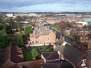
Smethwick is a town in the Metropolitan Borough of Sandwell, in the West Midlands of England.
This article needs additional citations for verification .(August 2014) |
Smethwick is a town in the Metropolitan Borough of Sandwell, in the West Midlands of England.
The area is centered on Bearwood Road; one of Smethwick’s shopping areas. Bearwood Bus Station is at the end of Bearwood Road and the corner of Hagley Road. Next to it is Lightwoods Park, on the border with Birmingham. Heading towards Cape Hill is Hadley Stadium. Warley Woods, a scheduled protected public open space is to the west of Bearwood on Abbey Road.
The area is centered on Black Patch Park and Soho Railway Junction, which is an imposing structure to the south. Soho is home to a Train Care Depot and the Soho Foundry, which was Matthew Boulton and James Watt’s famous factory, Most of the rest of the area is industrial with some housing.
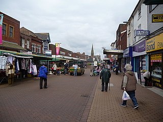
It is centred on the road of the same name and includes the adjoining streets. This is Smethwick’s busiest shopping area and home to Asda and the Indoor Market. This is the former home of The Mitchells & Butler Brewery, which was demolished and replaced by housing. Most of the rest of the area is housing. Victoria Park is located at the High Street end. Windmill Lane Housing Estate is to the West of Cape Hill.
Victoria Park, Smethwick, is the main formal garden for the town of Smethwick and has a Green Flag award. In 2010 the park was the subject of considerable investment and regeneration including a new bandstand. A flagship Adidas outdoor gym kit along with additional gym stations has also been installed.
The park occupies 14 ha. (around 34 acres) and is situated just off Smethwick High Street next to the Council House the park provides a range of facilities including a play area and multi-use games area. A flagship CCTV system and path lighting has been installed in January 2009. This provides a 24-hour monitoring system approved by the Victoria Park Smethwick Committee established in 2008. Victoria Park Lodge, the former park keeper's house, is now home to the Smethwick Heritage Centre [1]
West Smethwick is home to West Smethwick Park and housing running to Spon Lane and the Oldbury border and also along St Pauls Road bordering Smethwick High Street and the along Oldbury Road including Galton Village. The new housing opposite West Smethwick Park used to be occupied by a Neurological and former infections diseases hospital. A small graveyard for this can still be seen on Holly Lane. West Smethwick is also home to what is now known as West Cross shopping centre on the Oldbury Road, Oldbury Cemetery and part industrial including the old Chance's Glass factory bordering Oldbury and West Bromwich.
Galton Village is a housing estate next to Smethwick Galton Bridge railway station along the Oldbury Road towards Oldbury and West Bromwich.
The High Street used to be Smethwick’s main shopping and commerce centre until Toll House Way was built, demolishing half of the High Street on the railway side. It is home to the Job Centre Plus, Royal Mail sorting office and the Guru Nanak Gurdwara (Sikh Temple). Both Smethwick railway stations are located here. Rolfe St is located opposite the Holy Trinity Church and Galton Bridge is at the start of the Oldbury Road. Smethwick West was closed in 1995 and is located next to Galton Bridge Station. Smethwick Council House is located at the Victoria Park end, not far from Smethwick Police Station (in Piddock Road) and the site of the former technical college.
This area, mostly made up of housing, runs along Smethwick’s border with Oldbury. Londonderry (also known as the Queen's Head locally) is home to a small shopping area located on Londonderry Lane, including a post office. Manor Lane has an allotment and another small park. The area borders West Smethwick, Rood End and Langley (Oldbury).
An industrial area located just west of Black Patch and north of the High Street. The Smethwick Canal Heritage Centre was located on Brasshouse Lane. On Halford's Lane is The Hawthorns Railway Station and West Bromwich Albion Football Club. Bridge Street, former home of the Smethwick Engine (now in the Think Tank, Birmingham), is off Rolfe Street past the railway station.
The Uplands is primarily a residential area, centred on The Uplands (Road) and located between Bearwood and the High Street. The area around the Uplands proper and heading towards the High Street is made up of mainly terraced housing built around 1900, with the Bearwood side being of more modern construction. Among Smethwick’s oldest buildings, The Old Church and associated Old Chapel public house are located at the Church Road end of the Uplands. Historically, the area that now comprises The Uplands was known as "Bosom's End". The area was almost entirely farmland and is referenced in the Census of 1841.
Other landmarks include: Smethwick Hall Park, The Akril Methodist Church building (now a Sikh temple), Harry Mitchell Leisure Centre & Park, the Dorothy Parks Centre and Smethwick Cricket Club. Uplands Manor School and the cemetery are located a little to the north of the Old Church on Church Road. Besides the Old Chapel Pub, the area is home to the Hollybush Public House and a number of social clubs.

West Bromwich, commonly known as West Brom, is a market town in the borough of Sandwell, West Midlands, England. Historically part of Staffordshire, it is 7 miles northwest of Birmingham. West Bromwich is part of the area known as the Black Country, in terms of geography, culture and dialect. West Bromwich had a population of 103,112 in the 2021 Census.

Tipton is an industrial town in the Metropolitan Borough of Sandwell in the West Midlands County in England. It had a population of 38,777 at the 2011 UK Census. It is located northwest of Birmingham and southeast of Wolverhampton. It is also contiguous with nearby towns of Darlaston, Dudley, Wednesbury and Bilston.

Smethwick is an industrial town in Sandwell, West Midlands, England. It lies 4 miles (6 km) west of Birmingham city centre. Historically it was in Staffordshire and then Worcestershire before being placed into then West Midlands county.

Sandwell is a metropolitan borough of the West Midlands county in England. The borough is named after the Sandwell Priory, and spans a densely populated part of the West Midlands conurbation. Sandwell Metropolitan Borough Council defines the borough as the six amalgamated towns of Oldbury, Rowley Regis, Smethwick, Tipton, Wednesbury and West Bromwich. Rowley Regis includes the towns of Blackheath and Cradley Heath.

Oldbury is a market town in the Metropolitan Borough of Sandwell, West Midlands, England. It is the administrative centre of the borough. At the 2011 census, the town had a population of 13,606, while the 2017 population of the wider built-up area was estimated at 25,488. Sandwell Metropolitan Borough Council, which defines Oldbury Town as consisting of the wards of Bristnall, Langley, Oldbury, and Old Warley, gave the population as 50,641 in 2011.

Sandwell Metropolitan Borough Council was created in 1974 to administer the newly formed Metropolitan Borough of Sandwell, in the West Midlands county of England.

Richmond is an inner-city suburb in Melbourne, Victoria, Australia, 3 km (1.9 mi) east of the Melbourne central business district, located within the City of Yarra local government area. Richmond recorded a population of 28,587 at the 2021 census, with a median age of 34.

Soho is an area split between the Birmingham and Sandwell metropolitan boroughs of the West Midlands in England. The area is located on the A41 road. The name is an abbreviation of South House, denoting that it was located to the south of Handsworth. The section of the A41 separating Handsworth from Winson Green is known as Soho Road.

Warley was a short-lived county borough and civil parish in the geographical county of Worcestershire, England, forming part of the West Midlands conurbation. It was formed in 1966 by the combination of the existing county borough of Smethwick with the municipal boroughs of Oldbury and Rowley Regis, by recommendation of the Local Government Commission for England. It was abolished just 8 years later in 1974 under the Local Government Act 1972, with its area passing to the Metropolitan Borough of Sandwell.

Brandhall is a suburb of Oldbury in the south of the Metropolitan Borough of Sandwell, West Midlands, bordering Birmingham and Halesowen. The development of the area commenced during the 1930s with the construction of several hundred private houses along the Hagley Road and Wolverhampton Road, as well as several side roads leading off the main dual carriageways. Oldbury Corporation founded a municipal farm in 1943. In 1949, the farm included a piggery, and fields growing wheat, potatoes, barley, hay, clover and oats. Oldbury Council placed a public notice for the demolition and removal of the farm buildings in February 1952. Most of Brandhall was developed in the 1950s and 1960s, when several thousand council houses, flats and bungalows were built by Oldbury Council on farmland to the south of Brand Hall. The Hall, which had become the clubhouse for Brandhall Golf Course, was demolished. Some of the first families moving on to the estate were relocating from Smethwick. Most of the high and medium-rise flats in Brandhall were demolished in the early 2000s and in their place housing associations built new low-rise homes.

Bearwood is the southern part of Smethwick, in the metropolitan borough of Sandwell, West Midlands, England. It lies north of the A456 Hagley Road. Bearwood Hill was the original name of the High Street from Smethwick Council House to Windmill Lane. The border at the Shireland Brook where Portland Road, Edgbaston becomes Shireland Road, Smethwick is signed "Bearwood" as of February 2014.

The Birmingham to Worcester via Kidderminster line is a railway line which runs from Birmingham Snow Hill to Worcester via Stourbridge and Kidderminster in the West Midlands, England. It is one of the Snow Hill Lines, with trains operated by West Midlands Trains and Chiltern Railways using a variety of rolling stock including Class 172 and Class 168 diesel units. It is a future aspiration of Network Rail to electrify the entire line, as well as the Chiltern Main Line to London Marylebone.

Tipton Green is the central area of Tipton, a town in the West Midlands of England. It was heavily developed for heavy industry and housing during the 19th century, as Tipton was one of the most significant towns during the Industrial Revolution. Tipton Green is one of three electoral wards covering Tipton for Sandwell Metropolitan Borough Council. The population of this Sandwell ward taken at the 2011 census was 12,834. It is represented by three Labour councillors.
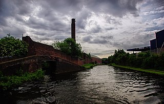
The BCN Main Line, or Birmingham Canal Navigations Main Line is the evolving route of the Birmingham Canal between Birmingham and Wolverhampton in England.
Galton Village is a residential area of Smethwick, West Midlands, England. It takes its name from the iconic nearby Galton Bridge that was named after local business man Samuel Galton whose land the new BCN Main Line canal was built through, the canal runs behind Galton Village as does the Stour Valley section of West Coast Mainline. The Oldbury Road runs through the area which begins next to Smethwick’s Galton Bridge railway station and ends at Spon Lane, next to a small shopping centre.
Cape Hill is an area of Smethwick, in the Metropolitan Borough of Sandwell, West Midlands, England, 2+3⁄4 miles (4.4 km) west of Birmingham City Centre. The area includes Waterloo Road near Shireland Collegiate Academy and the High Street near Victoria Park; it borders Birmingham at the A457 Dudley Road. Cape Hill is Smethwick's busiest shopping area.

Bearwood bus station is a small bus station in Smethwick, West Midlands, England. It is located on the Hagley Road junction with Bearwood Road. It is Smethwick's only bus station. It is accessed via one-way streets, and consequently most services use the stands located outside the station. It is managed by Transport for West Midlands.

Galton Valley Canal Museum is a small museum, located in Smethwick, England, on the border with Birmingham and alongside the BCN Main Line canals. The Museum tells the story of the development of the Galton Valley canals and those who designed, built and worked on them.