West Midlands is a ceremonial county in the larger West Midlands region of England. A landlocked county, it is bordered by Staffordshire to the north and west, Worcestershire to the southwest, and is surrounded by Warwickshire to the east and southeast. The largest settlement is the city of Birmingham.

West Bromwich is a market town in the borough of Sandwell, West Midlands, England. Historically part of Staffordshire, it is 7 miles northwest of Birmingham. West Bromwich is part of the area known as the Black Country, in terms of geography, culture and dialect. West Bromwich had a population of 103,112 in the 2021 Census.

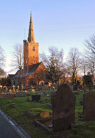
Smethwick is an industrial town in Sandwell, West Midlands, England. It lies 4 miles (6 km) west of Birmingham city centre. Historically it was in Staffordshire and then Worcestershire before being placed into then West Midlands County.

Sandwell is a metropolitan borough of the West Midlands county in England. The borough is named after the Sandwell Priory, and spans a densely populated part of the West Midlands conurbation. Sandwell Metropolitan Borough Council defines the borough as the six amalgamated towns of Oldbury, Rowley Regis, Smethwick, Tipton, Wednesbury and West Bromwich. Rowley Regis includes the towns of Blackheath and Cradley Heath.

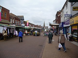
Halesowen is a market town in the Metropolitan Borough of Dudley, in the county of West Midlands, England.

Sandwell Metropolitan Borough Council was created in 1974 to administer the newly formed Metropolitan Borough of Sandwell, in the West Midlands county of England.

Warley was a short-lived county borough and civil parish in the geographical county of Worcestershire, England, forming part of the West Midlands conurbation. It was formed in 1966 by the combination of the existing county borough of Smethwick with the municipal boroughs of Oldbury and Rowley Regis, by recommendation of the Local Government Commission for England. It was abolished just 8 years later in 1974 under the Local Government Act 1972, with its area passing to the Metropolitan Borough of Sandwell.

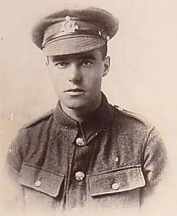
Harold John Colley VC MM was an English recipient of the Victoria Cross, the highest and most prestigious award for gallantry in the face of the enemy that can be awarded to British and Commonwealth forces.

Bearwood is the southern part of Smethwick, Sandwell, West Midlands, England, and north of the A456 Hagley Road. Bearwood Hill was the original name of the High Street from Smethwick Council House to Windmill Lane. The border at the Shireland Brook where Portland Road (Edgbaston) becomes Shireland Road (Sandwell) is signed "Bearwood".
Galton Village is a residential area of Smethwick, West Midlands, England. It takes its name from the iconic nearby Galton Bridge that was named after local business man Samuel Galton whose land the new BCN Main Line canal was built through, the canal runs behind Galton Village as does the Stour Valley section of West Coast Mainline. The Oldbury Road runs through the area which begins next to Smethwick’s Galton Bridge railway station and ends at Spon Lane, next to a small shopping centre.
Cape Hill is an area in Smethwick, Sandwell, West Midlands. It is centred on the road of the same name and includes the adjoining streets. Cape Hill starts at Waterloo Road near Shireland Collegiate Academy and ends at the High Street near Victoria Park. Cape Hill finishes at the start of the Dudley Road which forms the boundary with Birmingham and leads to Birmingham City Centre. Cape Hill is Smethwick's busiest shopping area.

The administrative boundaries of Worcestershire, England have been fluid for over 150 years since the first major changes in 1844. There were many detached parts of Worcestershire in the surrounding counties, and conversely there were islands of other counties within Worcestershire. The 1844 Counties Act began the process of eliminating these, but the process was not completed until 1966, when Dudley was absorbed into Staffordshire.

Warley Woods is a 100-acre (40 ha) public park in the Warley district of Smethwick, in Sandwell, in the West Midlands of England, originally laid out by Humphry Repton. It has been grade II listed by English Heritage in their Register of Historic Parks and Gardens of special historic interest since September 1994.

West Smethwick Park is a public park in the St Pauls ward of Smethwick, England. It opened on 7 September 1895.

The Cheltenham Municipal Offices are a municipal facility on The Promenade, Cheltenham, England. The offices, which are the headquarters of Cheltenham Borough Council, are a Grade II* listed building.

Westhoughton Town Hall is a municipal building in Market Street, Westhoughton, Greater Manchester, England. The town hall is the meeting place of Westhoughton Town Council.

The Municipal Buildings are in Oldbury town centre, West Midlands, England. The structure served as the headquarters of Oldbury Borough Council.

Wednesbury Town Hall is a municipal building in Holyhead Road in Wednesbury, West Midlands, England. The structure, which was the meeting place of Wednesbury Borough Council, now operates as an events venue.

Horbury Town Hall is a former municipal building in Westfield Road, Horbury, West Yorkshire, England. The structure, which is now used as business centre, is a locally listed building.


