Touggourt is a city and commune, former sultanate and capital of Touggourt District, in Touggourt Province, Algeria, built next to an oasis in the Sahara. As of the 2008 census, the commune had a population of 39,409 people, up from 32,940 in 1998, and an annual growth rate of 1.8%. Touggourt's urban area includes the communes of Nezla, Tebesbest and Zaouia El Abidia, for a total population of 146,108.
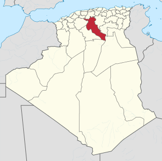
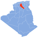
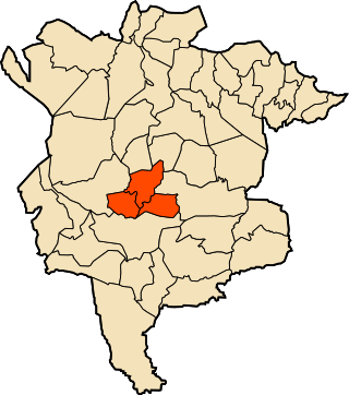
Djelfa is a province (wilaya) of Algeria. Its capital is Djelfa. It was first established by the administrative reorganization of 1974, and is home to over 1.2 million inhabitants. Localities in this province include Tadmit, El Khemis, and Selmana.

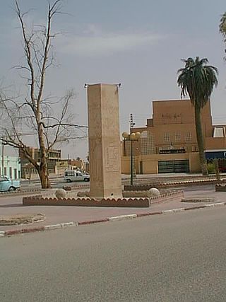
Djelfa is the capital city of Djelfa Province, Algeria and the site of ancient city and former bishopric Fallaba, which remains a Latin catholic titular see.
Tsletsi Airport is an airport serving Djelfa, the capital of Djelfa Province in Algeria. The airport is approximately 6 kilometres (3.7 mi) east of the city.
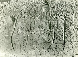
The rock art of the Djelfa region in the Ouled Naïl Range (Algeria) consists of prehistoric cave paintings and petroglyphs dating from the Neolithic age which have been recognized since 1914. Following the Saharan Atlas Mountains they follow on from those, to the west, of south Oran, to which they are related. Comparable engravings have also been described further to the east, in the Constantine (Algeria) region.

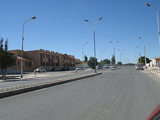
Aïn Oussera or Aïn Oussara is a city in Djelfa Province, Algeria, with an estimated (2005) population of 134,174. It is the district seat of the Aïn Oussera District. This city, located 200 km south of the capital Algiers, is crossed by the Trans-Saharan Highway main road number 1. The road that runs through the whole of Algeria from north to south over 2000 km, connects Algiers on its southern border with Mali near Tamanrasset. Ain Oussera, has experienced, since 1990, rapid population growth due to its proximity to the 15 MW Es Salam nuclear reactor. Aïn Oussera is on the crossroads of the N1 (Trans-Saharan) and N40B highways. The nearest airport is the Algerian Air Force's Aïn Oussera airfield (DAAQ).

Aïn El Ibil District is a district of Djelfa Province, Algeria.
Birine District is a district of Djelfa Province, Algeria.
El Idrissia District is a district of Djelfa Province, Algeria.
Faidh El Botma District is a district of Djelfa Province, Algeria.
Had Sahary District is a district of Djelfa Province, Algeria.
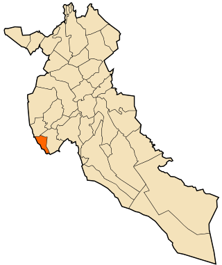
Messaâd District is one of the districts of Djelfa Province, Algeria.
Aïn Chouhada is a town and commune in Djelfa Province, Algeria. According to the 1998 census it has a population of 8,337.
Benhar is a small town and commune in Djelfa Province, Algeria. According to the 1998 census it has a population of 10,380 and it has the biggest surface in Djelfa.
Dar Chioukh is a town and commune in Djelfa Province, Algeria. According to the 2008 census it has a population of 26,605. It is located northeast of Djelfa and north by a smaller road from the N46 from M'Liliha.
Mouilha, Aïn Mouilha or M'Liliha is a town and commune in Djelfa Province, Algeria. According to the 1998 census it has a population of 13,155. It lies on the N46 highway, northeast of Djelfa.
Bou Saâda District is a district of M'Sila Province, Algeria.

The Ouled Naïl are an Arab tribal confederation living in the Ouled Naïl Range, Algeria. They are found mainly in Bou Saâda, M'Sila and Djelfa, but there is also a significant number of them in Ghardaïa.

The wilaya of Ouled Djellal is an Algerian province created in 2019, previously, a delegated wilaya created in 2015. It is in the Algerian Sahara.
Charef is a town and commune in Djelfa Province within Algeria.