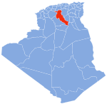
Djelfa is the capital city of Djelfa Province, Algeria and the site of ancient city and former bishopric Fallaba, which remains a Latin catholic titular see.
Deldoul, Djelfa is a town in north-central Algeria.
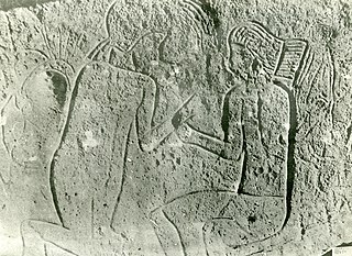
The rock art of the Djelfa region in the Ouled Naïl Range (Algeria) consists of prehistoric cave paintings and petroglyphs dating from the Neolithic age which have been recognized since 1914. Following the Saharan Atlas Mountains they follow on from those, to the west, of south Oran, to which they are related. Comparable engravings have also been described further to the east, in the Constantine (Algeria) region.

Aïn El Ibil District is a district of Djelfa Province, Algeria.
Charef District is a district of Djelfa Province, Algeria.
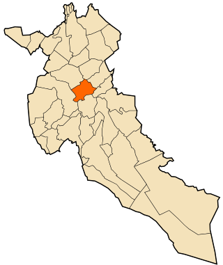
Dar Chioukh District is a district of Djelfa Province, Algeria.
El Idrissia District is a district of Djelfa Province, Algeria.
Faidh El Botma District is a district of Djelfa Province, Algeria.
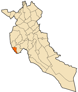
Messaâd District is one of the districts of Djelfa Province, Algeria.
Aïn Chouhada is a town and commune in Djelfa Province, Algeria. According to the 1998 census it has a population of 8,337.

Aïn El Ibel is a town and commune in Djelfa Province, Algeria. According to the 1998 census it has a population of 20,436. The N18 and the N1 Trans Saharan highway connects it to the provincial capital of Djelfa in the northeast. To the southwest of the town are a number of fields in which the inhabitants grow crops.
Aïn Maabed is a town and commune in Djelfa Province, Algeria. According to the 1998 census it has a population of 13,183. Aïn Maabed lies on the N1 Trans-Saharan highway to the north by road from the provincial capital of Djelfa. Further north along the highway is the town of Hassi Bahbah.
Beni Yagoub is a town and commune in Djelfa Province, Algeria.
Charef is a town and commune in Djelfa Province, Algeria. According to the 1998 census it had a population of 19,373.
Bordj Douis or Douis is a small town and commune in Djelfa Province, Algeria. According to the 1998 census it has a population of 10,356. It is located southeast of El Idrissia.
El Idrissia is a town and commune in Djelfa Province, Algeria. According to the 2008 census it has a population of 29,856. It used to be known as Zenina, named after a wealthy woman who was married to a Roman officer called Serdoun. This name was given to the nearby mountain.
Faidh El Botma is a town and commune in Djelfa Province, Algeria. According to the 2008 census it has a population of 26,857.
Selmana is a small town and commune in Djelfa Province, Algeria, located in the south-eastern outskirts of Messaâd. According to the 1998 census it has a population of 14,008.

Zaafrane, Algeria is a town and commune in Djelfa Province, Algeria. According to the 1998 census it has a population of 12,865.

The Hautes Plaines, also known as Hauts Plateaux, is a steppe-like natural region located in the Atlas Mountains in northern Algeria. It stretches more than 600 km (370 mi) in an east northeast – west southwest direction from northeastern Morocco to the Aures. It is a high plateau area consisting of undulating, steppe-like alluvial plains lying between the Tell and Saharan Atlas ranges.