Alt Penedès is a comarca (county) in Catalonia, northern Spain. The capital is Vilafranca del Penedès.

Bozhurishte is a town in western Bulgaria. It is the administrative center of Bozhurishte Municipality in Sofia Province; close to Kostinbrod and the capital Sofia. The old airport of Sofia, now a military one, is near the town. Bozhurishte was first mentioned in 1750. Its name is derived from the flower peony.

The Idaho House of Representatives is the lower chamber of the Idaho State Legislature. It consists of 70 representatives elected to two-year terms. The state is divided into 35 districts, each of which elect two representatives. It meets at the Idaho State Capitol in Boise, Idaho.
The Idaho Senate is the upper chamber of the Idaho State Legislature. It consists of 35 Senators elected to two-year terms, each representing a district of the state. The Senate meets at the Idaho State Capitol in Boise, Idaho.

Mount Hope Township is located in McLean County, Illinois. As of the 2010 census, its population was 1,103 and it contained 455 housing units.
The canton of Saint-Bonnet-en-Champsaur is an administrative division in southeastern France. At the French canton reorganisation which came into effect in March 2015, the canton was expanded from 16 to 27 communes :

Dzoramut is a town in the Lori Province of Armenia.

Obrowo is a village in the administrative district of Gmina Kęsowo, within Tuchola County, Kuyavian-Pomeranian Voivodeship, in north-central Poland. The village has a population of 160.
Żmudź-Kolonia is a village in the administrative district of Gmina Żmudź, within Chełm County, Lublin Voivodeship, in eastern Poland.

Muradxan is a village and municipality in the Kurdamir Rayon of Azerbaijan.

Dębe Wielkie is a village in Mińsk County, Masovian Voivodeship, in east-central Poland. It is the seat of the gmina called Gmina Dębe Wielkie. It lies approximately 9 kilometres (6 mi) west of Mińsk Mazowiecki and 31 km (19 mi) east of Warsaw.
Bronibór is a village in the administrative district of Gmina Szczytniki, within Kalisz County, Greater Poland Voivodeship, in west-central Poland.
Klików is a village in the administrative district of Gmina Iłowa, within Żagań County, Lubusz Voivodeship, in western Poland. It lies approximately 4 kilometres (2 mi) south of Iłowa, 19 km (12 mi) south-west of Żagań, and 57 km (35 mi) south of Zielona Góra.
Zwierzynek is a settlement in the administrative district of Gmina Tczew, within Tczew County, Pomeranian Voivodeship, in northern Poland. It lies approximately 6 kilometres (4 mi) south-west of Tczew and 35 km (22 mi) south of the regional capital Gdańsk.
Al-Sharafiyah Madrasa is a madrasah complex in Aleppo, Syria.
Sobiemyśl is a village in the administrative district of Gmina Gryfino, within Gryfino County, West Pomeranian Voivodeship, in north-western Poland, close to the German border.
Świątki is a part of the town Szczecinek, in West Pomeranian Voivodeship, in north-western Poland. It lies approximately 142 km (88 mi) east of the regional capital Szczecin.

Holubice is a village and municipality in Prague-West District in the Central Bohemian Region of the Czech Republic.

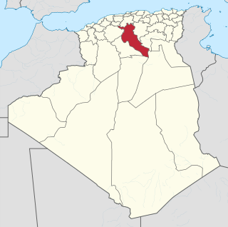
Benchicao is a town and commune in Médéa Province, Algeria. According to the 1998 census it has a population of 8946.
Stance is a village in the municipality of Vranje, Serbia. According to the 2002 census, the village has a population of 113 people.