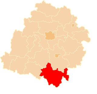
Berghem is a town in the Dutch municipality of Oss. It is located about 4 km northeast of Oss itself.

Bogdanów is a village in the administrative district of Gmina Kostomłoty, within Środa Śląska County, Lower Silesian Voivodeship, in south-western Poland. Prior to 1945 it was in Germany, the name was "Neuhof".

Będkowo is a village in the administrative district of Gmina Trzebnica, within Trzebnica County, Lower Silesian Voivodeship, in south-western Poland. Prior to 1945 it was in Germany.

Białotul is a village in the administrative district of Gmina Mogilno, within Mogilno County, Kuyavian-Pomeranian Voivodeship, in north-central Poland. It lies approximately 7 kilometres (4 mi) east of Mogilno, 51 km (32 mi) south of Bydgoszcz, and 57 km (35 mi) south-west of Toruń.
Kątno is a village in the administrative district of Gmina Mogilno, within Mogilno County, Kuyavian-Pomeranian Voivodeship, in north-central Poland.

Łyski is a village in the administrative district of Gmina Choroszcz, within Białystok County, Podlaskie Voivodeship, in north-eastern Poland. It lies approximately 5 kilometres (3 mi) north-east of Choroszcz and 10 km (6 mi) north-west of the regional capital Białystok.
Olszewo is a village in the administrative district of Gmina Perlejewo, within Siemiatycze County, Podlaskie Voivodeship, in north-eastern Poland.
Wiktorowo is a village in the administrative district of Gmina Perlejewo, within Siemiatycze County, Podlaskie Voivodeship, in north-eastern Poland.
Krzyżówki is a village in the administrative district of Gmina Szczerców, within Bełchatów County, Łódź Voivodeship, in central Poland.
Józefina is a settlement in the administrative district of Gmina Gorzkowice, within Piotrków County, Łódź Voivodeship, in central Poland.

Rożniatów-Kolonia is a village in the administrative district of Gmina Uniejów, within Poddębice County, Łódź Voivodeship, in central Poland. It lies approximately 10 kilometres (6 mi) north of Uniejów, 19 km (12 mi) north-west of Poddębice, and 53 km (33 mi) north-west of the regional capital Łódź.

Klonów is a village in the administrative district of Gmina Goszczanów, within Sieradz County, Łódź Voivodeship, in central Poland. It lies approximately 6 kilometres (4 mi) north-east of Goszczanów, 28 km (17 mi) north-west of Sieradz, and 62 km (39 mi) west of the regional capital Łódź.

Bobrówka is a village in the administrative district of Gmina Laszki, within Jarosław County, Subcarpathian Voivodeship, in south-eastern Poland. It lies approximately 4 kilometres (2 mi) north-west of Laszki, 14 km (9 mi) east of Jarosław, and 62 km (39 mi) east of the regional capital Rzeszów.
Wierzchy is a settlement in the administrative district of Gmina Kazimierz Biskupi, within Konin County, Greater Poland Voivodeship, in west-central Poland.

Adamowo is a village in the administrative district of Gmina Kleczew, within Konin County, Greater Poland Voivodeship, in west-central Poland. It lies approximately 13 kilometres (8 mi) north-west of Kleczew, 30 km (19 mi) north-west of Konin, and 77 km (48 mi) east of the regional capital Poznań.

Klewno is a settlement in Gmina Miastko, Bytów County, Pomeranian Voivodeship, in northern Poland. It lies approximately 30 kilometres (19 mi) south-west of Bytów and 109 km (68 mi) south-west of Gdańsk.

Kostkowice is a village in the administrative district of Gmina Kroczyce, within Zawiercie County, Silesian Voivodeship, in southern Poland. It lies approximately 3 kilometres (2 mi) north of Kroczyce, 15 km (9 mi) north-east of Zawiercie, and 56 km (35 mi) north-east of the regional capital Katowice.

Młynki is a settlement in the administrative district of Gmina Wejherowo, within Wejherowo County, Pomeranian Voivodeship, in northern Poland. It lies approximately 4 kilometres (2 mi) south-east of Wejherowo and 33 km (21 mi) north-west of the regional capital Gdańsk.
Kępiste is a settlement in the administrative district of Gmina Bobolice, within Koszalin County, West Pomeranian Voivodeship, in north-western Poland.
Hahneberg is a mountain of Saxony, southeastern Germany.


