Dollar Lake (Blaine County, Idaho)

Last updated
Dollar Lake
USA Idaho location map.svg
Red pog.svg
Dollar Lake
Location in Idaho
Usa edcp relief location map.png
Red pog.svg
Dollar Lake
Location in the United States
Location Blaine County, Idaho
Coordinates 43°41′18″N114°25′06″W / 43.6882112°N 114.4184282°W / 43.6882112; -114.4184282 Coordinates: 43°41′18″N114°25′06″W / 43.6882112°N 114.4184282°W / 43.6882112; -114.4184282 [1]
Primary outflows Warm Springs Creek to Big Wood River
Basin  countriesUnited States
Max. length175 ft (53 m)
Max. width150 ft (46 m)
Surface area0.7 acres (0.28 ha) [2]
Surface elevation5,958 ft (1,816 m) [1]

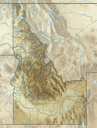
Dollar Lake is a lake in Blaine County, Idaho, United States, located in the Smoky Mountains in Sawtooth National Forest. The lake is located along Warm Springs Creek along forest road 227 just south of Penny Lake and east of the town of Ketchum. [3]
Blaine County, Idaho County in the United States

Blaine County is a county in the U.S. state of Idaho. As of the 2010 United States Census, the population was 21,376. The county seat and largest city is Hailey.

Idaho State of the United States of America

Idaho is a state in the northwestern region of the United States. It borders the state of Montana to the east and northeast, Wyoming to the east, Nevada and Utah to the south, and Washington and Oregon to the west. To the north, it shares a small portion of the Canadian border with the province of British Columbia. With a population of approximately 1.7 million and an area of 83,569 square miles (216,440 km2), Idaho is the 14th largest, the 12th least populous and the 7th least densely populated of the 50 U.S. states. The state's capital and largest city is Boise.

United States federal republic in North America

The United States of America (USA), commonly known as the United States or America, is a country composed of 50 states, a federal district, five major self-governing territories, and various possessions. At 3.8 million square miles, the United States is the world's third or fourth largest country by total area and is slightly smaller than the entire continent of Europe's 3.9 million square miles. With a population of over 327 million people, the U.S. is the third most populous country. The capital is Washington, D.C., and the largest city by population is New York City. Forty-eight states and the capital's federal district are contiguous in North America between Canada and Mexico. The State of Alaska is in the northwest corner of North America, bordered by Canada to the east and across the Bering Strait from Russia to the west. The State of Hawaii is an archipelago in the mid-Pacific Ocean. The U.S. territories are scattered about the Pacific Ocean and the Caribbean Sea, stretching across nine official time zones. The extremely diverse geography, climate, and wildlife of the United States make it one of the world's 17 megadiverse countries.

Related Research Articles

Sawtooth Wilderness a wilderness area in the US state of Idaho

The Sawtooth Wilderness is a federally-protected wilderness area that covers 217,088 acres (87,852 ha) of the state of Idaho. Managed by the U.S. Forest Service in the U.S. Department of Agriculture, it was designated the Sawtooth Primitive Area in 1937 to preserve the exceptional scenic beauty of the Sawtooth Mountains. On August 22, 1972 Public Law 92-400 designated the Primitive Area as the Sawtooth Wilderness and part of the newly created Sawtooth National Recreation Area. As part of the National Wilderness Preservation System, the Sawtooth Wilderness is an area where human development and use are restricted and people are to remain only visitors. According to the United States Environmental Protection Agency, the Sawtooth Wilderness has some of the clearest air in the lower 48 states.

Sawtooth National Forest A national forest located in the US states of Idaho and Utah

Sawtooth National Forest is a National Forest that covers 2,110,408 acres in the U.S. states of Idaho and Utah. Managed by the U.S. Forest Service in the U.S. Department of Agriculture, it was originally named the Sawtooth Forest Reserve in a proclamation issued by President Theodore Roosevelt on May 29, 1905. On August 22, 1972 a portion of the forest was designated as the Sawtooth National Recreation Area (SNRA), which includes the Sawtooth, Cecil D. Andrus–White Clouds, and Hemingway–Boulders wilderness areas. The forest is managed as four units: the SNRA and the Fairfield, Ketchum, and Minidoka Ranger Districts.

Alice Lake (Sawtooth Wilderness) lake in Blaine County, Idaho, USA

Alice Lake is an alpine lake in Blaine County, Idaho, United States, located high in the Sawtooth Mountains in the Sawtooth National Recreation Area. The lake is one of the largest in the Sawtooth Wilderness and is most easily accessed via the trailhead at Pettit Lake, accessed from State Highway 75 via Sawtooth National Forest road 208.

Ardeth Lake

Ardeth Lake is an alpine lake in Boise County, Idaho, United States, located high in the Sawtooth Mountains in the Sawtooth National Recreation Area. The lake is approximately 18 miles (29 km) south of Stanley. Ardeth Lake is most easily accessed from trailheads in the Sawtooth Valley, which are accessed from State Highway 75 or from the Grandjean trailhead to the northwest off of State Highway 21.

Johnson Lake is a small alpine lake in Elmore County, Idaho, United States, located in the Sawtooth Mountains in the Sawtooth National Recreation Area. The lake is accessed from Sawtooth National Forest a cutoff of trail 459 along Johnson Creek.

Confusion Lake is a small alpine lake in Elmore County, Idaho, United States, located in the Sawtooth Mountains in the Sawtooth National Recreation Area. The lake is accessed from Sawtooth National Forest trail 479 along Timpa Creek or 462 along the Middle Fork of the Boise River.

Low Pass Lake is a small alpine lake in Elmore County, Idaho, United States, located in the Sawtooth Mountains in the Sawtooth National Recreation Area. The lake is accessed from Sawtooth National Forest trail 479 along Timpa Creek or 462 along Lake Ingeborg.

Baron Lake (Idaho)

Baron Lake is an alpine lake in Boise County, Idaho, United States, located in the Sawtooth Mountains in the Sawtooth National Recreation Area. Sawtooth National Forest trail 101 goes to the lake.

Smoky Mountains (Idaho) mountain range in the US state of Idaho

The Smoky Mountains are part of the Rocky Mountains and located on the west side of the Wood River Valley near Sun Valley, Idaho, in the Western United States. The range is within Sawtooth National Forest, while part of it is within the Sawtooth National Recreation Area. The highest point in the range is Saviers Peak at 10,441 ft (3,182 m).

Jimmy Smith Lake lake of the United States of America

Jimmy Smith Lake is an alpine lake in Custer County, Idaho, United States, located at the northeast end of the White Cloud Mountains on the Bureau of Land Management land just east and downstream of the Sawtooth National Recreation Area border. The lake is accessed from trail 677, which is a 1-mile (1.6 km) improved ATV trail along Big Lake Creek, but there is no motorized vehicle access beyond the lake.

The Boulder Chain Lakes are a chain of thirteen alpine and glacial Paternoster lakes in Custer County, Idaho, United States, located in the White Cloud Mountains in the Sawtooth National Recreation Area. The lakes are located in the upper portion of the Little Boulder Creek watershed north of Merriam Peak. Sawtooth National Forest trail 683 along leads to the Boulder Chain Lakes.

Albion Mountains mountain range in the US state of Idaho

The Albion Mountains are a mountain range in the U.S. states of Idaho (~99%) and Utah (~1%), spanning Cassia County, Idaho and barely reaching into Box Elder County, Utah. The highest point in the range is Cache Peak at 10,339 feet (3,151 m), and the range is a part of the Great Basin Divide and the Basin and Range Province. Most of the mountains are part of the Albion Division of the Minidoka Ranger District of Sawtooth National Forest.

Cache Peak (Idaho) mountain in Castle Rocks State Park

Cache Peak, at 10,339 feet (3,151 m) above sea level, is the highest peak in the Albion Mountains of Cassia County in Southern Idaho. Cache Peak is located in the central part of the range southeast of Oakley and north of Almo in the Albion Division of the Minidoka Ranger District of Sawtooth National Forest.

Mount Harrison (Idaho) mountain in the Albion Mountains in the US state of Idaho

Mount Harrison, at 9,265 feet (2,824 m) is a peak in the northern Albion Mountains of Cassia County in southern Idaho. Mount Harrison is located in north of Cache Peak, south of Burley, northeast of Oakley, and west of Malta in the Albion Division of the Minidoka Ranger District of Sawtooth National Forest. Mount Harrison is in the watershed of tributaries of the Snake River, which itself is a tributary of the Columbia River. The peak can be reached via a paved road that runs all the way to its summit. Lake Cleveland is located in the basin north of the peak, and a small unnamed lake is located in the basin southeast of the peak.

Baker Lake (Blaine County, Idaho) lake in Blaine County, Idaho, USA

Baker Lake is an alpine lake in Blaine County, Idaho, United States, located in the Smoky Mountains in Sawtooth National Forest. The lake is most easily accessed via a trail from the end of forest road 162. The lake is located just east of Backdrop Peak and north of Baker Peak.

Big Lost Lake

Big Lost Lake is an alpine lake in Blaine County, Idaho, United States, located in the Smoky Mountains in Sawtooth National Forest. The lake is most easily accessed via trail 135 from the end of forest road 170. The lake is located just east of Prairie Creek Peak. It is also near Smoky Lake, Little Lost Lake, and Upper and Lower Norton lakes.

Little Lost Lake

Little Lost Lake is an alpine lake in Blaine County, Idaho, United States, located in the Smoky Mountains in Sawtooth National Forest. While no trails lead to the lake, it is most easily accessed from the end of forest road 170. The lake is located just east of Prairie Creek Peak. It is also near Smoky Lake, Big Lost Lake, and Upper and Lower Norton lakes.

Penny Lake is a lake in Blaine County, Idaho, United States, located in the Smoky Mountains in Sawtooth National Forest. The lake is located along Warm Springs Creek along forest road 227 just west of Dollar Lake and west of the town of Ketchum.

Mount Independence (Idaho) mountain in United States of America

Mount Independence, at 9,950 feet (3,030 m) above sea level is the second highest peak in the Albion Mountains of Idaho. The peak is located in Sawtooth National Forest and Cassia County. It is located about 1 mi (1.6 km) northwest of Cache Peak. The Independence Lakes are located in the basin to the east of the peak. Mount Independence supports one of the three populations of Cymopterus davisii, a plant that is endemic to the Albion Mountains. The Mount Independence population is considered a single population with Cache Peak.

Graham Peak (Idaho) mountain in United States of America

Graham Peak, at 8,867 feet (2,703 m) above sea level is the fourth highest peak in the Albion Mountains of Idaho. The peak is located in the City of Rocks National Reserve and Cassia County less than 0.2 mi (0.32 km) south of the Sawtooth National Forest border. It is located 5.13 mi (8.26 km) south-southwest of Cache Peak. Forest road 707 leads directly to the summit. The peak contains the smallest of the three known populations of Cymopterus davisii, estimated at 500–1000 individuals.

References

  1. 1 2 "Dollar Lake". Geographic Names Information System . United States Geological Survey.
  2. "Dollar Lake". Idaho Department of Fish and Game. Retrieved November 17, 2018.
  3. Sawtooth National Forest (Map) (1998 ed.). Sawtooth National Forest, U.S. Forest Service.