Brierfield is a town and civil parish in the Borough of Pendle, in Lancashire, England. It is 3 miles (4.8 km) north east of Burnley, 1 mile (1.6 km) south west of Nelson, and 1 mile (1.6 km) north east of Reedley. The parish had a population of 8,193, at the census of 2011.

Whalley is a large village and civil parish in the Ribble Valley on the banks of the River Calder in Lancashire, England. It is overlooked by Whalley Nab, a large wooded hill over the river from the village. The population of the civil parish was 2,645 at the census of 2001, and increased to 3,629 at the census of 2011.
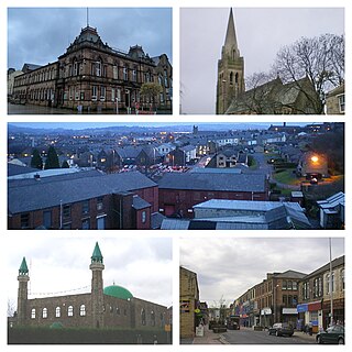
Nelson is a town and civil parish in the Borough of Pendle in Lancashire, England, it had a population of 29,135 in the 2011 Census. Nelson is 3 miles (5 km) north of Burnley and 2 miles (3 km) south-west of Colne. Nelson developed as a mill town during the Industrial Revolution.
Wycoller is a village in the civil parish of Trawden Forest in Pendle, Lancashire, England. It is 3 miles (4.8 km) east of Colne, near to the junction of the Lancashire, West Yorkshire and North Yorkshire borders.
Dunnockshaw or Dunnockshaw and Clowbridge is a civil parish in the borough of Burnley, in Lancashire, England. The parish is situated between Burnley and Rawtenstall. According to the United Kingdom Census 2011, the parish has a population of 185.

Eccleston is a village and civil parish of the Borough of Chorley in Lancashire, England. It is beside the River Yarrow, and was formerly an agricultural and later a weaving settlement.

Clayton-le-Woods is a large village and civil parish of the Borough of Chorley, in Lancashire, England. According to the census of 2001, it has a population of 14,528. At the 2011 census the population of Cuerden civil parish was included within Clayton-le-Woods, giving a total of 14,532.

Dolphinholme is a historic village in Lancashire, North West England.

Cliviger is a civil parish in the Borough of Burnley, in Lancashire, England. It is situated to the southeast of Burnley, and northwest of Todmorden. According to the 2011 census, the parish has a population of 2,238.

Cockersand Abbey is a former abbey and former civil parish near Cockerham in the City of Lancaster district of Lancashire, England. It is situated near the mouth of the River Cocker.
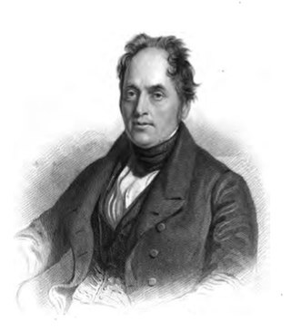
Samuel Clegg was a British engineer, known mostly for his development of the gas works process.

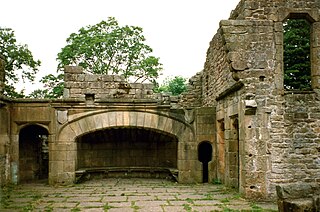
Bury Castle was an early medieval moated manor house in Bury, Lancashire. Its remains are listed as a Scheduled Ancient Monument. The manor house was built by Sir Thomas Pilkington – lord of the manors of Bury and Pilkington, and an influential member of Lancashire's gentry – in 1469. He was given permission by Edward IV to:
"'build to make and to construct walls and turrets with stone, lime and sand around and below his manor house in Bury in the County of Lancaster, and to shut in the manor house with such manner of walls and turrets; also to embattle, crenellate and machicolate those towers."

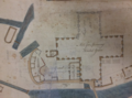
Up Holland Priory was a Benedictine priory in Up Holland, Lancashire, England. It was founded in 1319. The priory remains are recorded in the National Heritage List for England as a designated Grade II listed building. and the site is listed as a scheduled monument. The former chancel is now the nave of the Church of St Thomas the Martyr.

Skerton Bridge is a road bridge carrying the southbound lanes of the A6 road over the River Lune in Lancaster, Lancashire, England. The bridge is recorded in the National Heritage List for England as a designated Grade II* listed building and Scheduled Monument.
St Mark's Church is in the village of Dolphinholme, Lancashire, England. It is an active Anglican parish church in the deanery of Lancaster and Morecambe, the archdeaconry of Lancaster, and the diocese of Blackburn. Its benefice is united with those of Christ Church, Over Wyresdale, and St Peter, Quernmore. The church is recorded in the National Heritage List for England as a designated Grade II listed building.
Nether Wyresdale is a civil parish in the Wyre district of Lancashire, England. It contains 23 listed buildings that are recorded in the National Heritage List for England. All the listed buildings are designated at Grade II, the lowest of the three grades, which is applied to "buildings of national importance and special interest". The parish includes the villages of Scorton, the southern part of the village of Dolphinholme, and the countryside between and around them. Most of the listed buildings are houses, cottages, country houses and associated structures, and farmhouses. Also listed are a medieval cross base, a milestone, bridges, and churches and associated structures.
This is a list of scheduled monuments in the English county of Lancashire.

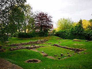
Portfield also known as Planes Wood Camp is a late Bronze Age or Iron Age hillfort situated close to the town of Whalley in Lancashire, Northern England. It is thought to have originally been constructed as a univallate structure and then modified into a small multivallate one sometime after.
Lancaster, Lancashire, a port city in north-west England, was involved in the transatlantic slave trade. Lancaster's part in the trade developed in the 17th and was linked to that of Liverpool also in north-west England. It became the fourth largest slave-trading centre in England and the most prominent in Lancashire. Lancaster slavers became influential within the city, and also played a role in getting parliamentary support for the development of the Port of Lancaster.