
Dhule is a city located in the Dhule District in the northwestern part of Maharashtra state, India known as West Khandesh. Situated on the banks of Panzara River, Dhule is the regional headquarters of MIDC, RTO, and MTDC.

Nandurbar district is an administrative district in the northwest corner of Maharashtra state in India. On 1 July 1998 Dhule was bifurcated as two separate districts now known as Dhule and Nandurbar. Nandurbar is a tribal-dominated district, The district headquarters are located at Nandurbar city. The district occupies an area of 5,955 square kilometres (2,299 sq mi) and has a population of 1,648,295 of which 16.71% were urban.

Shahada is a town in Nandurbar district of the Indian state of Maharashtra. It is a Municipal council. It is the second biggest town and the biggest Tehsil in Nandurbar district
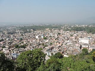
Nalagarh is a city and a municipal committee, near the city of Solan in Solan district in the Indian state of Himachal Pradesh. Nalagarh is a gateway to Himachal Pradesh in North India, 95.6 km (59.4 mi) from Shimla, 300 km (190 mi) from Delhi and 60 km (37 mi) from Chandigarh.
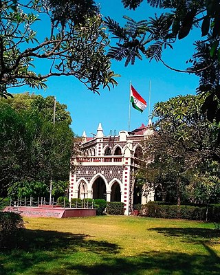
Jalgaon district is a district in Maharashtra, India. Its headquarters is the Jalgaon city.
Nagod or Nagaud is a town and a nagar panchayat in Satna district in the Indian state of Madhya Pradesh. It is located 17 miles (27 km) from the town of Satna. It is the administrative headquarters of Nagod Tehsil. who were exiled by the Gurjara Pratihar. Pratiharas originally came from Kannauj and belong to Agnikula Rajput.

Burhanpur District is a district of Madhya Pradesh state in central India. The city of Burhanpur is the district headquarters.
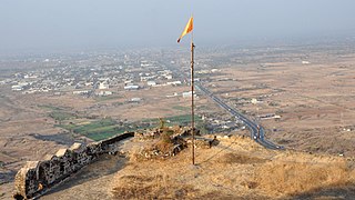
Dhule district is a district of Maharashtra, India. The city of Dhule is the administrative headquarters of the district. It is part of North Maharashtra.
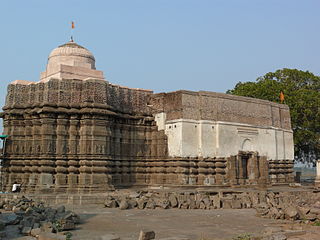
Muktainagar is a town in Jalgaon district, Maharashtra, India. It is the administrative headquarter of its eponymous taluka. It is located in North Maharashtra region.
Kannad is a Taluka and a Municipal Council City in Aurangabad District in the Indian state of Maharashtra. Kannad has located 58 km from Aurangabad. It is located 24 km away from the Ellora Caves and Grishneshwar Temple. It is 45 Km from Daulatabad / Deogiri Fort.
Nandurbar is a city and a municipal council in Nandurbar district in the Indian state of Maharashtra. Nandurbar municipal corporation is the first municipal corporation. The District Nandurbar was formed from the district Dhule on July 1, 1998. Nandurbar is an administrative district in the northwest corner of of Maharashtra. On 1 July 1998 Dhule was bifurcated as two separate districts now known as Dhule and Nandurbar. The district headquarters is located at Nandurbar city. The district occupies an area of 5034 km2 and has a population of 1,311,709 of which 15.45% is urban. Nandurbar district is bounded to the south and south-east by Dhule district, to the west and north is the state of Gujarat, to the north and north-east is the state of Madhya Pradesh. The northern boundary of the district is defined by the great Narmada river. It came into limelight during February 2006 bird flu crisis which struck many of its poultry farms. Thousand of chickens from the farms had to be killed and buried in nearby grounds to stop the virus spreading.
Rajura is a town and municipal council district of the Indian state of Maharashtra.
Surgana is a census town and taluka in Nashik District in the Indian state of Maharashtra.

Taloda is a historical city and a municipal council in Nandurbar district located in the Khandesh region of Indian state of Maharashtra. The city is surrounded by beautiful river and mountains.

Thiriya Nizawat Khan is a town and a nagar panchayat in Bareilly district in the Indian state of Uttar Pradesh.
Parola is a city and a municipal council in Jalgaon district in the Indian state of Maharashtra. It is located on the Hajira (Surat)–Dhule–Kolkata national highway 6. The municipal council was established by the British government before the independence of India. This City is centuries old known for the two main features such as the Shree Balaji Temple and The Parola fort Also known as the native of Rani Laxmibai of Jhansi. City and Fort Build by Jahagirdar Sadashiv Rao Damodar Newalkar the great grandfather in law of Rani Lakshmibai Jhansi.
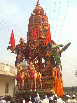
Shindkheda is a taluka in the Dhule district of Khandesh region of Maharashtra state in India. The city is situated on the west side of the Burai River.
Peth or Peint is the smallest tehsil of Nashik subdivision of Nashik district in Maharashtra, India. It belongs to Northern Maharashtra region. It belongs to Nashik Division. Peth is a Taluka headquarter. It is located 54 km to the West of Nashik District headquarters. It is also called as Peint. Pin code of Peth is 422208 and postal head office is Peth.
Betawad is a village in Sindkheda Taluka, Dhule District of Maharashtra State, India. It belongs to the Khandesh, the Northern Maharashtra regional and Nashik Division.
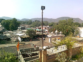
Pal is a village situated in Satpura range on the bank of the Suki River in Raver tehsil in Jalgaon district of Maharashtra state of India.


