Related Research Articles

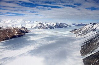
The Priestley Glacier is a major valley glacier, about 60 nautical miles long, originating at the edge of the Polar Plateau of Victoria Land, Antarctica. The glacier drains southeast between the Deep Freeze Range and Eisenhower Range to enter the northern end of the Nansen Ice Sheet. It was first explored by the Northern Party of the British Antarctic Expedition, 1910–13, and named for Raymond Priestley, a geologist with the Northern Party.

The Royal Society Range is a majestic range of mountains in Victoria Land, Antarctica, rising to 4,025 metres (13,205 ft) along the west shore of McMurdo Sound between the Koettlitz, Skelton and Ferrar Glaciers. They are south of the Kukri Hills, southeast of the Quartermain Mountains, and northeast of the Worcester Range.

Koettlitz Glacier is a large Antarctic glacier lying west of Mount Morning and Mount Discovery in the Royal Society Range, flowing from the vicinity of Mount Cocks northeastward between Brown Peninsula and the mainland into the ice shelf of McMurdo Sound.

Ferrar Glacier is a glacier in Antarctica. It is about 35 nautical miles long, flowing from the plateau of Victoria Land west of the Royal Society Range to New Harbour in McMurdo Sound. The glacier makes a right (east) turn northeast of Knobhead, where it where it is apposed, i.e., joined in Siamese-twin fashion, to Taylor Glacier. From there, it continues east along the south side of Kukri Hills to New Harbor.

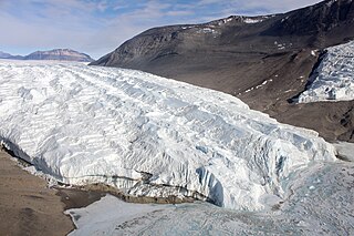
The Taylor Glacier is a glacier in Antarctica about 35 nautical miles long, flowing from the plateau of Victoria Land into the western end of Taylor Valley, north of the Kukri Hills. It flows to the south of the Asgard Range. The middle part of the glacier is bounded on the north by the Inland Forts and on the south by Beacon Valley.
Schweitzer Glacier is a glacier which drains west along the north side of Littlewood Nunataks into Vahsel Bay. The Lerchenfeld Glacier, trending west-northwestward, coalesces with the lower portion of this glacier. Discovered by the German Antarctic Expedition, 1911–12, under Wilhelm Filchner. He named it for Major Schweitzer, first president of the German Antarctic Expedition Society.

Taylor Valley77°37′S163°00′E is an ice-free valley about 18 nautical miles long, once occupied by the receding Taylor Glacier. It lies north of the Kukri Hills between the Taylor Glacier and New Harbour in Victoria Land, Antarctica. Taylor Valley is the southernmost of the three large McMurdo Dry Valleys in the Transantarctic Mountains, located west of McMurdo Sound.

Victoria Valley is an extensive ice-free valley, formerly occupied by a large glacier, extending from Victoria Upper Glacier to Victoria Lower Glacier in Victoria Land, Antarctica. It is one of the larger McMurdo Dry Valleys.
The Olympus Range is a primarily ice-free mountain range of Victoria Land, Antarctica, with peaks over 2,000 metres (6,600 ft) high, between Victoria Valley and McKelvey Valley on the north and Wright Valley on the south. It is south of the Clare Range and north of the Asgard Range.
The Nash Range is a mainly ice-covered coastal range in the Churchill Mountains of Antarctica.

Kukri Hills is a prominent east-west trending range, about 25 nautical miles (46 km) long and over 2,000 metres (6,600 ft) high, forming the divide between Ferrar Glacier on the south and Taylor Glacier and Taylor Valley on the north, in Victoria Land, Antarctica. They are south of the Asgard Range, east of the Quartermain Mountains and north of the Royal Society Range.
Greenville Valley is the large mainly ice-free valley lying south of Elkhorn Ridge in the Convoy Range of Victoria Land, Antarctica. A lobe of the Northwind Glacier flows a short distance west into the mouth of the valley. Near the head of the valley the south wall is breached by the entrance to Merrell Valley.
Doran Stream is a meltwater stream, 3 kilometres (2 mi) long, flowing north from Doran Glacier east of Sollas Glacier to Priscu Stream in Taylor Valley, Victoria Land. It was named by the Advisory Committee on Antarctic Names in 1996 after Peter Doran, a paleolimnologist currently an endowed chair at Louisiana State University, who has conducted studies of the paleolimnology and climate of the McMurdo Dry Valleys since 1993.

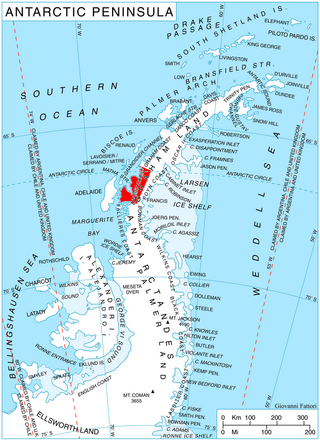
Drummond Glacier is a glacier 10 nautical miles (18 km) long and 2 nautical miles (4 km) wide, on the west coast of Graham Land, situated south of Hopkins Glacier and flowing west-northwest between Voit Peak and Sherba Ridge into Darbel Bay east of Sokol Point.
Evans Piedmont Glacier is a broad ice sheet occupying the low-lying coastal platform between Tripp Island and Cape Archer in Victoria Land, Antarctica.
Flagship Mountain is a prominent, conical rock peak, 1,720 metres (5,640 ft) high, surmounting the south part of the large rock mass between Northwind Glacier and Atka Glacier.
The Gonville and Caius Range is a range of peaks, 1,000 to 1,500 metres high, between Mackay Glacier and Debenham Glacier in Victoria Land, Antarctica.
Saint Johns Range is a crescent-shaped mountain range about 20 nautical miles long, in Victoria Land, Antarctica. It is bounded on the north by the Cotton Glacier, Miller Glacier and Debenham Glacier, and on the south by Victoria Valley and the Victoria Upper Glacier and Victoria Lower Glacier.
Roa Ridge is a bow-shaped ridge, 5 mi (8.0 km) long in the Asgard Range of Victoria Land, Antarctica. For much of its extent, it separates Matterhorn Glacier and Lacroix Glacier. Named by New Zealand Geographic Board (NZGB) in 1998. Roa is a Maori word meaning “long” ridge.
Blue Glacier is a large glacier which flows into Bowers Piedmont Glacier about 10 nautical miles south of New Harbour, in Victoria Land, Antarctica. It was discovered by the British National Antarctic Expedition (BrNAE) under Robert Falcon Scott, 1901–04, who gave it this name because of its clear blue ice at the time of discovery.
References
- ↑ "Doran Glaciery". Geographic Names Information System . United States Geological Survey, United States Department of the Interior . Retrieved 2012-01-26.
![]() This article incorporates public domain material from "Doran Glacier". Geographic Names Information System . United States Geological Survey.
This article incorporates public domain material from "Doran Glacier". Geographic Names Information System . United States Geological Survey.