Hanover County is a county in the Commonwealth of Virginia. As of the 2020 census, the population was 109,979. Its county seat is Hanover.

Caroline County is a United States county located in the eastern part of the Commonwealth of Virginia. The northern boundary of the county borders on the Rappahannock River, notably at the historic town of Port Royal. The Caroline county seat is Bowling Green.

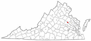
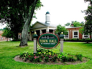
Bowling Green is an incorporated town in Caroline County, Virginia, United States. The population was 1,111 at the 2010 census.

Bon Air is a census-designated place (CDP) in Chesterfield County, Virginia, United States. The population was 18,022 at the 2020 census. The community is considered a suburb of the independent city of Richmond in the Richmond-Petersburg region and is a part of the Southside neighborhoods. Originally developed as a resort, a central portion of Bon Air has been designated as a National Historic District with many structures of Victorian design from the late 19th and early 20th centuries. Its name means "good air," reflecting its role as a resort getaway that wealthy Richmonders enjoyed for its fresh air as opposed to the dirty air of Richmond's industrial downtown of the late 19th century.
Ashland is a town in Hanover County, Virginia, United States, located 16 miles (26 km) north of Richmond along Interstate 95 and U.S. Route 1. As of the 2020 census it had a population of 7,565, up from 7,225 at the 2010 census.

Purcellville is a town in Loudoun County, Virginia. The population was 8,929 according to the 2020 census. Purcellville is the major population center for Western Loudoun and the Loudoun Valley. Many of the older structures remaining in Purcellville reflect the Victorian architecture popular during the early twentieth century.

The Richmond, Fredericksburg, and Potomac Railroad was a railroad connecting Richmond, Virginia, to Washington, D.C. The track is now the RF&P Subdivision of the CSX Transportation system; the original corporation is no longer a railroad company.

Manchester is a former independent city in Virginia in the United States. Prior to receiving independent status, it served as the county seat of Chesterfield County, between 1870 and 1876. Today, it is a part of the city of Richmond, Virginia.

Broad Street is a 15-mile-long (24 km) road located in the independent city of Richmond, Virginia, and adjacent Henrico County. Broad Street is significant to Richmond due to the many commercial establishments that have been built along it throughout Richmond's history. From downtown through miles into the suburbs, the street is largely dedicated to retailing and offices, including regional and neighborhood shopping centers and malls.

The Virginia Central Railroad was an early railroad in the U.S. state of Virginia that operated between 1850 and 1868 from Richmond westward for 206 miles (332 km) to Covington. Chartered in 1836 as the Louisa Railroad by the Virginia General Assembly, the railroad began near the Richmond, Fredericksburg and Potomac Railroad's line and expanded westward to Orange County, reaching Gordonsville by 1840. In 1849, the Blue Ridge Railroad was chartered to construct a line over the Blue Ridge Mountains for the Louisa Railroad which reached the base of the Blue Ridge in 1852. After a decision from the U.S. Supreme Court, the Louisa Railroad was allowed to expand eastward from a point near Doswell to Richmond.

Richmond Main Street Station, officially the Main Street Station and Trainshed, is a historic railroad station and office building in Richmond, Virginia. It was built in 1901, and is served by Amtrak. It is also an intermodal station with Richmond's city transit bus services, which are performed by Greater Richmond Transit Company (GRTC). The station is colloquially known by residents as The Clock Tower. It was listed to the National Register of Historic Places in 1970, and in 1976 was made a U.S. National Historic Landmark. Main Street Station serves as a secondary train station for Richmond providing limited Amtrak service directly to downtown Richmond. Several Amtrak trains serving the Richmond metropolitan area only stop at the area's primary rail station, Staples Mill Road which is located five miles to the north in Henrico County.
Elmont is an unincorporated community in Hanover County in the Central Region of the U.S. state of Virginia. It was located on the former Richmond, Fredericksburg and Potomac Railroad, now owned by CSX Transportation. Elmont was located on the old Washington Highway, and was served by an electric trolley car line between Richmond and Ashland.
Buckingham Branch Railroad is a Class III short-line railroad operating over 275 miles (443 km) of historic and strategic trackage in Central Virginia. Sharing overhead traffic with CSX and Amtrak, the company's headquarters are in Dillwyn, Virginia in the former Chesapeake and Ohio Railway (C&O) station, itself a historic landmark in the community.

Lee Hall is a community located in the extreme northern portion of the independent city of Newport News in the Commonwealth of Virginia in the United States.

The Tri-Cities of Virginia is an area in the Greater Richmond Region which includes the three independent cities of Petersburg, Colonial Heights, and Hopewell and portions of the adjoining counties of Chesterfield, Dinwiddie, and Prince George in south-central Virginia. Other unincorporated communities located in the Tri-Cities area include Ettrick, Fort Gregg-Adams, and City Point, the latter formerly a historic incorporated town which was annexed to become part of the City of Hopewell.

State Route 30 is a primary state highway in the U.S. state of Virginia. The state highway runs 61.87 miles (99.57 km) from U.S. Route 1 in Doswell east to Interstate 64 (I-64) and SR 607 near Norge. SR 30 runs east–west through Hanover and Caroline Counties, connecting US 1 and I-95 with the Kings Dominion amusement park and US 301. The state highway serves as the principal highway of King William County, connecting U.S. Route 360 with SR 33 in West Point via the county's namesake county seat. SR 30 also connects SR 33 and US 60 in New Kent and James City Counties.

Interstate 95 (I-95) runs 179 miles (288 km) within the commonwealth of Virginia between its borders with North Carolina and Maryland. I-95 meets the northern terminus of I-85 in Petersburg and is concurrent with I-64 for three miles (4.8 km) in Richmond. Although I-95 was originally planned as a highway through Washington, D.C., it was rerouted along the eastern portion of the Capital Beltway concurrent with I-495. From Petersburg to Richmond, I-95 utilized most of the Richmond–Petersburg Turnpike, a former toll road. In addition to Richmond, the route also runs through the medium-sized cities of Emporia, Petersburg, Colonial Heights, Fredericksburg, and Alexandria.

Wingina is an unincorporated community in Nelson County, Virginia, United States.

The Meadow Event Park is an event center in Doswell, Virginia. Previously called the Meadow Stables, the park hosts the annual State Fair of Virginia. On March 14, 2013, the Virginia Farm Bureau Federation bought the State Fair of Virginia and the Meadow Event Park from Universal Fairs LLC of Cordova, Tennessee. The Meadow Event Park also hosts other events. The historic structures of the Thoroughbred farm remain on the 331-acre (1.34 km2) site. The park was the birthplace of famous Thoroughbred racing horse Secretariat, 1973 Triple Crown champion.

Dawn, is an unincorporated community in Caroline County, in the U.S. state of Virginia. It is located at the intersection of US 301 / SR 2 and SR 30, roughly east of Doswell, north of Hanover, west of Central Garage, and south of Bowling Green.