A Michigan left or P-turn is an at-grade intersection design that replaces each left (farside) turn at an intersection between a (major) divided roadway and a secondary (minor) roadway with the combination of a right (nearside) turn followed by a U-turn, or a U-turn followed by a right (nearside) turn, depending on the situation. It is in use in numerous countries.
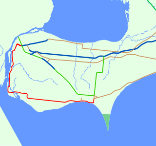
The E. C. Row Expressway is a municipal expressway in the city of Windsor, Ontario, Canada. It divides the city in half as it crosses it between the Ojibway Parkway in the west and Banwell Road in the east, a distance of 15.4 kilometres (9.6 mi). It was built between 1971 and 1983, reaching completion across the city on June 9, 1983. It was part of Highway 2 and Highway 18 until the province transferred ownership and responsibility for the route to the City of Windsor on April 1, 1997. In 2015, the westernmost 3 kilometres (1.9 mi) was significantly upgraded as part of the Highway 401 extension project. The freeway is named after Edgar Charles Row, the president of Chrysler Canada between 1951 and 1956.
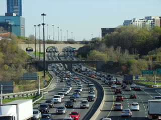
King's Highway 402, commonly referred to as Highway 402 and historically as the Blue Water Bridge Approach, is a 400-series highway in the Canadian province of Ontario that connects the Blue Water Bridge international crossing near Sarnia to Highway 401 in London. It is one of multiple trade links between Ontario and the Midwestern United States. It is four lanes for much of its length, though the approach to the Blue Water Bridge is six lanes.

A partial cloverleaf interchange or parclo is a modification of a cloverleaf interchange.

Lake Shore Boulevard is a major arterial road running along more than half of the Lake Ontario waterfront in the city of Toronto, Ontario, Canada. Prior to 1998, two segments of Lake Shore Boulevard were designated as part of Highway 2, with the highway following the Gardiner Expressway between these two sections.

State Route 161 is a primary state highway in and near Richmond, Virginia, United States. It extends from an interchange with Interstate 95 (I-95) in the independent city of Richmond north to an intersection with U.S. Route 1 in the Lakeside area of central Henrico County.

The Roy A. Battagello River Walk Bike Trail is the current backbone of the "Windsor Loop" bike trail network in Windsor, Ontario. The bike trail travels from the foot of the Ambassador Bridge, to traffic lights at Riverside Drive and Lincoln Avenue. This makes the trail the second-longest trail in the City of Windsor, at 8.0 km.
The Little River Extension is one of the newest and busiest recreational trails in Windsor, Ontario, having been built in 1996. The trail is used mainly as a link between the large subdivision of Forest Glade, to Ganatchio Trail, Sandpoint Beach, Stop 26 Beach, and Lakeview Park And Marina. The trail has a posted speed limit of 20 kilometres per hour (12 mph).
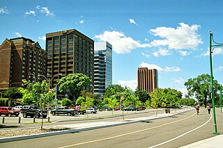
Windsor, Ontario, has a very diverse population, and this diversity is shown in its many neighbourhoods. Windsor has twenty in all, ranging from rural farmland to densely built-up areas.

U.S. Route 41 (US 41) in the U.S. state of Illinois runs north from the Indiana border beneath the Chicago Skyway on Indianapolis Boulevard to the Wisconsin border north of the northern terminus of the Tri-State Tollway with Interstate 94. It is the only north–south U.S. Route to travel through a significant portion of the city of Chicago, carrying Lake Shore Drive through the central portion of the city along the lakefront. US 41 in Illinois is 64.81 miles (104.30 km) in length.
King's Highway 39, commonly referred to as Highway 39, was a provincially maintained highway in the Canadian province of Ontario. The 33.8-kilometre (21.0 mi)-long route connected Highway 3 in downtown Windsor with Highway 2 south of Belle River, travelling along the southern shoreline of Lake St. Clair. Highway 39 was established in 1934. By 1961, the Pike Creek Bypass was opened and Highway 39 was rerouted along it, with the former route briefly becoming Highway 39B. The route was renumbered as Highway 2 in 1970, retiring the designation from the provincial highway system. Highway 2 was itself decommissioned along the former route of Highway 39 on January 1, 1998, and transferred to Essex County and the City of Windsor. It was subsequently redesignated as Essex County Road 22.
King's Highway 98, commonly referred to as Highway 98, was a provincially maintained highway in the Canadian province of Ontario, designated as part of the provincial highway system between 1939 and 1971. The route travelled through the northern part of Essex County and through south-central Chatham-Kent, extending 96.3 kilometres (59.8 mi) from Windsor to Blenheim. Since 1998, it has been known as Essex County Road 46 between Windsor and Tilbury, and Chatham-Kent Road 8 between Tilbury and Blenheim.

King's Highway 18, commonly referred to as Highway 18, was a provincially maintained highway in the Canadian province of Ontario, located entirely within Essex County. Since 1998, the majority of the former route has been known as Essex County Road 20. The route travelled at the southernmost point in Canada, along or near the shoreline of the Detroit River and Lake Erie between Windsor and Leamington, with Highway 3 as the terminus at both ends. The former route provides access to the communities of LaSalle, Amherstburg, Malden Centre, Harrow, Kingsville and Union.
Grand Marais Road is a road that travels through Windsor, Ontario. Its use and significance has dwindled considerably following the completion of the E.C. Row Expressway.

Ouellette Avenue is one of the main North-South Roads in Windsor, Ontario, and acts as its Main Street. The road diverges from Dougall Avenue south of Downtown Windsor, travelling northward over the Essex Terminal Railway/CP Rail tracks, before terminating at a turnaround and parking lot at Dieppe Gardens in Windsor's core.

King's Highway 3B, commonly referred to as Highway 3B, was a provincially maintained highway within Windsor, in the Canadian province of Ontario. Its purpose was to link Highway 3 and Highway 401 with the Detroit–Windsor tunnel and downtown Windsor. Highway 3B was routed along the city streets of Ouellette Avenue, Ouellette Place, Howard Avenue, and Dougall Avenue.
The Grand Marais Trail is the name of a small bicycle trail that follows Turkey Creek in the middle of Windsor, Ontario. It starts off as a minor spur route, connecting the West Windsor Recreationway with Huron Church Road and the neighbourhood of South Windsor.

A total of eight special routes of U.S. Route 65 exist, divided between the U.S. states of Arkansas and Missouri. Currently, they are all business loops, although a spur route in Pine Bluff, Arkansas and bypass routes in Baton Rouge, Louisiana and Springfield, Missouri both existed in the past.

Terminology related to road transport—the transport of passengers or goods on paved routes between places—is diverse, with variation between dialects of English. There may also be regional differences within a single country, and some terms differ based on the side of the road traffic drives on. This glossary is an alphabetical listing of road transport terms.


