Dove Bridge

Last updated

The southern (downstream) elevation of the bridge in 2006 Dove bridge 231394 40b11970.jpg
The southern (downstream) elevation of the bridge in 2006

Dove Bridge is a medieval bridge across the River Dove on the boundary of Staffordshire and Derbyshire in England. A river crossing has existed here since before the 1086 Domesday Book, on the road between Derby and Newcastle-under-Lyme. The current structure, a six-arch bridge, is thought to date from the 15th century, though it has been subject to later repairs and significant widening work in 1913. A larger replacement bridge was constructed in the 1970s and now carries the A50 dual carriageway. Dove Bridge is now only used by pedestrian and farm traffic.

Contents

Description

The current bridge consists of six arches. The outer four arches are pointed and medieval in origin, the central two arches are rounded and later in style. [1] [2]

The bridge is constructed of sandstone blocks laid in regular courses. It rises slightly towards its centre. [1] One of the older arches is ribbed, typical of Romanesque architecture. [2] The cutwaters, located on both sides of the bridge between each arch, are triangular in cross section and rise to the full height of the deck. They are substantial and allow for large recesses at deck level for use as pedestrian refuges. [2] [1] [3] The bridge spans 63 yards (58 m) and measures approximately 24 feet (7.3 m) between parapets. [2] The parapets are relatively plain. [1]

The bridge is a Grade II* listed building, first listed on 13 September 1967, and a scheduled monument. [1] [4]

History

Looking north (upstream) from the bridge deck, showing the top of one of the cutwaters The River Dove - geograph.org.uk - 1196803.jpg
Looking north (upstream) from the bridge deck, showing the top of one of the cutwaters

The site is the location of an ancient crossing of the River Dove, forming the boundary between Staffordshire and Derbyshire. [3] [2] The bridge carried the road between Derby and Newcastle-under-Lyme. [3] The site is recorded in the 1086 Domesday Book as "Dubridge" and by the 13th century was known as "Douebrigg". [2] In the 4th year of the reign of Edward I (c. 1276) a jury presented findings to justices in Eyre that the merchants of Melbourne, Derbyshire, had for three years unjustly withheld the payment of tolls at the bridge, which affected the money available for repairs. [5]

Edwyn Jervoise, an early 20th-century architectural historian, thought that the outer arches might date from the 14th century, though Historic England currently believe them to be 15th century. [2] [1] The central two arches are from a later rebuilding. This has potentially been dated to 1691 based on an engraving in the parapet and records of the Staffordshire Quarter Sessions which allocated £350 (equivalent to £65,669in 2021) for work on the bridge between 1689 and 1691. [2]

By the 17th century the maintenance of the bridge was partly funded by the income from agricultural land in Staffordshire. This included the 120 acres (49 ha) of Broad Meadow and Netherwood Meadow and 7 acres (2.8 ha) of enclosed land, which was formerly part of Broad Meadow. However revenues from this land were relatively low, at around £7 (equivalent to £1,299in 2021) a year, as the locals refused to maximise revenue by allowing higher charges for grazing on the aftermath of the harvest. A decree of 24 October 1690 failed to secure a change in this practice. An inquiry of 10 May 1727 led to a decree by the charity commissioners. This led to enclosure of the land from 8 August each year, with all animals excluded and access granted at the end of August for grazing by horses (for a 7 shilling charge) and cows (for a 4 shilling charge). Some 300-400 cattle were grazed each year, greatly increasing income for the repairs. Later the rights to graze the aftermath were sold at auction, raising around £50 (equivalent to £7,912in 2021) a year. [6]

A hermitage was located at the bridge in the 17th century. [7] Also during the 17th century freemason and alchemist Elias Ashmole participated in a ceremony at the bridge to attempt to invoke spirits. [8] The bridge was visited by Daniel Defoe and the event recorded in his 1724–27 travelogue A Tour thro' the Whole Island of Great Britain . He notes that the locals referred to it as Dowbridge. Defoe reached the bridge on a journey from Derby to Uttoxeter and Ashbourne but his onward travel was prevented by rains that swelled the river and he instead returned to Derby to travel on to High Peak. [9]

In the mid-19th century workmen found a large stag's horn, buried 6–7 feet (1.8–2.1 m) deep in the ground some 30 yards (27 m) downstream of the bridge. [10] By 1858 the quarter sessions of Staffordshire and Derbyshire had agreed to share responsibility for maintenance of the bridge, which was administered by justices of the peace. [11] Significant repairs were carried out in spring 1864 with stones protecting the river bed under the bridge replaced. In 1874 the western-most arch was rebuilt, though the original ribbed design was not replicated. During this period the parapet was also rebuilt a number of times. [6]

The Dove bridge (right) and its modern replacement Two Bridges over the Dove - geograph.org.uk - 1196741.jpg
The Dove bridge (right) and its modern replacement

In 1913 a scheme to widen the bridge by 13 feet (4.0 m) on the upstream side was approved with an estimated cost of £4,800 (equivalent to £502,486in 2021). [12] These works were completed by around 1915. [2] During the Second World War two type 24 pillboxes were constructed near the bridge, intended to defend the crossing in case of German invasion. [13]

The road over the bridge came to be administered by the Department of the Environment, as part of the A50 trunk road. In 1975 the department awarded a £389,966 (equivalent to £3,480,073in 2021) contract to Lehane, Mackenzie and Shand for the construction of a three-span replacement bridge to the south of the original structure. [14] This was completed by late 1976, a second bridge was installed to the south as part of an upgrade to dual carriageway status completed in 1998. [15] The medieval bridge was retained and now carries pedestrians, cattle and local farm traffic. [16] [3] [17] Until at least the mid-20th century the River Tean joined the Dove upstream of Dove Bridge; it now joins immediately downstream of the new bridge. [18]

Related Research Articles

<span class="mw-page-title-main">Uttoxeter</span> Market town in Staffordshire, England

Uttoxeter is a market town and civil parish in the East Staffordshire borough of Staffordshire, England. It is near to the Derbyshire county border.

<span class="mw-page-title-main">Mickleover</span> Human settlement in England

Mickleover is a town in the unitary authority of Derby, in Derbyshire, England. It is 2 miles (3.2 km) west of Derby, 10 miles (16 km) northeast of Burton-upon-Trent, 19 miles (31 km) west of Nottingham, 13 miles (21 km) southeast of Ashbourne and 12 miles (19 km) northeast of Uttoxeter.

<span class="mw-page-title-main">East Staffordshire</span> Non-metropolitan district and Borough in England

East Staffordshire is a local government district with borough status in Staffordshire, England. The council is based in Burton upon Trent. The borough also contains the town of Uttoxeter and numerous villages and surrounding rural areas.

<span class="mw-page-title-main">A50 road</span> Road in England

The A50 is a major trunk road in England between Warrington and Leicester; historically it was also a major route from London to Leicester.

Blythe Bridge is a village in Staffordshire, England, south-east of Stoke-on-Trent.

<span class="mw-page-title-main">River Dove, central England</span> River in Derbyshire and Staffordshire, England

The River Dove is the principal river of the southwestern Peak District, in the Midlands of England, and is around 45 miles (72 km) in length. It rises on Axe Edge Moor near Buxton and flows generally south to its confluence with the River Trent at Newton Solney. From there, its waters reach the North Sea via the Humber Estuary. For almost its entire course it forms the boundary between the counties of Staffordshire and Derbyshire. The river meanders past Longnor and Hartington and cuts through a set of deep limestone gorges, Beresford Dale, Wolfscote Dale, Milldale and Dovedale.

<span class="mw-page-title-main">Doveridge</span> Human settlement in England

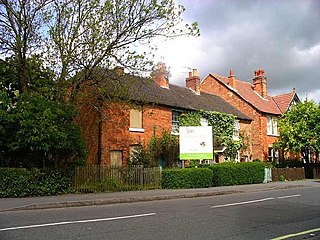
Doveridge is a village and civil parish in Derbyshire, United Kingdom, near the border with Staffordshire and about 2 km (1.2 mi) east of Uttoxeter. Its name may come from its having a bridge over the river Dove, a tributary of the River Trent. The civil parish population as taken at the 2011 Census was 1,622.

<span class="mw-page-title-main">Cropredy Bridge</span> Bridge in United Kingdom

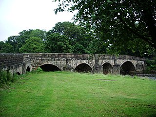
Cropredy Bridge is a bridge in north Oxfordshire, England, that carries the minor road between Cropredy and the hamlet of Williamscot. It spans the River Cherwell, which is also the boundary between the civil parishes of Wardington and Cropredy. The bridge has three spans, a reinforced concrete deck and is faced with Hornton stone. Each of the three spans is 12 feet (3.7 m). The present bridge was completed in 1937, but there has been a bridge on this site since at least 1312.

<span class="mw-page-title-main">Rocester</span> Human settlement in England

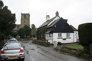
Rocester is a village and civil parish in the East Staffordshire district of Staffordshire, England. Its name is spelt Rowcestre in the Domesday Book. It is located on the Derbyshire border.

<span class="mw-page-title-main">Hatton, Derbyshire</span> Human settlement in England

Hatton is a village and civil parish in South Derbyshire, England. It is 5 miles (8.0 km) north of Burton upon Trent, 10 miles (16 km) south-west of Derby and 24 miles (39 km) south-east of Stoke-on-Trent. The population of the civil parish as of the 2011 census was 2,785. It adjoins Tutbury to the south.

<span class="mw-page-title-main">Derby Friargate railway station</span> Former railway station in Derby, England

Derby Friargate railway station was the main station in Derby on the Great Northern Railway Derbyshire Extension, popularly known as the (Derby) Friargate Line.

<span class="mw-page-title-main">Marchington</span> Human settlement in England

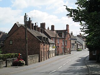
Marchington is a small village in East Staffordshire, England. It lies between the towns of Burton upon Trent and Uttoxeter. Marchington has a small community-run shop, a first school, two churches and two pubs. The population of the village was 1,127 at the 2001 census, increasing to 2,017 at the 2011 census.

<span class="mw-page-title-main">The Heath, Staffordshire</span> Village near Uttoxeter in Staffordshire, England

The Heath is a village in the East Staffordshire borough of Staffordshire, England. It is close to the border with Derbyshire. The village adjoins the town of Uttoxeter and the villages of Bramshall and Spath.

<span class="mw-page-title-main">Tean, Staffordshire</span> Human settlement in England

Tean is a large village in Staffordshire, England. It is around 15 miles (24 km) south-east of Stoke-on-Trent. The River Tean runs through the village, heading east towards Uttoxeter. Population details for the 2011 census can be found under Checkley.

<span class="mw-page-title-main">Checkley</span> Human settlement in England

Checkley is a village and civil parish in the district of Staffordshire Moorlands in the English county of Staffordshire.

<span class="mw-page-title-main">Old Exe Bridge</span> Ruined medieval bridge in Devon, England

The Old Exe Bridge is a ruined medieval arch bridge in Exeter in south-western England. Construction of the bridge began in 1190, and was completed by 1214. The bridge is the oldest surviving bridge of its size in England and the oldest bridge in Britain with a chapel still on it. It replaced several rudimentary crossings which had been in use sporadically since Roman times. The project was the idea of Nicholas and Walter Gervase, father and son and influential local merchants, who travelled the country to raise funds. No known records survive of the bridge's builders. The result was a bridge at least 590 feet long, which probably had 17 or 18 arches, carrying the road diagonally from the west gate of the city wall across the River Exe and its wide, marshy flood plain.

<span class="mw-page-title-main">Monks Bridge, River Dove</span> Bridge in Staffordshire/Egginton, Derbyshire

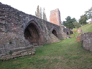
Monks Bridge is a road bridge across the River Dove between Stretton, Staffordshire, and Egginton, Derbyshire. A bridge has existed here since the early 13th century, though much of the current structure dates to the 15th century. It formerly carried traffic on what is now the A38 road but a replacement structure was built to the north in 1926. It was formerly used as a slip road but is now out of use to vehicular traffic.

<span class="mw-page-title-main">Edisford Bridge</span> Bridge in Lancashire, England

Edisford Bridge is a toll-free, nine-span bridge over the River Ribble near Clitheroe, Lancashire, England. A Grade II listed structure and a Scheduled monument, located about a mile WSW of the centre of town, it crosses the river to the civil parish of Great Mitton. The bridge carries the two-lane traffic of the B6243 Edisford Road.

<span class="mw-page-title-main">Hoon, Derbyshire</span> Civil parish in Derbyshire, England

Hoon is a hamlet and civil parish within the South Derbyshire district, which is in the county of Derbyshire, England. It is a predominantly rural area with few residences or farms, and had a population of 55 residents in 2021. The parish is 110 miles (180 km) north west of London, 8 miles (13 km) south west of the county city of Derby, and 5 miles (8.0 km) north of the nearest market town of Burton-on-Trent in Staffordshire. It shares a border with the parishes of Church Broughton, Hatton, Hilton, Marston on Dove, Sutton on the Hill, as well as Tutbury.

<span class="mw-page-title-main">Hampton in Arden packhorse bridge</span> Bridge in the West Midlands of England

Hampton in Arden packhorse bridge crosses the River Blythe near Hampton in Arden in the West Midlands of England, between Birmingham and Coventry. Dating from the 15th century, it is the only bridge of its kind in the area now covered by the West Midlands, and is a grade II* listed building and a scheduled monument.

References

  1. 1 2 3 4 5 6 "DOVE BRIDGE, Doveridge - 1237731". Historic England. Retrieved 7 September 2022.
  2. 1 2 3 4 5 6 7 8 9 Jervoise, E. (25 August 2017). The Ancient Bridges of Mid and Eastern England. Read Books Ltd. p. 5. ISBN   978-1-4733-4079-4.
  3. 1 2 3 4 "Dove Bridge, Doveridge". National Transport Trust. Retrieved 7 September 2022.
  4. "MDR7768 - Dove Bridge, north of the A50, Doveridge". Derbyshire Historic Environment Record. Derbyshire County Council. Retrieved 7 September 2022.
  5. Briggs, John Joseph (1859). The Trent: And Other Poems. Bemrose. pp. 75–76.
  6. 1 2 Redfern, Francis (1886). History and Antiquities of the Town and Neighbourhood of Uttoxeter, with Notices of Adjoining Places. Allbut. p. 417.
  7. Redfern, Francis (1886). History and Antiquities of the Town and Neighbourhood of Uttoxeter, with Notices of Adjoining Places. Allbut. p. 301.
  8. Churton, Tobias (27 June 2006). The Magus of Freemasonry: The Mysterious Life of Elias Ashmole—Scientist, Alchemist, and Founder of the Royal Society. Simon and Schuster. p. 236. ISBN   978-1-59477-650-2.
  9. Defoe, Daniel. A Tour Through the Whole Island of Great Britain III. Рипол Классик. p. 46. ISBN   978-5-521-06818-0.
  10. The Reliquary and Illustrated Archaeologist,: A Quarterly Journal and Review Devoted to the Study of Early Pagan and Christian Antiquities of Great Britain. J. R. Smith. 1864. p. 2.
  11. The Practice of the Court of General Quarter Sessions of the Peace, for the County of Stafford. And Orders of Court Relating Thereto. Revised 1858. R. and W. Wright, printers. 1858. p. 11.
  12. Page's Engineering Weekly. 1913. p. 888.
  13. Osborne, Mike (2004). Defending Britain: Twentieth-century Military Structures in the Landscape. Tempus. p. 228. ISBN   978-0-7524-3134-5.
  14. Highways & Road Construction. IPC Building & Contract Journals Limited. 1975. p. 50.
  15. Country Life. Country Life, Limited. September 1976. p. 1096.
  16. Darbyshire, Jayne (15 April 2012). River Dove. Amberley Publishing Limited. p. 39. ISBN   978-1-4456-2537-9.
  17. "A564 (T) Doveridge Bypass Archaeological Evaluation". p. 20. Retrieved 20 March 2023.
  18. "Side by side georeferenced maps viewer – Map images – OS 1:10,000 1949-1971". National Library of Scotland.

52°54′27″N1°50′40″W / 52.90756°N 1.84449°W / 52.90756; -1.84449