Illinois is a state in the Midwestern region of the United States. It borders Lake Michigan to its northeast, the Mississippi River to its west, and the Wabash and Ohio rivers to its south. Of the fifty U.S. states, Illinois has the fifth-largest gross domestic product (GDP), the sixth-largest population, and the 25th-most land area. Its capital is Springfield.

Winnebago County is a county located in the U.S. state of Illinois. According to the 2020 census, it had a population of 285,350 making it the seventh most populous county in Illinois behind Cook County and its five surrounding collar counties. Its county seat is Rockford. Winnebago County is the central county of the Rockford metropolitan area.

Randolph County is a county located in the U.S. state of Illinois. According to the 2020 census, it had a population of 30,163. Its county seat is Chester.

Elk Grove Village is a village in Cook and DuPage counties in the U.S. state of Illinois. Per the 2020 census, the population was 32,812. Located 20 miles (32 km) northwest of Chicago along the Golden Corridor, the Village of Elk Grove Village was incorporated on July 17, 1956. It is directly adjacent to O'Hare International Airport and is economically important to the Chicago metropolitan area due to its large industrial park, located on the eastern border of the village. The community is served by several Interstate highways including I-90, I-290/I-355/Route 53, and IL-390. Elk Grove is also expected to be served by the I-490 Western O'Hare Bypass upon completion of the project.

DeKalb is a city in DeKalb County, Illinois, United States. The population was 40,290 at the 2020 census. The city is named after decorated Franconian-French war hero Johann de Kalb, who died during the American Revolutionary War.

Pecatonica is a village in Winnebago County, Illinois, United States. It is part of the Rockford, Illinois Metropolitan Statistical Area. The population was 2,195 at the 2010 census, up from 1,997 in 2000.

Rockford is a city in Winnebago County, Illinois, United States. Located in far northern Illinois on the banks of the Rock River, Rockford is the county seat of Winnebago County. The population was 148,655 at the 2020 census, making Rockford the fifth-most populous city in Illinois, as well as the state's most populous city outside of the Chicago metropolitan area. It anchors the Rockford metropolitan area, which had 338,798 residents in 2020.

The mayor of Chicago is the chief executive of city government in Chicago, Illinois, the third-largest city in the United States. The mayor is responsible for the administration and management of various city departments, submits proposals and recommendations to the Chicago City Council, is active in the enforcement of the city's ordinances, submits the city's annual budget and appoints city officers, department commissioners or directors, and members of city boards and commissions.

The Chicago metropolitan area, also referred to as Chicagoland, is the largest metropolitan statistical area in the U.S. state of Illinois, and the Midwest, containing the City of Chicago along with its surrounding suburbs and satellite cities. Encompassing 10,286 square mi (28,120 km2), the metropolitan area includes the city of Chicago, its suburbs and hinterland, that span 13 counties across northeast Illinois and northwest Indiana. The MSA had a 2020 census population of 9,618,502 and the combined statistical area, which spans 19 counties and additionally extends into southeast Wisconsin, had a population of nearly 10 million people. The Chicago area is the third largest metropolitan area in the United States and the fourth largest metropolitan area in North America, and the largest in the Great Lakes megalopolis. Its urban area is one of the forty largest in the world.

The economy of Illinois is the fifth largest by GDP in the United States and one of the most diversified economies in the world. Fueled by the economy of Chicago, the Chicago metropolitan area is home to many of the United States' largest companies, including Abbott Laboratories, AbbVie Inc., Allstate, Baxter International, Conagra, Crate and Barrel, Kraft Heinz, McDonald's, CNH Industrial, GE Healthcare, Aon PLC, Willis Towers Watson, Mondelez International, Motorola, United Airlines, US Foods, Walgreens, and more. The Chicago area is a global financial center and headquarters a wide variety of financial institutions including Citadel LLC, CNA Financial, Discover Financial Services, Morningstar, Inc., Nuveen, and more. Chicago is also home to the largest futures exchange in the world, the Chicago Mercantile Exchange.
Illinois is in the midwestern United States. Surrounding states are Wisconsin to the north, Iowa and Missouri to the west, Kentucky to the east and south, and Indiana to the east. Illinois also borders Michigan, but only via a northeastern water boundary in Lake Michigan. Nearly the entire western boundary of Illinois is the Mississippi River, except for a few areas where the river has changed course. Illinois' southeastern and southern boundary is along the Wabash River and the Ohio River, whereas its northern boundary and much of its eastern boundary are straight survey lines. Illinois has a maximum north–south distance of 390 miles (630 km) and 210 miles (340 km) east-west. Its total area is 57,918 square miles (150,010 km2).

Forgottonia, also spelled Forgotonia, is the name given to a 16-county region in Western Illinois in the late 1960s and early 1970s. This geographic region forms the distinctive western bulge of Illinois that is roughly equivalent to "The Tract", the Illinois portion of the Military Tract of 1812, along and west of the Fourth Principal Meridian. Since this wedge-shaped region lies between the Illinois and Mississippi rivers, it has historically been isolated from the eastern portion of Central Illinois.

The Eternal Indian, sometimes called the Black Hawk Statue, is a 48-foot sculpture by Lorado Taft located in Lowden State Park, near the city of Oregon, Illinois. Dedicated in 1911, the statue is perched over the Rock River on a 77-foot bluff overlooking the city.
The 16th congressional district of Illinois is represented by Republican Darin LaHood. Prominent past representatives from the 16th district have included Everett Dirksen, who went on to become the Republican leader in the United States Senate; John B. Anderson, who became the 3rd highest ranking Republican in the House and went on to run as a major independent candidate in the 1980 Presidential election; and Lynn Martin, who later served as United States Secretary of Labor.

Northern Illinois is a region generally covering the northern third of the U.S. state of Illinois. The region is by far the most populous of Illinois, with nearly 9.7 million residents as of 2010.
The 2007 Midwest flooding was a major flooding event that occurred in the Midwestern United States in the third week of August 2007. While Hurricane Dean was affecting the Yucatán Peninsula and the Gulf of Mexico, and Tropical Storm Erin was affecting Oklahoma and Texas, a persistent storm system hung over the Midwest for several days, causing repeated flash flooding in the US states of Illinois, Indiana, Iowa, Minnesota, Ohio, and Wisconsin. Cool Canadian air clashed with large quantities of warm moist air from the Gulf, producing torrential rains along a stationary front. 5 deaths across the central United States were attributed to the resulting flooding. Seven Minnesota counties, eight Ohio counties, fourteen counties in Wisconsin, and seven counties in Illinois were declared Federal Disaster Areas.
Joe Sosnowski is a member of the Illinois House of Representatives, first sworn in to represent the 69th district in 2010. The district he represents includes the municipalities of Belvidere, Caledonia, Capron, Cherry Valley, Loves Park, Machesney Park, Roscoe, South Beloit, Timberlane.

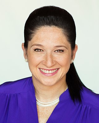
A special election for Illinois Comptroller took place on November 8, 2016. After comptroller Judy Baar Topinka died shortly after her reelection in 2014, Republican Governor Bruce Rauner appointed Leslie Munger, a former business executive and unsuccessful 2014 nominee for the Illinois House of Representatives, to fill her seat at the beginning of his term in 2015. Per Illinois state law, a special election was held to elect a comptroller to finish Topinka's term. Munger ran as the Republican nominee against Democratic Chicago City Clerk Susana Mendoza. State Senator Daniel Biss ran for the Democratic nomination, but dropped out in November 2015.
The Chicago, Aurora and DeKalb Railroad was a 29-mile (47 km) interurban line which operated from 1906 to 1923 and connected the cities of Aurora and DeKalb, Illinois. The line made connections in Aurora with the Aurora, Elgin and Fox River Electric Company, the Chicago, Aurora and Elgin Railroad, and the Aurora, Plainfield and Joliet Railroad. Entry into Aurora was made via streetcar trackage of the Aurora, Elgin and Fox River Electric. Over the course of its history, the railroad used internal combustion, steam, and finally electric traction as motive power.
The Northern League is a collegiate summer baseball league consisting of teams in Indiana. It was named the Midwest Collegiate League (MCL) from 2010 to 2021.


