
The Loop, one of Chicago's 77 designated community areas, is the central business district of the city and is the main section of Downtown Chicago. Home to Chicago's commercial core, it is the second largest commercial business district in North America and contains the headquarters and regional offices of several global and national businesses, retail establishments, restaurants, hotels, and theaters, as well as many of Chicago's most famous attractions. It is home to Chicago's City Hall, the seat of Cook County, and numerous offices of other levels of government and consulates of foreign nations. The intersection of State Street and Madison Street, located in the area, is the origin of the address system of Chicago's street grid. Most of Grant Park's 319 acres (1.29 km2) are in the eastern section of the community area. The Loop community area is bounded on the north and west by the Chicago River, on the east by Lake Michigan, and on the south by Roosevelt Road.
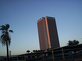
McAllen is the largest city in Hidalgo County, Texas, United States, and the 22nd-most populous city in Texas. It is located at the southern tip of the state in the Rio Grande Valley, on the Mexico–United States border. The city limits extend south to the Rio Grande, across from the Mexican city of Reynosa. McAllen is about 70 mi (110 km) west of the Gulf of Mexico. As of the 2020 census, McAllen's population was 142,210. It is the fifth-most populous metropolitan area (McAllen–Edinburg–Mission) in the state of Texas, and the binational Reynosa–McAllen metropolitan area counts a population of more than 1.5 million.

Downtown is the largest central business district in the city of Houston and the largest in the state of Texas, located near the geographic center of the metropolitan area at the confluence of Interstate 10, Interstate 45, and Interstate 69. The 1.84-square-mile (4.8 km2) district, enclosed by the aforementioned highways, contains the original townsite of Houston at the confluence of Buffalo Bayou and White Oak Bayou, a point known as Allen's Landing. Downtown has been the city's preeminent commercial district since its founding in 1836.
Uptown is a business district in Houston, located 6.2 miles (10.0 km) west of Downtown and is centered along Post Oak Boulevard and Westheimer Road. The Uptown District is roughly bounded by Woodway Drive to the north, the I-610 to the east, Richmond Avenue to the south, and Yorktown Street to the west. It covers 1,010 acres (410 ha).

The Central Business District (CBD) is a neighborhood of the city of New Orleans, Louisiana, United States.
Downtown Orlando is the historic core and central business district of Orlando, Florida, United States. It is bordered by Marks Street in the north, Mills Avenue in the east, Orange Blossom Trail in the west, and Kaley Avenue in the south. There are several distinct neighborhoods in downtown; "North Quarter" to the north, "Lake Eola Heights Historic District" just north of Lake Eola, "South Eola" contains Lake Eola Park and continues to the east and south of Lake Eola, "Thornton Park" in the east, "Parramore" in the west, "Lake Cherokee Historic District" to the south, and the "Central Business District" between Colonial Drive and Lake Lucerne in the center. In 2010, the estimated population of downtown was 18,731. The daytime population was estimated to be 65,000. The 5-mile radius population of downtown is 273,335.

Center City includes the central business district and central neighborhoods of Philadelphia. It comprises the area that made up the City of Philadelphia prior to the Act of Consolidation, 1854, which extended the city borders to be coterminous with Philadelphia County.

Downtown Portland is the central business district of Portland, Oregon, United States. It is on the west bank of the Willamette River in the northeastern corner of the southwest section of the city and where most of the city's high-rise buildings are found.

Peachtree Center is a district located in Downtown Atlanta, Georgia. Most of the structures that make up the district were designed by Atlanta architect John C. Portman, Jr. A defining feature of the Peachtree Center is a network of enclosed pedestrian sky bridges suspended above the street-level, which have garnered criticism for discouraging pedestrian street life. The district is served by the Peachtree Center MARTA station, providing access to rapid transit.

Downtown Atlanta is the central business district of Atlanta, Georgia, United States. The larger of the city's two other commercial districts, it is the location of many corporate and regional headquarters; city, county, state, and federal government facilities; Georgia State University; sporting venues; and most of Atlanta's tourist attractions. It measures approximately four square miles, and had 26.850 residents as of 2017. Similar to other central business districts in the United States, it has recently undergone a transformation that includes the construction of new condos and lofts, renovation of historic buildings, and arrival of new residents and businesses.
Brickell is a neighborhood in Miami, Florida located directly east of Interstate 95, south of the historic CBD, and north of Coconut Grove. Brickell is known as the financial district in Miami, as well as South Florida.
The City of Oklahoma City uses Special Zoning Districts as a tool to maintain the character of many neighborhood communities.
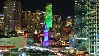
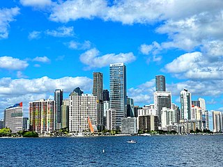
Downtown Miami is the urban city center of Miami, Florida. The city's greater downtown region consists of the Central Business District, Brickell, the Historic District, Government Center, the Arts & Entertainment District, and Park West. It is divided by the Miami River and is bordered by Midtown Miami's Edgewater and Wynwood sections to its north, Biscayne Bay to its east, the Health District and Overtown to its west, and Coconut Grove to its south.

Downtown Detroit is the central business district and a residential area of the city of Detroit, Michigan, United States. Locally, downtown tends to refer to the 1.4 square mile region bordered by M-10 to the west, Interstate 75 to the north, I-375 to the east, and the Detroit River to the south. Although, it may also refer to the Greater Downtown area, a 7.2 square mile region that includes surrounding neighborhoods such as Midtown, Corktown, Rivertown, and Woodbridge.

Downtown Columbus is the central business district of Columbus, Ohio. Downtown is centered on the intersection of Broad and High Streets, and encompasses all of the area inside the Inner Belt. Downtown is home to most of the tallest buildings in Columbus.

Downtown San Antonio is the central business district of San Antonio, Texas and the urban core of Greater San Antonio, a metropolitan area with nearly 2.5 million people.

Downtown Austin is the central business district of Austin, Texas. Downtown is located on the north bank of the Colorado River. The approximate borders of Downtown include Lamar Boulevard to the west, Martin Luther King Jr. Boulevard and the University of Texas at Austin to the north, Interstate 35 to the east, and Lady Bird Lake to the south.
Center City is the downtown and central business district of Allentown, Pennsylvania, the third largest city in the U.S. state of Pennsylvania. It has a dense population and is currently undergoing an urban revitalization process.

Downtown Dallas is the central business district (CBD) of Dallas, Texas, United States, located in the geographic center of the city. It is the second-largest business district in the state of Texas. The area termed "Downtown" has traditionally been defined as bounded by the downtown freeway loop, bounded on the east by I-345 (although known and signed as the northern terminus of I-45 and the southern terminus of US 75, on the west by I-35E, on the south by I-30, and on the north by Woodall Rodgers Freeway.
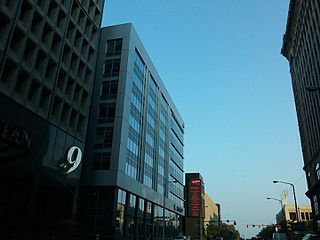
The Nine-Twelve District is a major area of downtown Cleveland, in the U.S. state of Ohio, that is the re-branding of the former Financial District of Cleveland. This re-branding has largely been championed by the Downtown Cleveland Alliance. The name refers to the two major commercial avenues between which the district lies, East 9th Street and East 12th Street, with Lakeside Avenue and Euclid Avenue serving as the northern and southern boundaries, respectively. This revamping and reboot of the Cleveland Central Business District has occurred because property and business owners demanded more investment in the central area. The district is home to the newly expanded Cuyahoga County Headquarters.