Driezum

Last updated
Driezum
Driesum
Village
Kerk Driesum..jpg
Driezum Church
Vlag Driesum.svg
Driezum wapen.svg
Map NL Dantumadiel Driezum.png
Location in Dantumadiel municipality
2010-NL-P02-Fryslan-positiekaart-gemnamen.jpg
Red pog.svg
Driezum
Location in the Netherlands
Netherlands location map.svg
Red pog.svg
Driezum
Driezum (Netherlands)
Coordinates: 53°17′45″N6°2′44″E / 53.29583°N 6.04556°E / 53.29583; 6.04556
Country Flag of the Netherlands.svg Netherlands
Province Frisian flag.svg Friesland
Municipality Flag of Dantumadeel.svg Dantumadiel
Population
 (2017)
  Total850
Time zone UTC+1 (CET)
  Summer (DST) UTC+2 (CEST)

Driezum (Dutch : Driesum [1] [2] ) is a village in the Dantumadiel municipality of Friesland, the Netherlands. It had a population of around 850 in 2017. [3]

Contents

Together with Wâlterswâld it forms the twin village of Driezum-Wâlterswâld. The residential center of Driezum and the southern residential center of Wâlterswâld form a unit. The two villages have many common associations and a common village community centre, which is located in Wâlterswâld. On the eastern side of Driezum lies the hamlet Eastwâld.

History

The place Driezum is mentioned in the 12th century as Dresem. [4] This spelling also occurs in 1486-873 [2] as well as in 1543. [4] In the 16th century the maps speak of Dresum. In 1520 Peter van Thabor calls the village Dryesen. [4] The village lies on a sand ridge in the scenic landscape of the Dokkumer Wouden. [5]

It is more than possible that the village original was lying a bit more northeast of the modern center of the village on an artificial dwelling mound, an so called terp. And then later on the village switched to the sandy ridge and grew there. After the move the terp was still slightly populated and was in 1511 mentioned simply as Terp. In 1540 its mentioned as Deser Terp and in 1543 as Dresum Terp. Around 1700 its called Kanter on a map. That's probably the family that lives on the terp then. An indication that the place itself was not seen as big enough place to be called. In the 19th century the terp is called Driezumer Terp. [4]

In 1930 its called Driesumer Terp on the Kadaster map and from 1970 it's spelled as Driesummerterp. [6] In the 17th and 18th centuries the village itself is mainly mentioned as Driesum. [4] In 1786 one also sees the spelling Driezum. [2] The last two spellings then appear alternately. Since the 20th century, the official spelling became Driesum, with Driezum being the West Frisian name. [4]

The village was from 1971 the administrative center of the municipality of Dantumadiel. The town hall was located in the noble stone house (stins) of Rinsmastate  [ fy ]. In 1999 the new town hall was opened in Damwâld, which meant that Driezum was dismissed as an administrative center.

In 2008 the municipality Dantumadiel decided that it was going the replace all the official Dutch names within the municipality with the West Frisian names, [7] meaning that Driezum was from 2009 the official name for the village.

Related Research Articles

<span class="mw-page-title-main">Damwâld</span> Village in Friesland, Netherlands

Damwâld is a village in the Dantumadiel municipality of Friesland, in the Netherlands. In 2020 it had 5630 citizens. This number of citizens makes Damwâld the largest village in the municipality of Dantumadiel.

<span class="mw-page-title-main">Wâlterswâld</span> Village in Friesland, Netherlands

Wâlterswâld is a village in Dantumadiel municipality, Friesland, the Netherlands. The village had a population of approximately 920 in 2017.

<span class="mw-page-title-main">Burdaard</span> Village in Friesland, Netherlands

Burdaard is a village in Noardeast-Fryslân in the province of Friesland, the Netherlands. It had a population of around 1,173 in January 2017. Before 2019, the village was part of the Ferwerderadiel municipality.

<span class="mw-page-title-main">Sibrandahûs</span> Village in Friesland, Netherlands

Sibrandahûs is a small village in the Dantumadiel municipality of Friesland, the Netherlands. It had a population of around 40 in 2017. It is located just west of Dokkum.

<span class="mw-page-title-main">De Falom</span> Village in Friesland, Netherlands

De Falom is a village in the Dantumadiel municipality of Friesland, the Netherlands. It had a population of 235 in 2017.

<span class="mw-page-title-main">Readtsjerk</span> Village in Friesland, Netherlands

Readtsjerk is a village in the Dantumadiel municipality of Friesland, the Netherlands. It had a population of around 185 in 2017.

<span class="mw-page-title-main">Rinsumageast</span> Village in Friesland, Netherlands

Rinsumageast is a village in the Dantumadiel municipality of Friesland, the Netherlands. It had a population of around 965 in 2017.

<span class="mw-page-title-main">Broeksterwâld</span> Village in Friesland, Netherlands

Broeksterwâld is a village in the Dantumadiel municipality of Friesland, in the Netherlands. In 2017, it had a population of around 1,100.

<span class="mw-page-title-main">Feanwâlden</span> Village in Friesland, Netherlands

Feanwâlden is a village in the Dantumadiel municipality of Friesland, the Netherlands. It had a population of around 3,430 in 2014.

<span class="mw-page-title-main">De Westereen</span> Village in Friesland, Netherlands

De Westereen is a village in the Dantumadiel municipality of Friesland, the Netherlands. It had a population of around 5,000 in 2017.

<span class="mw-page-title-main">Wytgaard</span> Village in Friesland, Netherlands

Wytgaard is a village in Leeuwarden municipality in the province of Friesland, the Netherlands. It had a population of around 570 in January 2017.

<span class="mw-page-title-main">Feanwâldsterwâl</span> Village in Friesland, Netherlands

Feanwâldsterwâl is a village in the Dantumadiel and Tytsjerksteradiel municipality's of Friesland, the Netherlands. it had a population of around 420 in 2021, however Feanwâldsterwâl is not a statistical entity, and the population count is only an estimation.

Eastwâld is a hamlet in the municipality of Dantumadiel in the province of Friesland, the Netherlands.

Barrum is a hamlet in the Dutch municipality of Waadhoeke in the province of Friesland. It is located south of Tzum, of which it is a part administratively. It lies directly to the north of the hamlet of Koum. It currently consists of two farms on a side road of a road called the Slotwei.

<span class="mw-page-title-main">Arkens</span> Hamlet in Friesland, Netherlands

Arkens is a hamlet in the Dutch municipality of Waadhoeke in the province of Friesland. It is located southwest of Schalsum and on the direct northeast side of Franeker, of which it is a part administratively.

<span class="mw-page-title-main">Bonkwert</span> Hamlet in Friesland, Netherlands

Bonkwert is hamlet in the Dutch municipality of Waadhoeke in the province of Friesland. It is located northeast of Wommels, north of Iens and southwest of the village of Spannum, of which it is part administratively.
<span class="mw-page-title-main">De Puollen</span> Hamlet in Friesland, Netherlands

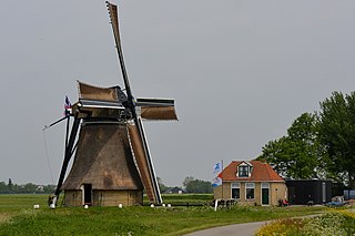
De Puollen is a hamlet in the Dutch municipality of Waadhoeke in the province of Friesland. It is located to the south of Deinum and on the east side of Dronryp, of which it is a part administratively. The Puolfeart flows through the hamlet and its surrounding polder. This canal forms the heart of the hamlet, which consists of scattered residences on the Puoldyk.

<span class="mw-page-title-main">Doijum</span> Hamlet in Friesland, Netherlands

Doijum is a hamlet in the Dutch municipality of Waadhoeke in the province of Friesland. It is located east of Hitzum, southeast of Kie and south of Franeker. The Doijumervaart flows through the hamlet.
<span class="mw-page-title-main">Franjumerbourren</span> Hamlet in Friesland, Netherlands

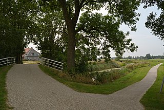
Franjumerbuorren is a hamlet in the Dutch municipality of Waadhoeke in the province of Friesland. It is located south of Ingelum and north of Marsum, of which it is a part administratively. The residences of the hamlet, mainly farmhouses, are located on the road of the same name, Franjumerbourren. The Ingelumer Feart flows through the hamlet.

<span class="mw-page-title-main">Koehool</span> Hamlet in Friesland, Netherlands

Koehool is a hamlet in the Dutch municipality of Waadhoeke in the province of Friesland. It is located on the Wadden Sea north of Tzummarum and west of Dijkshoek and Westhoek. The settlement of the hamlet is located on the Sedyk in the Horne region.

References

  1. Taalunie. "Friese namen" (in Dutch). Retrieved 11 April 2021.
  2. 1 2 3 G. van Berkel & K. Samplonius (2018). "Nederlandse plaatsnamen verklaard" (in Dutch). Retrieved 14 April 2021.
  3. Kerncijfers wijken en buurten 2017 - CBS
  4. 1 2 3 4 5 6 Gildemacher, Karel F. (2007). Friese plaatsnamen: alle steden, dorpen en gehuchten. Leeuwarden, Friese Pers/Noordboek (in Dutch)
  5. frieslandwonderland.nl. "Stichting Fryslâns Ferline; NoordBoek - Peter Karstkarel" (in Dutch). Retrieved 25 April 2021.
  6. "Kadaster maps via topotijdreis.nl" (in Dutch). Retrieved 25 April 2021.
  7. "Friese plaats- en straatnamen - Bezoekers - Gemeente Dantumadiel". Archived from the original on 2018-09-08. Retrieved 2021-04-14.

Commons-logo.svg Media related to Driezum at Wikimedia Commons