Klokotnitsa is a village in southern Bulgaria near Haskovo. It has a population of 619 people.

Sakar is a mountain in southeastern Bulgaria, between the rivers Maritsa, Tundzha, Sokolitsa and Sazliyka and close to the borders with Greece and Turkey. The mountain's highest peak is Vishegrad at 856 m.

Rakitovo is a town in the Pazardzhik Province, Bulgaria. As of 2005 the population is 8 952. It is located in the northern part of the Rhodopi mountains at 12 km to the east of Velingrad and 7 km to the southwest of the Batak Reservoir. There is timber industry in the town. People from the region grow crops, lavender, potatoes and barley.
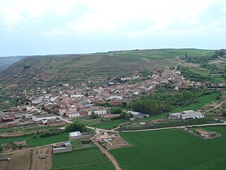
San Martín de Rubiales is a municipality and town located in the province of Burgos, Castile and León, Spain. According to the 2004 census (INE), the municipality has a population of 217 inhabitants.

Nagórki-Jabłoń is a village in the administrative district of Gmina Zambrów, within Zambrów County, Podlaskie Voivodeship, in north-eastern Poland. It lies approximately 3 kilometres (2 mi) west of Zambrów and 66 km (41 mi) west of the regional capital Białystok.
Dolna Krushitsa is a village in Petrich Municipality, in Blagoevgrad Province, Bulgaria.
Karnalovo is a village in Petrich Municipality, in Blagoevgrad Province, Bulgaria.
Gorno Osenovo is a village in Simitli Municipality, in Blagoevgrad Province, in southwestern Bulgaria.
Klepalo is a village in Strumyani Municipality, in Blagoevgrad Province, in southwestern Bulgaria.
Buntsevo is a village in Yakoruda Municipality, in Blagoevgrad Province, in southwestern Bulgaria.
Dragantsi is a village in Karnobat Municipality, in Burgas Province, in southeastern Bulgaria.
Zhitosvyat is a village in Karnobat Municipality, in Burgas Province, in southeastern Bulgaria.
Vedrovo is a village in Sungurlare Municipality, in Burgas Province, in southeastern Bulgaria.
Balaleya is a village in Dryanovo Municipality, in Gabrovo Province, in northern central Bulgaria.
Gesha is a village in Dryanovo Municipality, in Gabrovo Province, in northern central Bulgaria.
Biser is a village in the municipality of Harmanli, in Haskovo Province, in southern Bulgaria.
Bogomil is a village in the municipality of Harmanli, in Haskovo Province, in southern Bulgaria.
Preslavets, Bulgaria is a village in the municipality of Harmanli, in Haskovo Province, in southern Bulgaria.
Cherni Rid is a village in the municipality of Ivaylovgrad, in Haskovo Province, in southern Bulgaria.
Gornoseltsi is a village in the municipality of Ivaylovgrad, in Haskovo Province, in southern Bulgaria.


