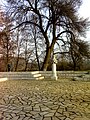
Bulgaria is a country situated in Southeast Europe that occupies the eastern quarter of the Balkan peninsula, being the largest country within its geographic boundaries. It borders Romania to the north, Serbia and North Macedonia to the west, Greece and Turkey to the south, and the Black Sea to the east. The northern border with Romania follows the river Danube until the city of Silistra. The land area of Bulgaria is 110,994 square kilometres (42,855 sq mi), slightly larger than that of Cuba, Iceland or the U.S. state of Tennessee. Considering its relatively compact territorial size and shape, Bulgaria has a great variety of topographical features. Even within small parts of the country, the land may be divided into plains, plateaus, hills, mountains, basins, gorges, and deep river valleys. The geographic center of Bulgaria is located in Uzana.

Kardzhali, sometimes spelt Kardžali or Kurdzhali, is a town in the Eastern Rhodopes in Bulgaria, centre of Kardzhali Municipality and Kardzhali Province. The noted Kardzhali Reservoir is located nearby. It is an important regional economic hub.

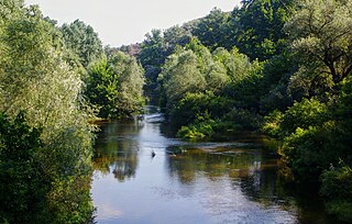
The Rhodopes are a mountain range in Southeastern Europe, and the largest by area in Bulgaria, with over 83% of its area in the southern part of the country and the remainder in Greece. Golyam Perelik is its highest peak at 2,191 meters (7,188 ft). The mountain range gives its name to the terrestrial ecoregion Rodope montane mixed forests that belongs in the temperate broadleaf and mixed forests biome and the Palearctic realm. The region is particularly notable for its karst areas with their deep river gorges, large caves and specific sculptured forms, such as the Trigrad Gorge.

Haskovo is a city in the region of Northern Thrace in southern Bulgaria and the administrative centre of the Haskovo Province, not far from the borders with Greece and Turkey. According to Operative Program Regional Development of Bulgaria, the urban area of Haskovo is the seventh largest in Bulgaria and has a population of 184,731 inhabitants. Haskovo has a population of 64,564 as of 2022, making it Bulgaria's 12th largest city.

Svilengrad is a town in Haskovo Province, south-central Bulgaria, situated at the tripoint of Bulgaria, Turkey, and Greece. It is the administrative centre of the homonymous Svilengrad Municipality.
The Muslim Bulgarians are Bulgarians who follow the faith of Islam. They are generally thought to be the descendants of the indigenous Slavs who converted to Islam during Ottoman rule. Most scholars have agreed that the Bulgarian Muslims are a "religious group of Bulgarian Slavs who speak Bulgarian as their mother tongue and do not understand Turkish, but whose religion and customs are Islamic". Bulgarian Muslims live mostly in the Rhodopes – Smolyan Province, the southern part of the Pazardzhik and Kardzhali Provinces and the eastern part of the Blagoevgrad Province in Southern Bulgaria. They also live in a group of villages in the Lovech Province in Northern Bulgaria. The name Pomak is pejorative in Bulgarian and is resented by most members of the community, The name adopted and used instead of Pomak is Bulgarian Muslims.

Madzharovo is a small Bulgarian town in the Eastern Rhodopes, part of Haskovo Province, situated on the banks of the river Arda. It has a population of only 590, as of December 2009, making it one of the smallest in the country. The town is the administrative centre of the homonymous Madzharovo Municipality.
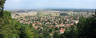
Peshtera is a town in the Rhodope Mountains, southern Bulgaria. It is located in Pazardzhik Province near the towns of Batak and Bratsigovo. The town is the third largest in the province after Pazardzhik and Velingrad and is the forty-fifth largest in Bulgaria. It is the administrative center of the municipality Peshtera. According to the 2021 census, Peshtera has a population of 15,175 inhabitants. At about 5 km to the south, along the road to Batak, is one of the most visited caves in Bulgaria — Snezhanka. Near the town is located the Peshtera Hydroelectric Power Station. The town is well known for producing the alcohol beverage mastika under the brand Peshterska.
Chernichevo is a village in southern Bulgaria, located in the municipality of Krumovgrad in the Kardzhali Province. It is situated in the Eastern part of Rhodope Mountains, near the border with Greece. Its original Bulgarian name is "Dunyata". The correct geographical location of Chernichevo is 41° 21' N, 25° 47' E.

Septemvri is a town in Pazardzhik Province, Southern Bulgaria, located at the western end of the Upper Thracian Lowland, 19 km (12 mi) away to the west from the city of Pazardzhik. It is the administrative centre of homonymous Septemvri Municipality. As of December 2009, the town had a population of 8,422.
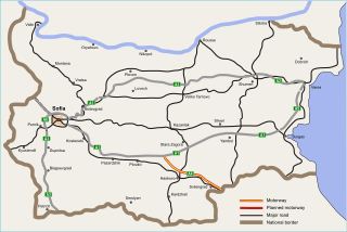
The Maritsa motorway, designated A4, is a motorway in Bulgaria, part of the Pan-European Corridor IV, between the Trakia motorway (A1), at the town of Chirpan, and Kapitan Andreevo, at the Turkish border.

Mandritsa is a village in southernmost Bulgaria, part of Ivaylovgrad municipality, Haskovo Province. It is known as the only Albanian village in Bulgaria. As of 14 December 2006, Mandritsa has a population of 75. It lies at 41°23′N26°8′E, 93 m above sea level.

Stambolovo is a village in central southern Bulgaria, part of Haskovo Province. It is the administrative centre of Stambolovo Municipality, which is located in the southwestern part of Haskovo Province. Stambolovo lies in the Eastern Rhodope Mountains, not far from the Upper Thracian Plain and 22 kilometres from the provincial capital of Haskovo.
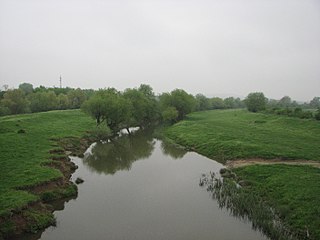
The Sazliyka or Rakitnitsa is a river in southeastern Bulgaria, a left tributary of the Maritsa. It originates in the Sarnena Sredna Gora mountain range. In its upper course until Radnevo, it is also known as the Rakitnitsa or Syuyutliyka. The river is 145 kilometres in length and is the fifth longest in the Maritsa drainage, following the Tundzha (390 km), the Arda (290 km), the Ergene (281 km) and the Topolnitsa (155 km).

Nikola Koev Nikolov, known as Mamin Kolyu was a Bulgarian revolutionary of the Internal Macedonian-Adrianopolitan Revolutionary Organization (IMARO) who fought for the liberation of Macedonia and Thrace from Ottoman rule.
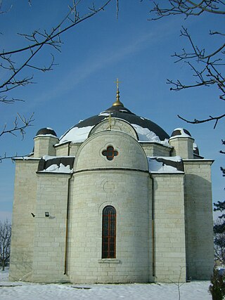
Uzundzhovo is a village in southeastern Bulgaria, part of Haskovo municipality, Haskovo Province. As of 2008, it has a population of 1,727 and the mayor is Vancho Vanchev. The village lies in the agricultural Upper Thracian Plain, east of Haskovo, south of Dimitrovgrad and west of Simeonovgrad and Harmanli. During Ottoman rule, the village was known as Uzunca ova, a direct translation of the area's former Byzantine Greek appellation, Makri livada. The village's current name is derived from the Ottoman Turkish name and modified with the Slavic placename suffix -ovo. An architectural reminder of the village's Ottoman history can also be seen, as the local Church of the Assumption was built originally as a mosque. Uzundzhovo hosts the Bulgarian Air Force's 21st Fighter and Bomber Airbase, shut down in 1998.
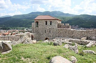
Mezek is a village in southeastern Bulgaria, part of Svilengrad municipality, Haskovo Province. It lies at the foot of the eastern Rhodope Mountains, just north of the Bulgaria–Greece border and not far west of the Bulgaria–Turkey border. Mezek is famous for the well-preserved medieval Mezek Fortress and its two ancient Thracian beehive tombs, the Mezek and Sheynovets tombs. The village is also well known for its own winery and the Mezzek brand of Bulgarian wine.

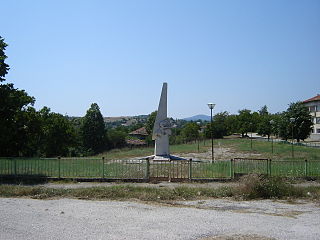
The Battle of Kircaali or Battle of Kardzhali was part of the First Balkan War between the armies of Bulgaria and the Ottoman Empire. It took place on 21 October 1912, when the Bulgarian Haskovo Detachment defeated the Ottoman Kırcaali Detachment of Yaver Pasha and permanently joined Kardzhali and the Eastern Rhodopes to Bulgaria. The anniversary of that event is celebrated annually on 21 October as a holiday of the city.

Harmanli massacre or Battle of Harmanli refers to the battle between Russian and Turkish forces and the ensuing mass death of Muslim civilians near Harmanli in early 1878, during the Russo-Turkish War (1877–1878). Approximately 2,000 to 5,000 Muslim civilians were massacred.
The Harmanliyska reka is a river in southern Bulgaria, a right tributary of the Maritsa. It is 92 km in length. The river drains the eastern slopes of the Mechkovets ridge, the northern slopes of the ridges Chukata and Huhla, and large areas of the Haskovo hills, all part of the Eastern Rhodope Mountains.