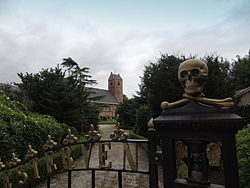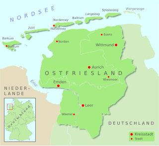
East Frisia or East Friesland is a historic region in modern Lower Saxony, Germany. The modern province is primarily located on the western half of the East Frisian peninsula, to the east of West Frisia and to the west of Landkreis Friesland but is known to have extended much further inland before modern representations of the territory. Administratively, East Frisia consists of the districts Aurich, Leer and Wittmund and the city of Emden. It has a population of approximately 469,000 people and an area of 3,142 square kilometres (1,213 sq mi).

Buitenpost is a village in north-east Friesland in the Netherlands.

Aldtsjerk is a village on the main road from Leeuwarden to Dokkum. It is part of Tytsjerksteradiel municipality, Friesland, the Netherlands and had around 615 inhabitants as of January 2018.

The Dutch are an ethnic group native to the Netherlands. They share a common ancestry and culture and speak the Dutch language. Dutch people and their descendants are found in migrant communities worldwide, notably in Aruba, Suriname, Guyana, Curaçao, Argentina, Brazil, Canada, Australia, South Africa, New Zealand and the United States. The Low Countries were situated around the border of France and the Holy Roman Empire, forming a part of their respective peripheries and the various territories of which they consisted had become virtually autonomous by the 13th century. Under the Habsburgs, the Netherlands were organised into a single administrative unit, and in the 16th and 17th centuries the Northern Netherlands gained independence from Spain as the Dutch Republic. The high degree of urbanisation characteristic of Dutch society was attained at a relatively early date. During the Republic the first series of large-scale Dutch migrations outside of Europe took place.

Munnekezijl is the easternmost village in Noardeast-Fryslân, Friesland, the Netherlands. It had a population of 488 in January 2017. Before 2019, the village was part of the Kollumerland en Nieuwkruisland municipality.

Boelenslaan is a village in Achtkarspelen municipality in Friesland province in the northern Netherlands.
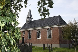
Surhuisterveen is the largest of the 12 villages of the municipality of Achtkarspelen, in the province of Friesland, the Netherlands. As of 1 January 2017, Surhuisterveen had a population of 5,929.
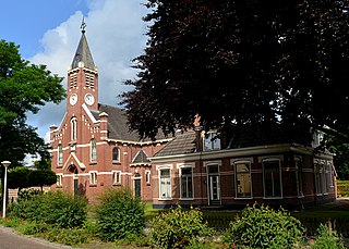
Harkema is a village in the municipality of Achtkarspelen, Friesland province, the Netherlands.

Augustinusga is a village in the municipality of Achtkarspelen, Friesland province, The Netherlands.

Eastermar is a village in Tytsjerksteradiel municipality in the province Friesland of the Netherlands. It had around 1,575 citizens in January 2017.

Kootstertille is a village in Achtkarspelen in the province of Friesland, the Netherlands. It had a population of around 2500 in 2017.

Twijzel is a village in Achtkarspelen in the province of Friesland, the Netherlands, with a population of around 1080.

Twijzelerheide is a village in Achtkarspelen in the province of Friesland, the Netherlands. It had a population of around 1800 in 2017.

Surhuizum is a village in Achtkarspelen in the province of Friesland, the Netherlands. It had a population of around 1300 in 2017. Surhuizum is known for its church tower.

Gerkesklooster is a village in Achtkarspelen in the province of Friesland, the Netherlands.

Stroobos is a village in Achtkarspelen in the province of Friesland, the Netherlands. The settlement of Stroobos used to be divided between Friesland and Groningen. In 1993, the entire village was transferred to Friesland.
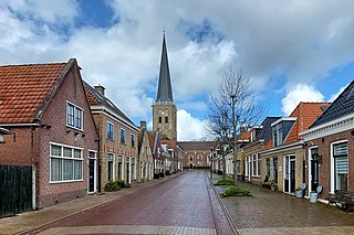
Tzum is a village in Waadhoeke municipality in the province of Friesland, the Netherlands. It had a population of around 1,110 in 2023. Tzum is known for its 72 metre tall church tower.

Sint Nicolaasga is a village in the Dutch province of Friesland. It is located in the municipality of De Fryske Marren, and had a population of around 3330 in 2017.

Oudehaske is a village in De Fryske Marren in the province of Friesland, the Netherlands. It had a population of around 1980 in 2017.
Hindeloopen Frisian is a West Frisian variety spoken in the port town of Hindeloopen and the village of Molkwerum on the west coast of Friesland. It has preserved much of the Old Frisian phonology and lexicon, and has been attested to since the 17th Century. Hindelooper is spoken by some 500 people in Hindeloopen, almost all of them elderly, with the number of speakers decreasing.
