Stroobos

Last updated
Stroobos
Strobos
Village
Sikkema aan het P.M.Kanaal.JPG
Factories on the canal
Gerkesklooster vlag.svg
Gerkeskleaster-Strobos wapen.svg
Map NL Achtkarspelen Stroobos.png
Location in Achtkarspelen municipality
2010-NL-P02-Fryslan-positiekaart-gemnamen.jpg
Red pog.svg
Stroobos
Location in the Netherlands
Netherlands location map.svg
Red pog.svg
Stroobos
Stroobos (Netherlands)
Coordinates: 53°14′N6°13′E / 53.233°N 6.217°E / 53.233; 6.217
Country Flag of the Netherlands.svg Netherlands
Province Frisian flag.svg Friesland
Municipality Flag of Achtkarspelen.svg Achtkarspelen
Area
[1]
  Total2.94 km2 (1.14 sq mi)
Elevation
[2]
0.7 m (2.3 ft)
Population
 (2021) [1]
  Total315
  Density110/km2 (280/sq mi)
Postal code
9871 [1]
Dialing code 0512

Stroobos (West Frisian : Strobos) is a village in Achtkarspelen in the province of Friesland, the Netherlands. The settlement of Stroobos used to be divided between Friesland and Groningen. In 1993, the entire village was transferred to Friesland. [3]

Contents

It forms, together with Gerkesklooster, the double village Gerkesklooster-Stroobos. The double village had a population of around 1144 in 2017, with 812 in Gerkesklooster and 332 in Stroobos. [4]

History

Gerkesklooster was established first as a village near a monastery. [5] Strobos was first mentioned around 1660, and means a large bundle of straw. [6] After a sluice was built in the canal from Dokkum to Groningen, it developed into a village. [5] In 1840, Strobos was home to 417 people. In 1850, a wharf was built in Stroobos and it developed into an industrial village. Around 1900, a dairy factory opened which nowadays produces about 57,000 tons of cheese a year. The village used to be divided by the provincial border of Friesland and Groningen. In 1993, the border was redrawn and the entire village is now part of Friesland. [3]

Related Research Articles

<span class="mw-page-title-main">Achtkarspelen</span> Municipality in Friesland, Netherlands

Achtkarspelen is a municipality in Friesland in the northern Netherlands.

<span class="mw-page-title-main">Buitenpost</span> Village in Friesland, Netherlands

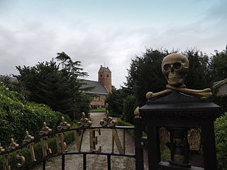
Buitenpost is a village in north-east Friesland in the Netherlands.

<span class="mw-page-title-main">Lauwers</span> River between Friesland and Groningen, the Netherlands

The Lauwers is a river in the Netherlands. It forms part of the border between the provinces of Friesland and Groningen. From the 730s to Widukind's defeat in 785, it was part of the border of the Frankish Empire.

<span class="mw-page-title-main">Drogeham</span> Village in Friesland, Netherlands

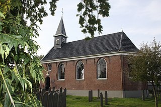
Drogeham is a village of about 1,700 inhabitants in the Dutch province of Friesland.

<span class="mw-page-title-main">Munnekezijl</span> Village in Friesland, Netherlands

Munnekezijl is the easternmost village in Noardeast-Fryslân, Friesland, the Netherlands. It had a population of 488 in January 2017. Before 2019, the village was part of the Kollumerland en Nieuwkruisland municipality.

The Friso-Hollandic Wars, also called Frisian-Hollandic Wars, were a series of short medieval wars consisting of the attempts made by the counts of Holland to conquer the free Frisian territories, which lay to the north and east of their domain. These wars were waged off and on from 1256 to 1297, 1324 to 1348, 1396 to 1411, and from 1421 to 1422, although it could be argued that a state of war continued to exist between the County of Holland and the Frisian territories till well after the year 1500.

<span class="mw-page-title-main">Boelenslaan</span> Village in Friesland, Netherlands

Boelenslaan is a village in Achtkarspelen municipality in Friesland province in the northern Netherlands.

<span class="mw-page-title-main">Surhuisterveen</span> Village in Friesland, Netherlands

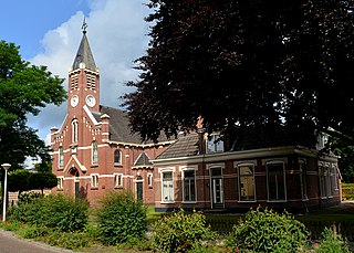
Surhuisterveen is the largest of the 12 villages of the municipality of Achtkarspelen, in the province of Friesland, the Netherlands. As of 1 January 2017, Surhuisterveen had a population of 5,929.

<span class="mw-page-title-main">Augustinusga</span> Village in Friesland, Netherlands

Augustinusga is a village in the municipality of Achtkarspelen, Friesland province, The Netherlands.

<span class="mw-page-title-main">Nietap</span> Village in Drenthe, Netherlands

Nietap is a village in the Netherlands and is part of the Noordenveld municipality in Drenthe.

<span class="mw-page-title-main">De Wilp</span> Village in Groningen, Netherlands

De Wilp is a village in the Netherlands south of the town of Marum. It is largely located in the municipality of Westerkwartier in the province of Groningen, but a few houses of the village are in the municipality of Opsterland in the province of Friesland.

<span class="mw-page-title-main">Eastergoa</span>

Eastergoa was one of the seven areas and one of the three Gaue within what is today the province of Friesland in the Netherlands.

<span class="mw-page-title-main">Kootstertille</span> Village in Friesland, Netherlands

Kootstertille is a village in Achtkarspelen in the province of Friesland, the Netherlands. It had a population of around 2500 in 2017.

<span class="mw-page-title-main">Twijzelerheide</span> Village in Friesland, Netherlands

Twijzelerheide is a village in Achtkarspelen in the province of Friesland, the Netherlands. It had a population of around 1800 in 2017.
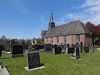
<span class="mw-page-title-main">Burdaard</span> Village in Friesland, Netherlands

Burdaard is a village in Noardeast-Fryslân in the province of Friesland, the Netherlands. It had a population of around 1,173 in January 2017. Before 2019, the village was part of the Ferwerderadiel municipality.

<span class="mw-page-title-main">Gerkesklooster</span> Village in Friesland, Netherlands

Gerkesklooster is a village in Achtkarspelen in the province of Friesland, the Netherlands.

<span class="mw-page-title-main">Frieschepalen</span> Village in Friesland, Netherlands

Frieschepalen is a village in the municipality of Opsterland in the east of Friesland, the Netherlands. It had a population of around 1,015 in January 2017.

<span class="mw-page-title-main">Rottevalle</span> Village in Friesland, Netherlands

Rottevalle is a village in Smallingerland municipality in the province of Friesland, the Netherlands. It had a population of around 1,363 in January 2017.

<span class="mw-page-title-main">Lauwersoog</span> Village and harbour in Groningen, Netherlands

Lauwersoog is a seaside village and harbour in the province of Groningen, located in the northern part of the Netherlands. It is part of the municipality of Het Hogeland. It was established on 23 May 1969. The ferry to Schiermonnikoog departs from Lauwersoog.

<span class="mw-page-title-main">Visvliet</span> Village in Groningen, Netherlands

Visvliet is a village in the Dutch province of Groningen. It is part of the municipality of Westerkwartier, and is located near the river Lauwers, the border between Friesland and Groningen.

References

  1. 1 2 3 "Kerncijfers wijken en buurten 2021". Central Bureau of Statistics. Retrieved 29 March 2022. two entries
  2. "Postcodetool for 9871PA". Actueel Hoogtebestand Nederland (in Dutch). Het Waterschapshuis. Retrieved 29 March 2022.
  3. 1 2 "Gerkesklooster-Stroobos". Plaatsengids (in Dutch). Retrieved 29 March 2022.
  4. Villages - Achtkarspelen (in Dutch)
  5. 1 2 Ronald Stenvert & Sabine Broekhoven (2000). "Gerkesklooster" (in Dutch). Zwolle: Waanders. ISBN   90 400 9476 4 . Retrieved 29 March 2022.
  6. "Stroobos - (geografische naam)". Etymologiebank (in Dutch). Retrieved 29 March 2022.