
Silistra is a town in Northeastern Bulgaria. The town lies on the southern bank of the lower Danube river, and is also the part of the Romanian border where it stops following the Danube. Silistra is the administrative center of the Silistra Province and one of the important towns of the historical region of Dobruja.
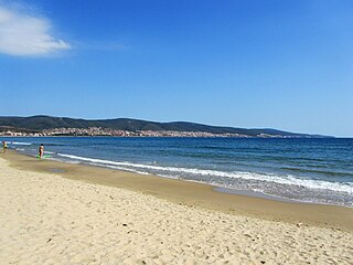
Burgas Province is a province in southeastern Bulgaria on the southern Bulgarian Black Sea Coast. The province is named after its administrative and industrial centre, the city of Burgas, the fourth biggest town in the country. It is the largest province by area, with a territory of 7,748.1 km2 (2,991.6 sq mi) that is divided into 13 municipalities. It has a total population, as of December 2009, of 422,319 inhabitants.

The Treaty of Neuilly-sur-Seine required Bulgaria to cede various territories, after Bulgaria had been one of the Central Powers defeated in World War I. The treaty was signed on 27 November 1919 at Neuilly-sur-Seine, France.

The provinces of Bulgaria are the first-level administrative subdivisions of the country.

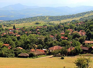
Blagoevgrad Province, also known as Pirin Macedonia or Bulgarian Macedonia, is a province (oblast) of southwestern Bulgaria. It borders four other Bulgarian provinces to the north and east, the Greek region of Macedonia to the south, and North Macedonia to the west. The province has 14 municipalities with 12 towns. Its principal city is Blagoevgrad, while other significant towns include Bansko, Gotse Delchev, Melnik, Petrich, Razlog, Sandanski, and Simitli.

Kardzhali Province is a province of southern Bulgaria, neighbouring Greece with the Greek regional units of Xanthi, Rhodope, and Evros to the south and east. It is 3209.1 km2 in area. Its main city is Kardzhali. It is Bulgaria's southernmost province.

Haskovo Province is a province in southern Bulgaria, neighbouring Greece and Turkey to the southeast, comprising parts of the Thracian valley along the river Maritsa. It is named after its administrative and industrial centre: the city of Haskovo. The province has a territory of 5,533.3 km2 (2,136.4 sq mi) that is divided into 11 municipalities with a total population, as of December 2009, of 256,408 inhabitants.

Lovech Province is one of the 28 provinces of Bulgaria, lying at the northern centre of the country. It is named after its main city: Lovech. As of December 2009, the population of the area was151,153.

Gabrovo Province is a small province lying at the geographical centre of Bulgaria. It is named after its main town - Gabrovo. In 2009 the total population of the area was 130,001.
Montana Province is a province in northwestern Bulgaria, bordering Serbia in the southwest and Romania in the north. It spreads its area between the Danube river and the Balkan Mountains. As of February 2011, the province had a population of 148,098, on territory of 3,635.5 km2 (1,403.7 sq mi). It was named after its administrative centre the city of Montana.
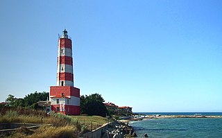
Dobrich Province is a province in northeastern Bulgaria, part of Southern Dobruja geographical region. It is bounded on the east by the Black Sea, on the south by Varna Province, on the west by Shumen and Silistra provinces, and on the north by Romania. It is divided into eight municipalities. At the 2011 census, it had a population of 186,016. The province was part of Romania between 1913 and 1940.

Veliko Tarnovo is a province in the middle of the northern part of Bulgaria. Its capital city, Veliko Tarnovo, is of historical significance as it is known as the capital of the Bulgarian Empire. The province is divided into ten municipalities with a total population, as of December 2009, of 275,395.
Borovo is a town in Ruse Province, Northern Bulgaria. It is the administrative centre of the homonymous Borovo Municipality. As of December 2009, the town had a population of 2,330.
Bosilegrad is a town and municipality located in the Pčinja District of southern Serbia. The municipality comprises an area of 571 km2 (220 sq mi). According to the 2022 census, the town has a population of 2,348, while the municipality has 6,065 inhabitants.

Momchilgrad is a town in the very south of Bulgaria, part of Kardzhali Province in the southern part of the Eastern Rhodopes. According to the 2011 census, Momchilgrad is the largest Bulgarian settlement with a Turkish majority.

Galabovo is a town in south-central Bulgaria, part of Stara Zagora Province. It is the administrative centre of the homonymous Galabovo Municipality. As of December 2022, the town had a population of 6,845.
The 28 provinces of Bulgaria are divided into 265 municipalities. Municipalities typically comprise multiple towns, villages and settlements and are governed by a mayor who is elected by popular majority vote for a four-year term, and a municipal council which is elected using proportional representation for a four-year term. The creation of new municipalities requires that they must be created in a territory with a population of at least 6,000 and created around a designated settlement. They must also be named after the settlement that serves as the territory's administrative center, among other criteria.
Aksakovo is a town in Varna Province, Northeastern Bulgaria. It is the administrative centre of the homonymous Aksakovo Municipality. The town is located on the Franga Plateau three kilometres northwest of the city of Varna. As of December 2022, it had a population of 30,576.
Valchedram is a town in northwestern Bulgaria, part of Montana Province. It is the administrative centre of Valchedram Municipality, which lies in the northeastern part of Montana Province. As of December 2009, the town had a population of 3,817.
Vetovo is a town in northeastern Bulgaria, part of Ruse Province. It is the administrative centre of Vetovo Municipality, which lies in the eastern part of the area, and ranks third in population in the province after Ruse and Byala. The town is located 40 kilometres away from the provincial capital, Ruse. As of December 2009, Vetovo had a population of 4,777.

